Connecting the Lost
- Student YASHSHREE VIVEK KARANDIKAR
- Code PG191183
- Faculty Architecture
- Unit L4 Studio Unit
- Tutor/s Anjali Jain,Priyal Shah
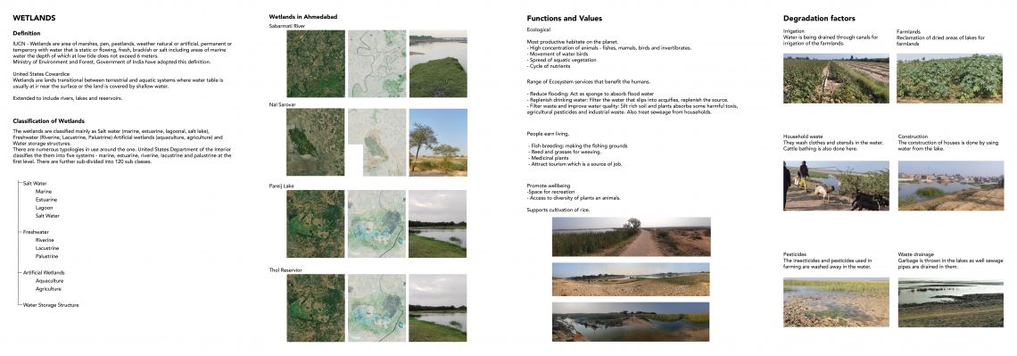
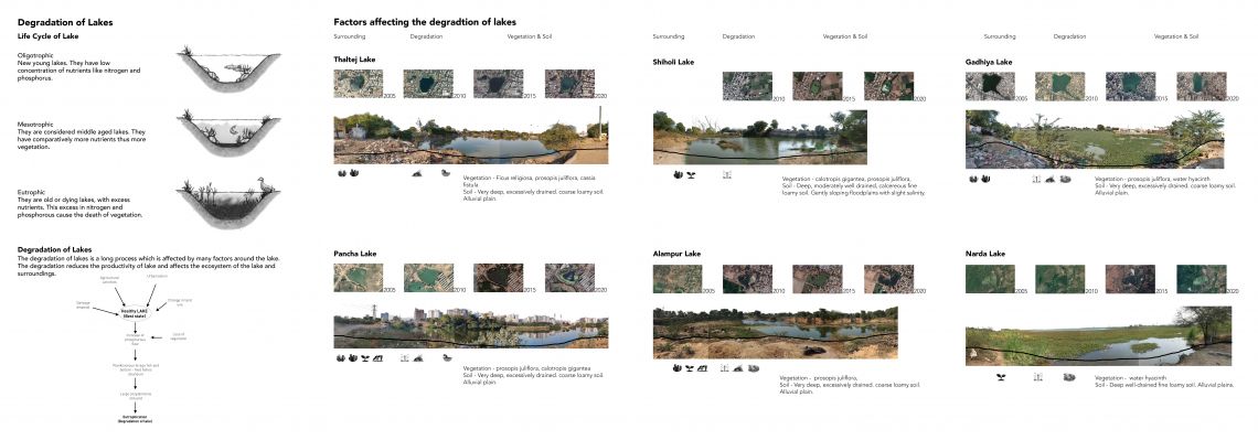
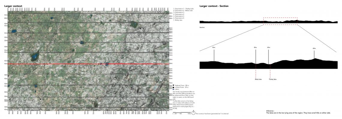
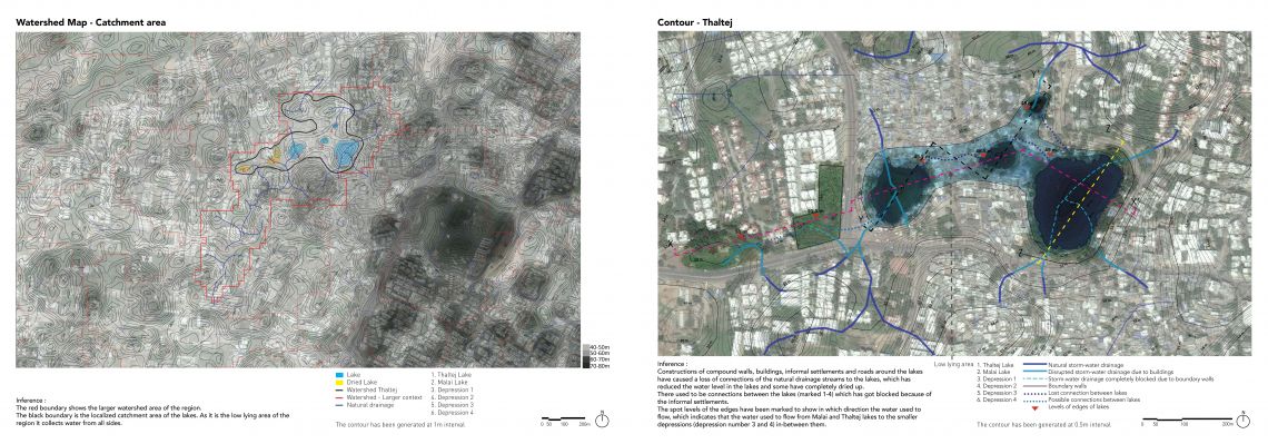
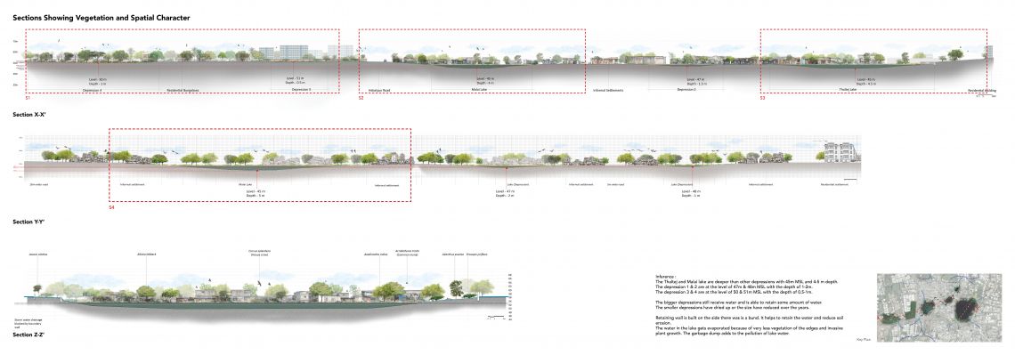
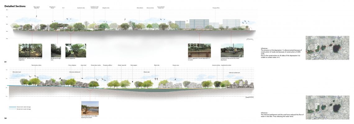
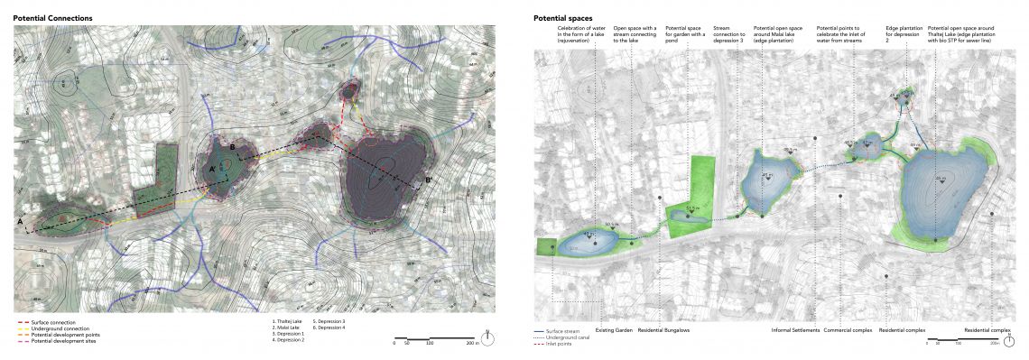
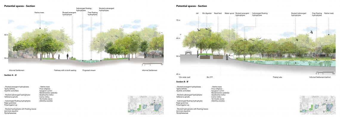
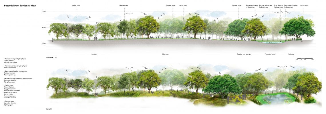
Lake being a very important part of our environment, benefits the humans as well as the environment in many ways. A few environmental benefits of lakes are – it helps in ground water recharge, it can reduce the impacts of floods and droughts by storing water, it plays an important role in water cycle by collecting storm water through streams from a specific watershed area, the lakes can be migration stops and breeding grounds for many birds, it helps in preserving biodiversity and providing habitat to a diversity of organisms, many aquatic plants and animals. Apart from the environmental benefits lakes have social and economic benefits - people use water from lakes for irrigation, it works as a primary water source for households in many rural areas, lakes can become recreational destinations, many lakes help in tourism also. The idea of looking at the lakes started with visiting different places of Ahmedabad and observing that there are a large number of lakes in and around the city. As Ahmedabad is a city in semi-arid region, before the site visits the image of the city was completely different. Although Ahmedabad has many lakes, this city being one of the fastest growing cities of Gujarat, has undergone rapid urbanization in the past few years and its impact on the quality and quantity of water bodies in the city is unavoidable. The number of lakes in Ahmedabad has fallen from more than 204 in 1960, to near about 137 in 2000 with many lakes still under the process of drying up or being rendered unfit for use due to excessive pollution. It has also been observed during site visits that in the rural areas many lakes are connected whereas some lakes of urban areas which used to be connected before, have lost their connections and have become fragmented due to urbanization. To understand what causing the disruption in the connections among the lakes of urban areas and how lakes are getting dried up, Thaltej has been chosen as the study area as this area has four lakes and a dried up lake. The four lakes used to be connected to each other but the connections are lost. The study has been done through a series of drawings to understand the natural settings of the area along with the impacts of human activities. At first the character of the area has been studied through a series of photographs. Then the study of topography has helped in understanding that the lakes of thaltej are located at a low lying area with small hillocks on either side. This has also helped in understanding the general slope and in which direction the storm water streams can flow. Then when the history and evolution of the area has been studied, it has been observed that the sizes of the lakes have reduced, water levels have decreased and one lake has completely dried up. To understand what are the causes of the decrease in water level and lakes getting dried up, the catchment area and the streams that can flow to the lakes from the surroundings have been studied through watershed map. When this study has been merged with the man-made layers of boundary walls, informal settlements and buildings, it has been observed how the connections has got disrupted. This study also shows how the connections among the lakes have got blocked. The cause of the lakes getting dried up is the change in land-use which has affected the catchment area of the lakes and has also caused disruption in the connections among them. The impacts of human activities on the lakes have also been studied, which shows how the edges of the lakes and the water are getting polluted. This study has finally lead to a possible design solution which can revive the lakes and the connections among them and prevent the process of drying up. The design also focuses on how humans can connect and interact with the lakes which may prevent them from polluting the area. The studio has helped in understanding the process of studying landscape in a different way through recording the character, understanding factors responsible for shaping the nature of it, analyzing it and finally forming a design proposal which can respond to the issues of a specific site. It has taught how to form a design idea based on what already exists and how the idea can be shaped through studying the area.