Growing Residential Hub in Suburban Mumbai
- Student NESWANKAR ANKITA GOVIND
- Code PUP20045
- Faculty Planning
- Tutor/s Rutul Joshi,Umesh Shurpali,Ravi Sannabhadti,Anil kumar Roy,Subhrangsu Goswami,Nitika Bhakuni,Vanishree Herlekar,Rujul Dipak joshi,Arjun Joshi,Tarun Patel,Narendra Mangwani
- TA Kinjal Ribadia,Aarzoo Samani,Jacob Baby,Navnit Sourirajan,Anuja Singh,Giby Abraham,Ann Elizabeth Francis,Kaveri Bahure,Nikita Doshi,Shreesha Arondekar,Shuktika Sabharwal
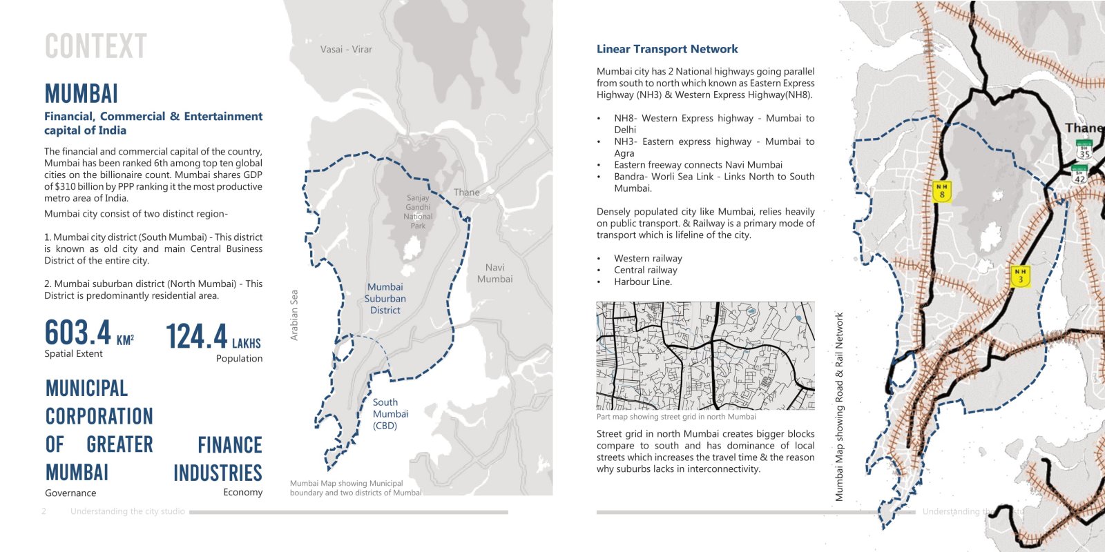
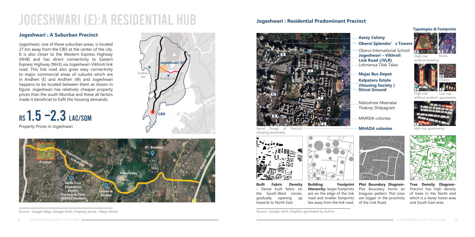
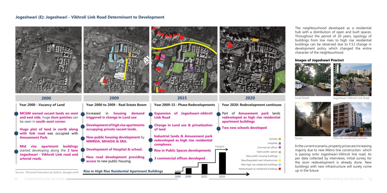
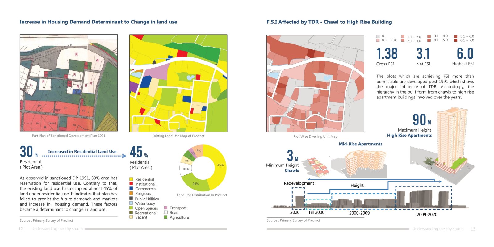
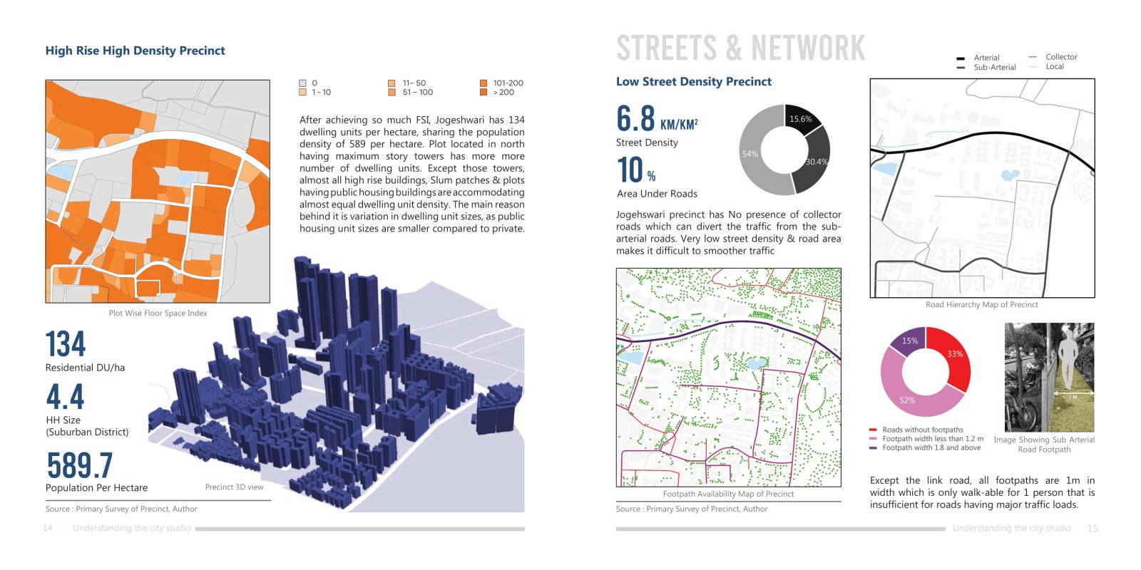
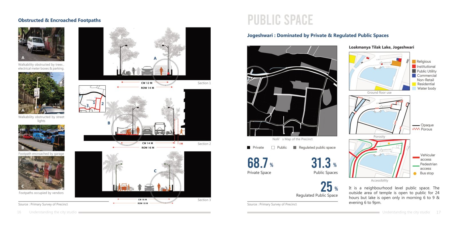
Mumbai is the commercial and financial capital of the India. The city offers many employment opportunities which resultant to increase the population of the city and became the most populous city in India today (Census, 2011). Mumbai is divided in two districts. Mumbai city district in the north is the core area of the city while Mumbai Suburban District in the south is a residential hub. With about millions of people residing in the city, the urban pressure created on the southern part has led to the development in the northern part of Mumbai. This report contains the study of one sq.km area of Jogeshwari located in northern Mumbai as a part of western suburbs. Report focuses on the built environment of that one sq.km of Jogeshwari and the factors may have led to them as well as the relationship with overall city. The city is the complex network of different parameters helps the city to shape and grow. These parameters are important for urbanization and livability for the people residing in the city. To understand these parameters, many aspects are studied. This portfolio is a compilation of outcome of four exercises covering four different aspects of Jogeshwari: First Impressions, History and Transformation, Streets and Networks and Land Development and Built Form, Housing Choices. These aspects acts as the function to shape the city in the form of urban fabric, built forms, street network and open spaces. By studying these, analytical inferences can be drawn on the basis of location of the area with respect to city center, market prices, and change in built environment due to demand and development regulations. These studies can be a database to draw and predict the future demands and development of that particular area. For this study, the area was first documented by preliminary survey through aerial imagery and site visits. Based on that the area was mapped using the Geographic Information System (GIS) for statistical analysis. For further detailed study, the data was collected from secondary sources like articles, government websites, relevant journals and personal interviews of residents of Jogeshwari.