HETEROGENEOUS SETTLEMENT AT THE FRINGES OF BELGAVI CITY
- Student APOORVA C JANAWAD
- Code PUD20059
- Faculty Planning
- Tutor/s Rutul Joshi,Umesh Shurpali,Ravi Sannabhadti,Anil kumar Roy,Subhrangsu Goswami,Nitika Bhakuni,Vanishree Herlekar,Rujul Dipak joshi,Arjun Joshi,Tarun Patel,Narendra Mangwani
- TA Kinjal Ribadia,Aarzoo Samani,Jacob Baby,Navnit Sourirajan,Anuja Singh,Giby Abraham,Ann Elizabeth Francis,Kaveri Bahure,Nikita Doshi,Shreesha Arondekar,Shuktika Sabharwal
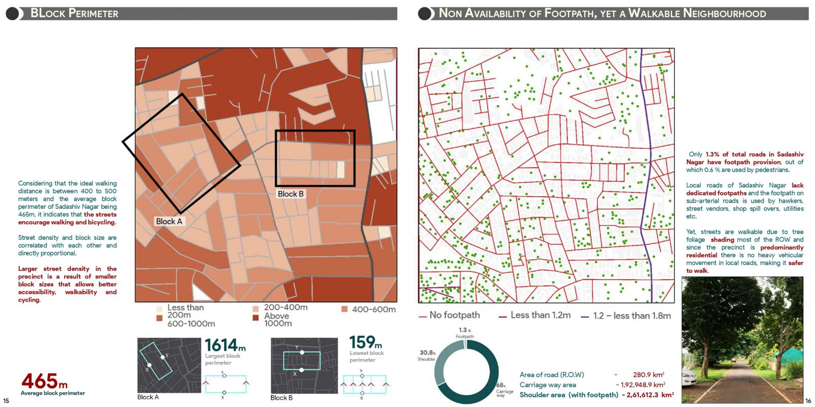
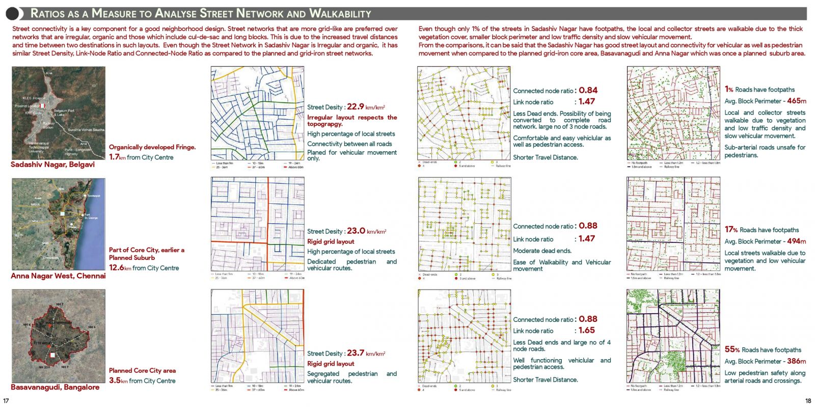
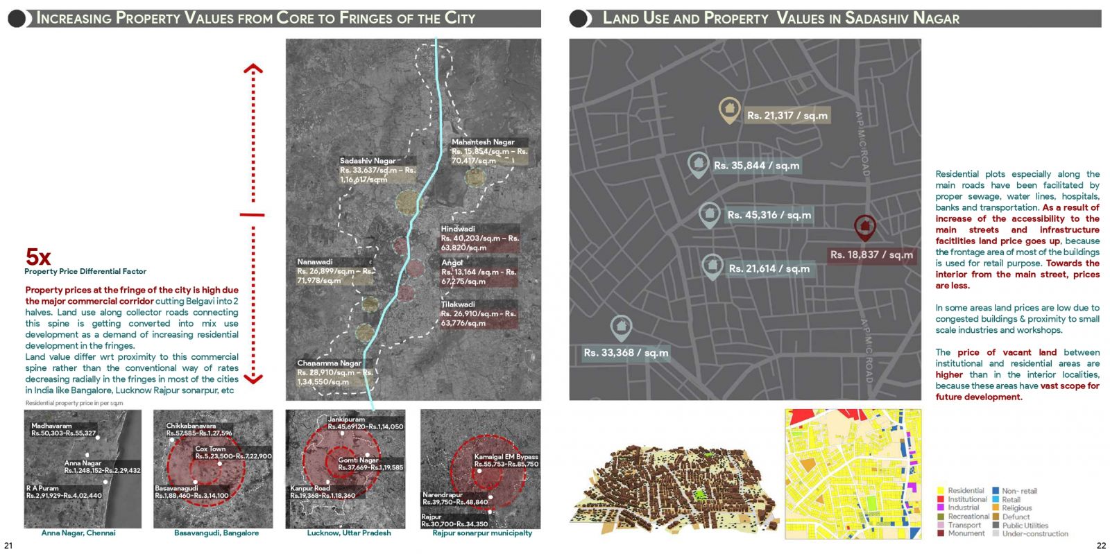
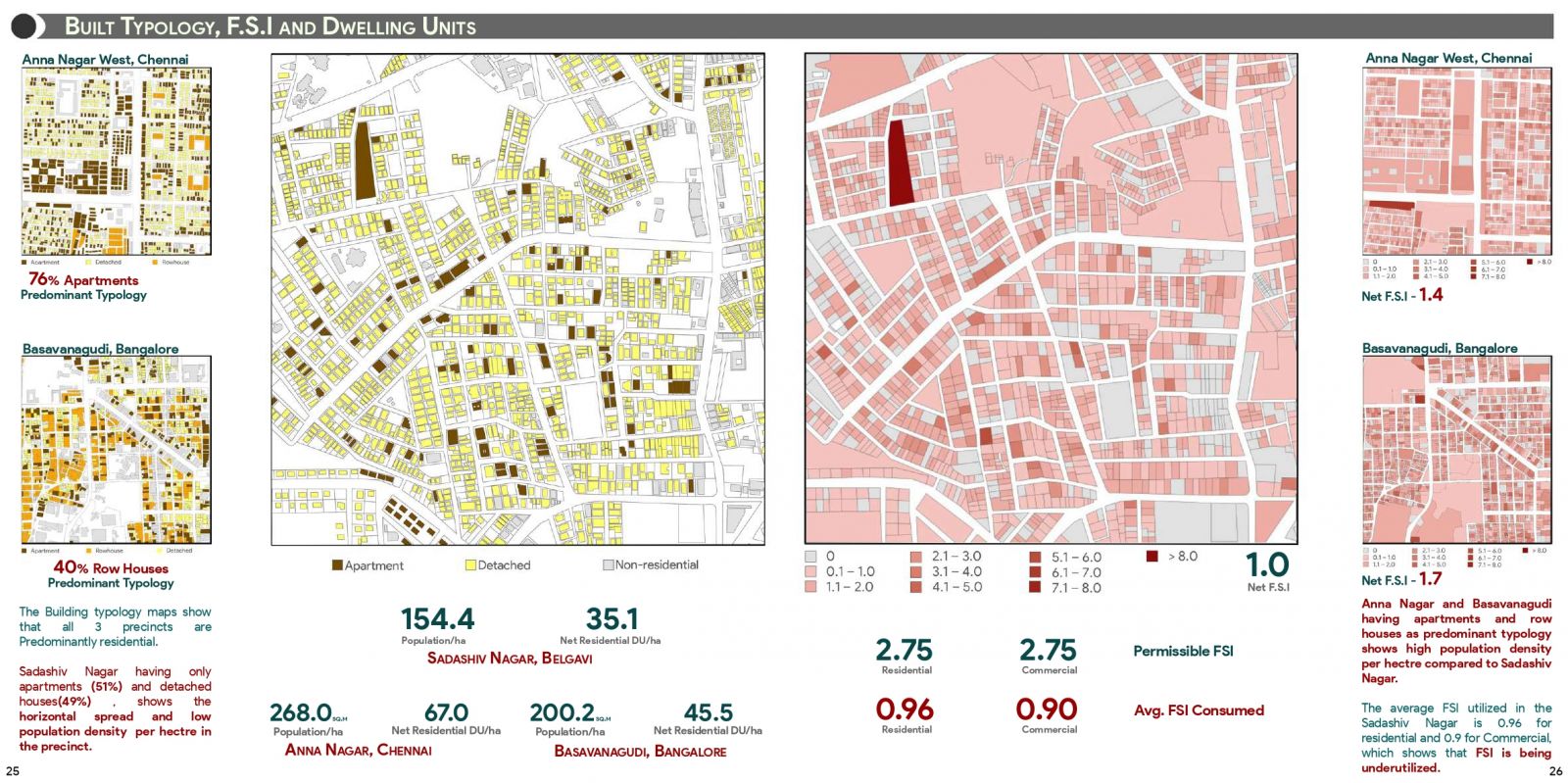
The portfolio focuses on summarizing development in the fringes of Belgavi city, by taking one square kilometer area of Sadashiv Nagar as the study area. The study was done layer by layer by detailed analysis of Sadashiv Nagar with respect to the various parameters, through primary observations, site visits, documentation and surveys and interviews.The study focuses on situating the precinct and understanding that despite being situated 1.7km away from the city center how is Sadashiv Nagar still a Fringe. The chronology of urban transformation of Belgavi city and Sadashiv Nagar including spatial, real estate, social, demographic results and their determinants has been highlighted in the analysis. In continuation to understanding the precinct, the aim is to analyze street hierarchy, networks and connectivity in Sadashiv Nagar. It is an also attempt to identifying the differences and gaps in the data generated from the statistical analysis to the actual condition of walkability and the street networks in an organic, irregular street network like Sadashiv Nagar. Property prices in the fringes of Belgavi city like Sadashiv Nagar, is higher than that of the core of the city. The study aims to understand the reasons behind the same and analyses the typical characteristics of a horizontally spread fringe. starting with the land use conversion from agriculture to residential to the overall development including the built form, land use , infrastructure services, jobs, livelihood educational and housing choices that lead to the migration of the people and influenced the overall growth of the city. The analysis has been supported with satellite images, statistical analysis through GIS (Geographic Information System) and secondary data from relevant journals, newspaper articles and government websites.