- Student ISHITA SINGH
- Code PGE21145
- Faculty Technology
- Tutor/s Shaily Gandhi,Bindi Dave,Piyush Shah
- TA Ashishkumar Upadhyay
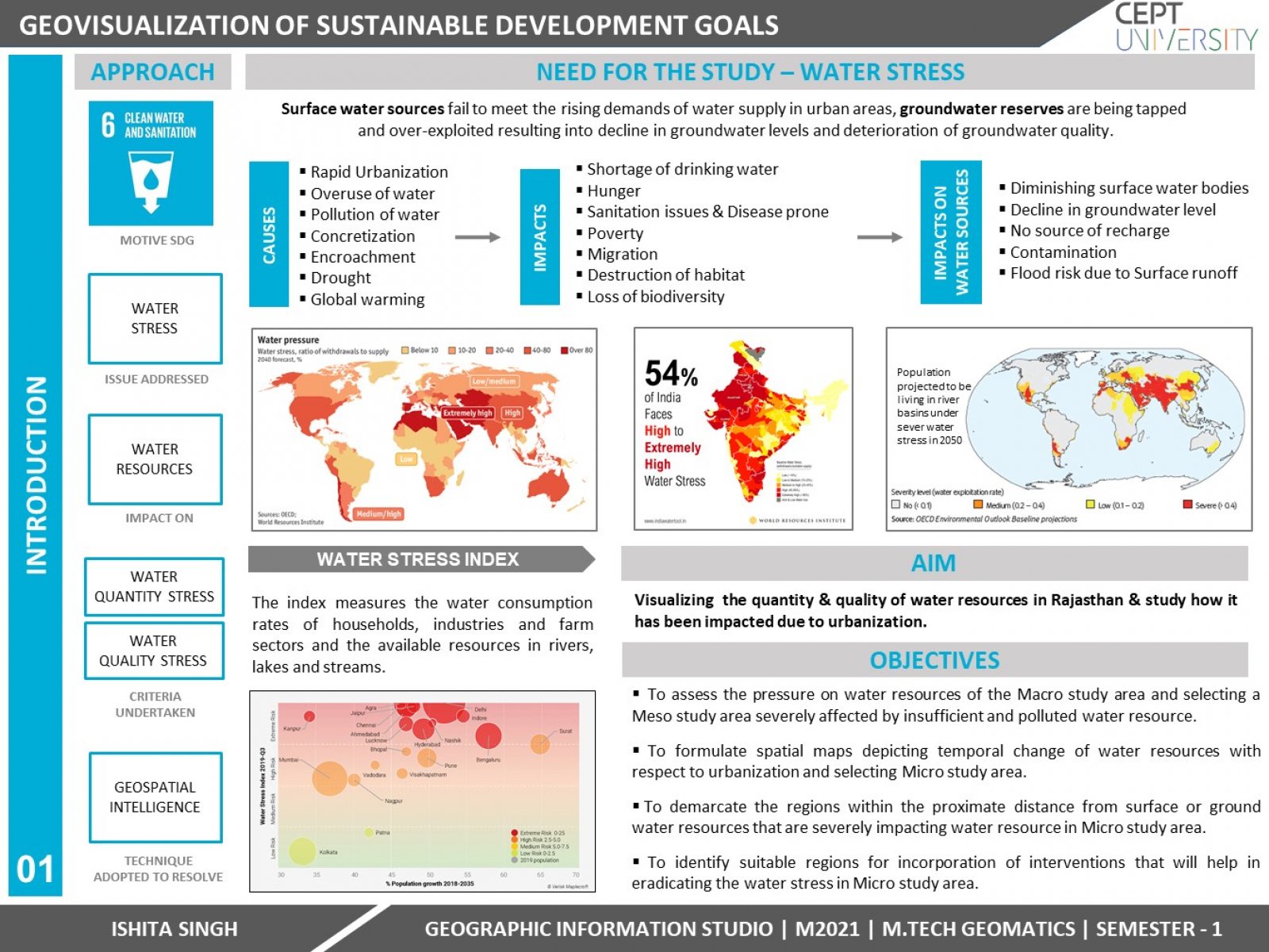
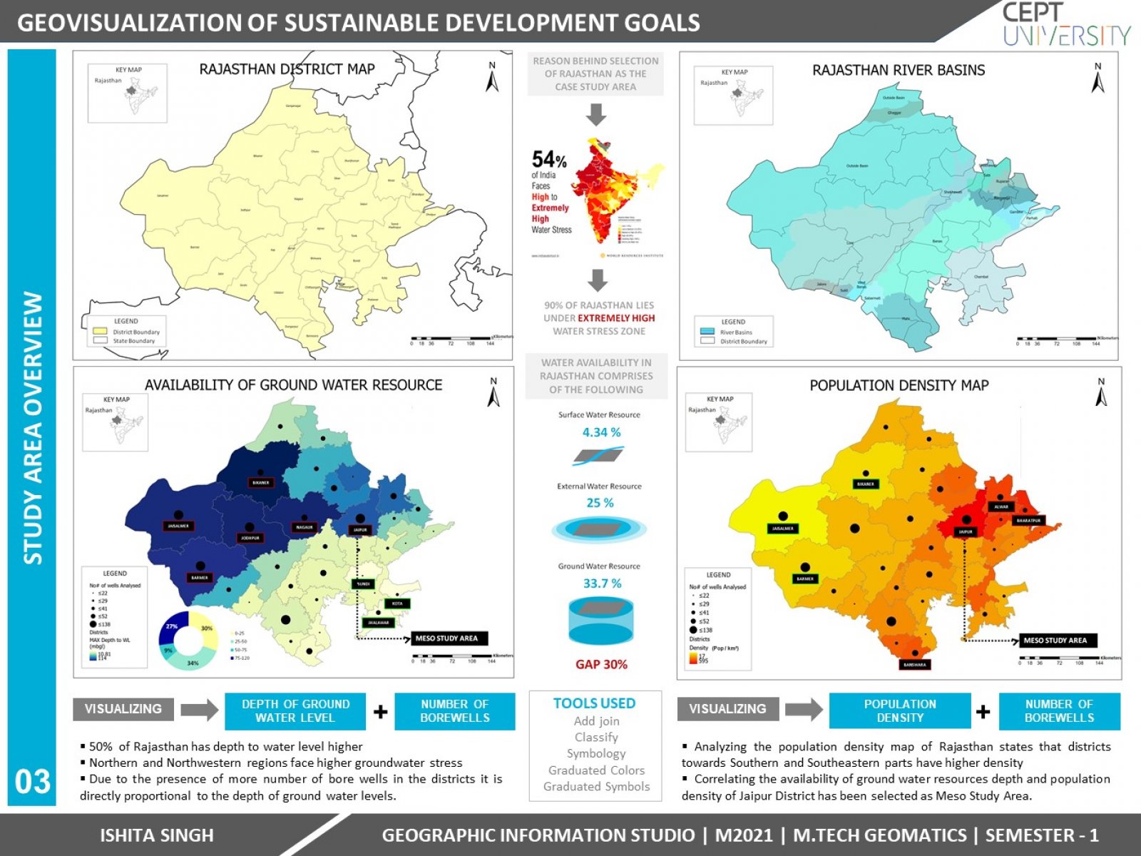
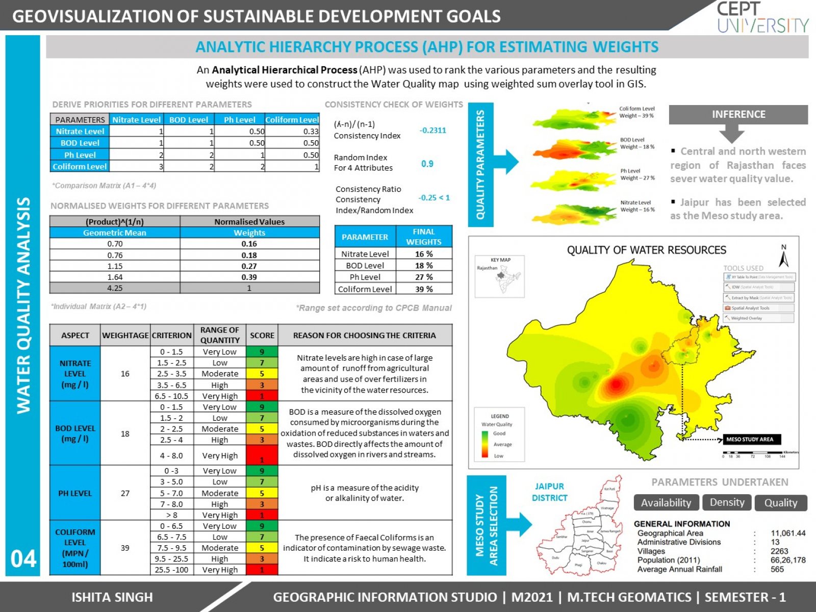
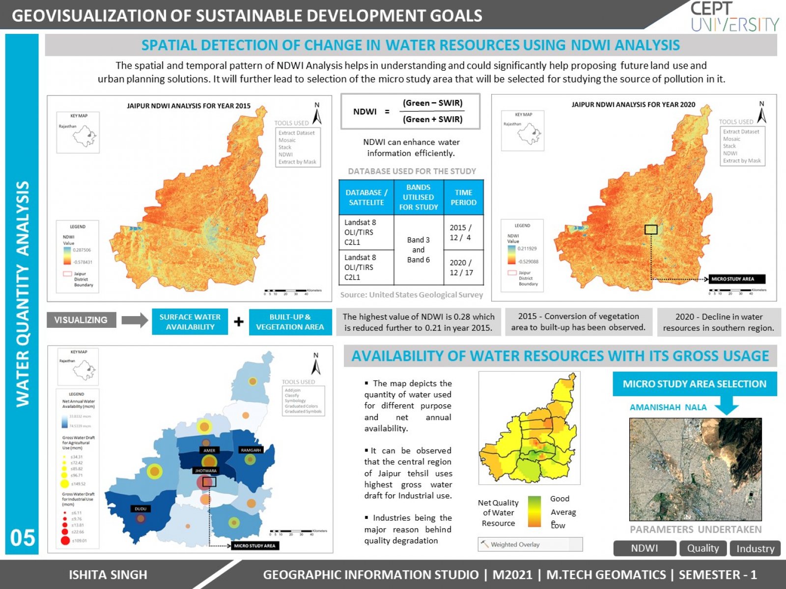
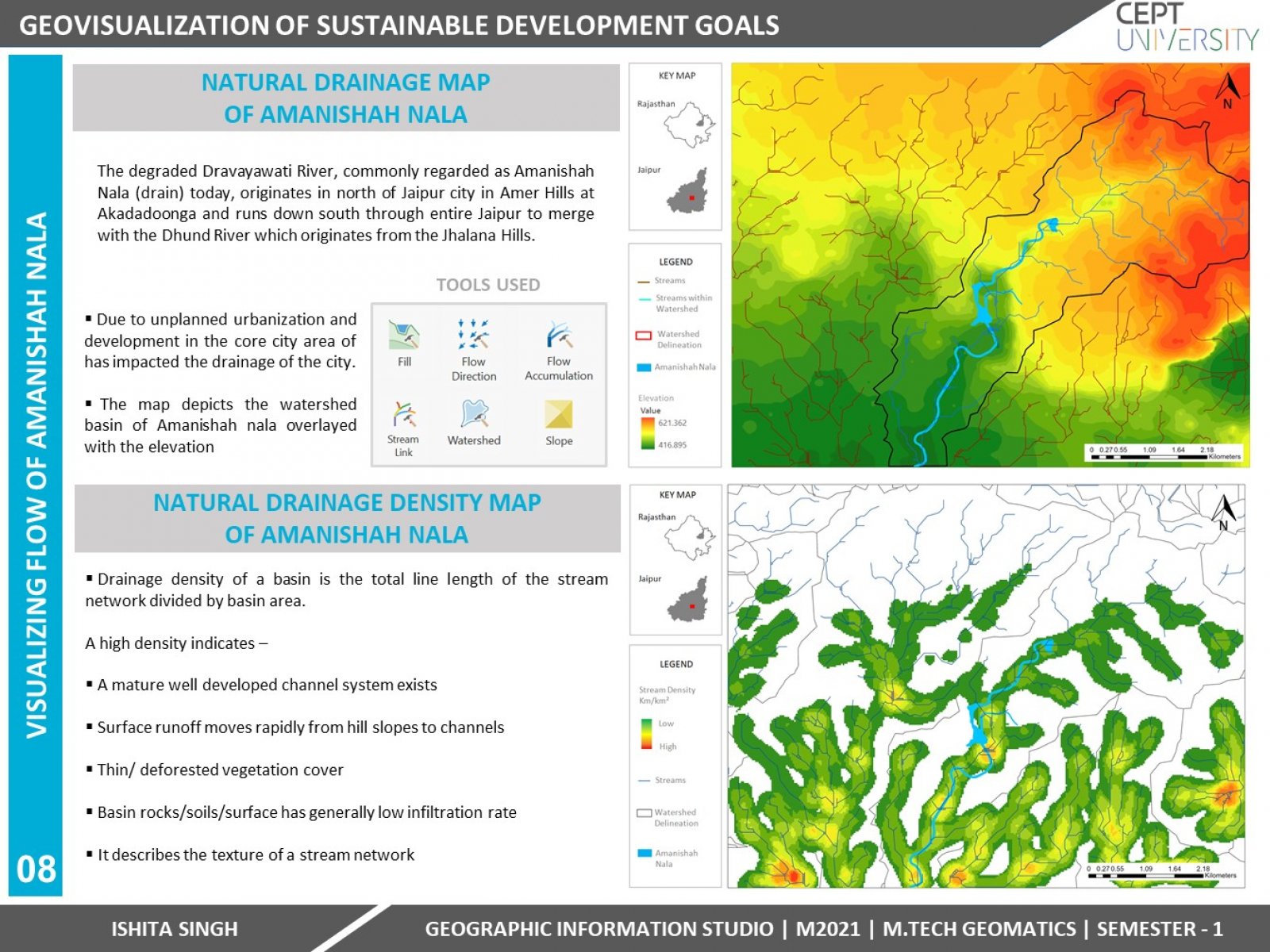
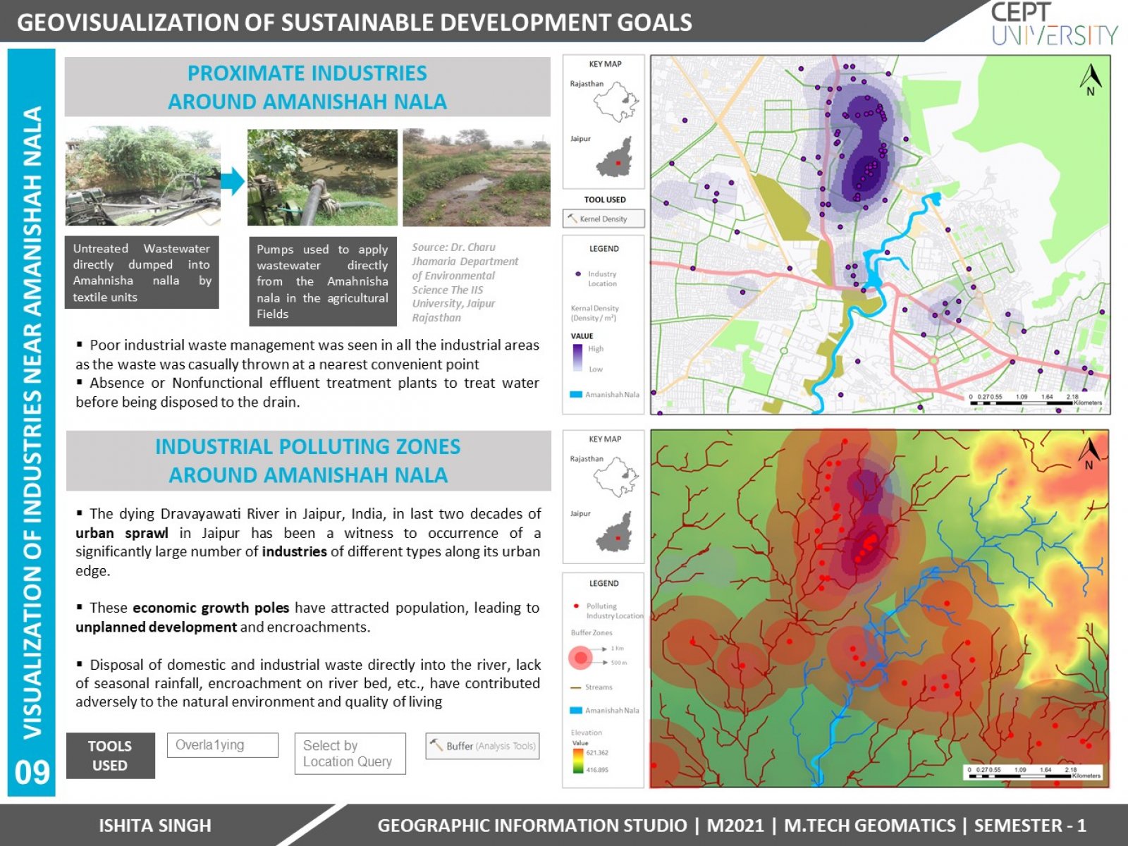
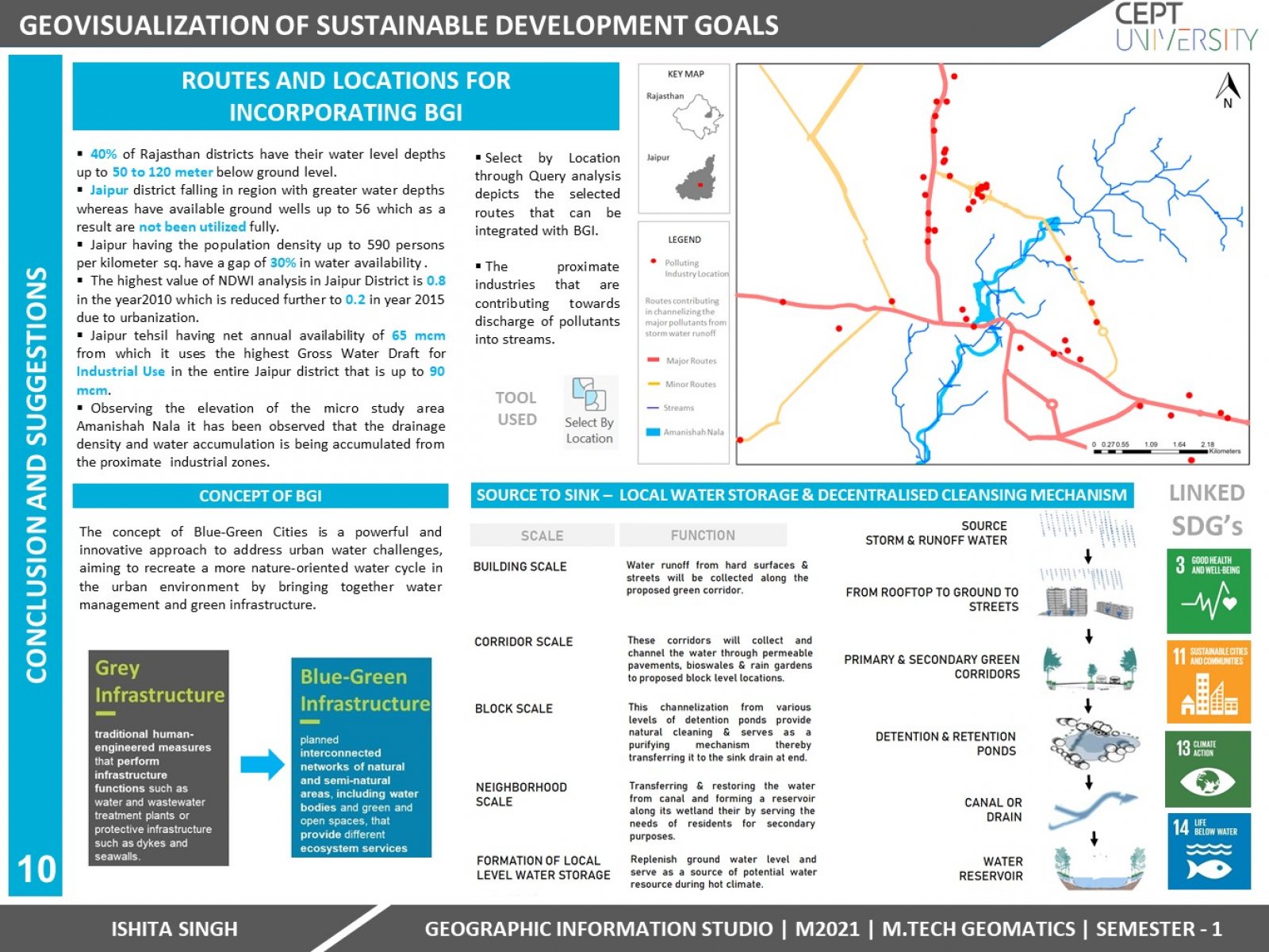
Water is an important aspect for sustainable development in any city as it lays a foundation for achieving Sustainable Development Goals. Despite this water stress is becoming a key issue around the world. Hence, this establishes a need of adopting a water resilient approach in the cities to adapt to such water stresses. With the advent of GIS and remote sensing technologies, many of these issues are being addressed and are having profound impact on both the management decisions as well as how data is analyzed. There is an urgent need to analyze and monitor current quality parameters of river so that corrective measures can be taken for the problems. In the project Water Availability in Rajasthan has been analyzed spatially by overlaying different attributes like population density, proximate water resource locations and depth of water levels. Then for analyzing the Water Quality different parameters has been interpolated and then assigned weightage in the context to its sensitivity towards water resources through Analytic Hierarchy Process (AHP). The outcome of this was a Weighted overlay map depicting the areas where water quality is low and area that have a good quality. After this for temporally detecting the change in Water Index of the area Normalized Difference of Water Index (NDWI) analysis was been performed which correlates the value of where water has been diminishing due to urban growth. Lastly, for studying the Drainage pattern of a study area Hydrology analysis was done which demonstrates the water accumulation and directional flow of water in the study area with respect to the Digital elevation model. The outcome of Hydrology analysis was a delineated Watershed basin and stream density map of the study area. The end result was spatially visualizing the industrial zones using Kernel density and Buffer analysis that are causing the inflow of pollutants thereby degrading the quality of water resources. And thereby proposing the ecological solution of incorporating the Blue-Green Infrastructure in the routes identified through Query analysis in GIS.