- Student Bhavya Trivedi
- Code UG180109
- Faculty Planning
- Tutor/s
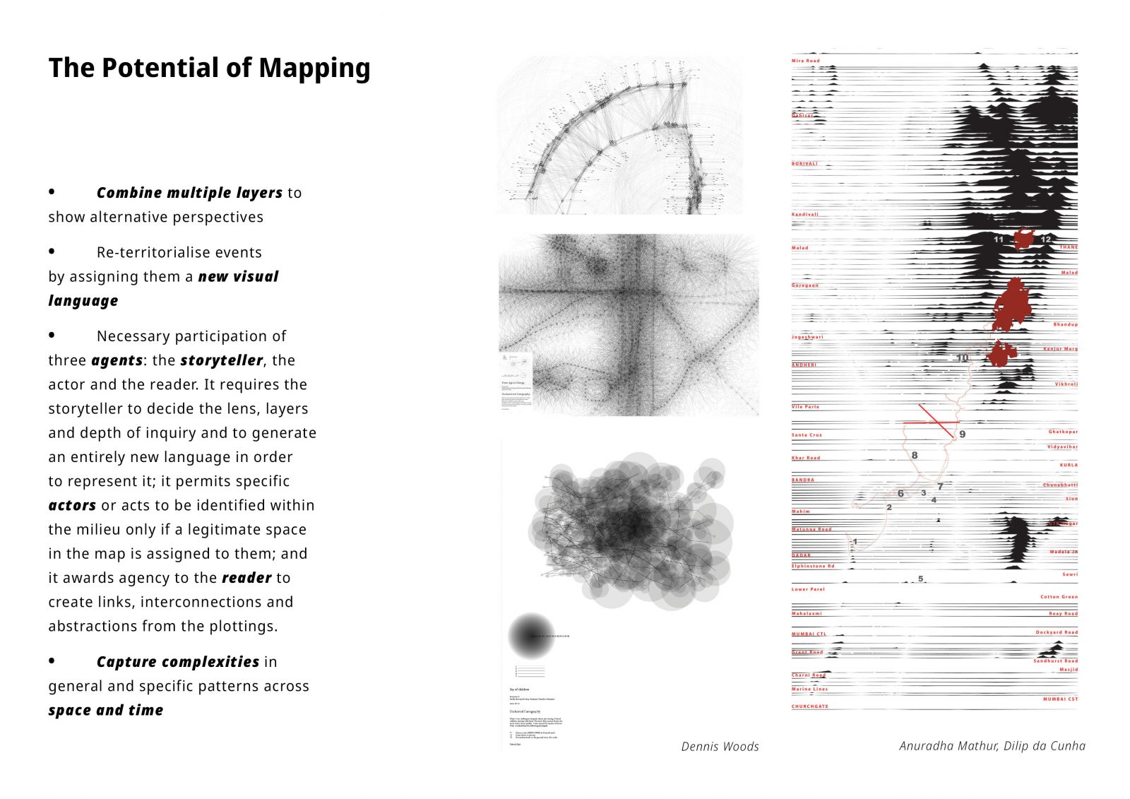
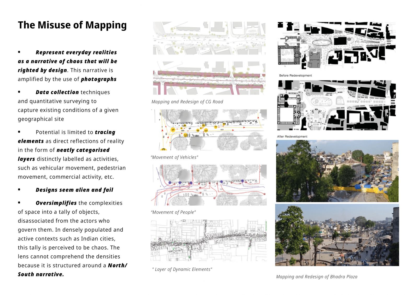
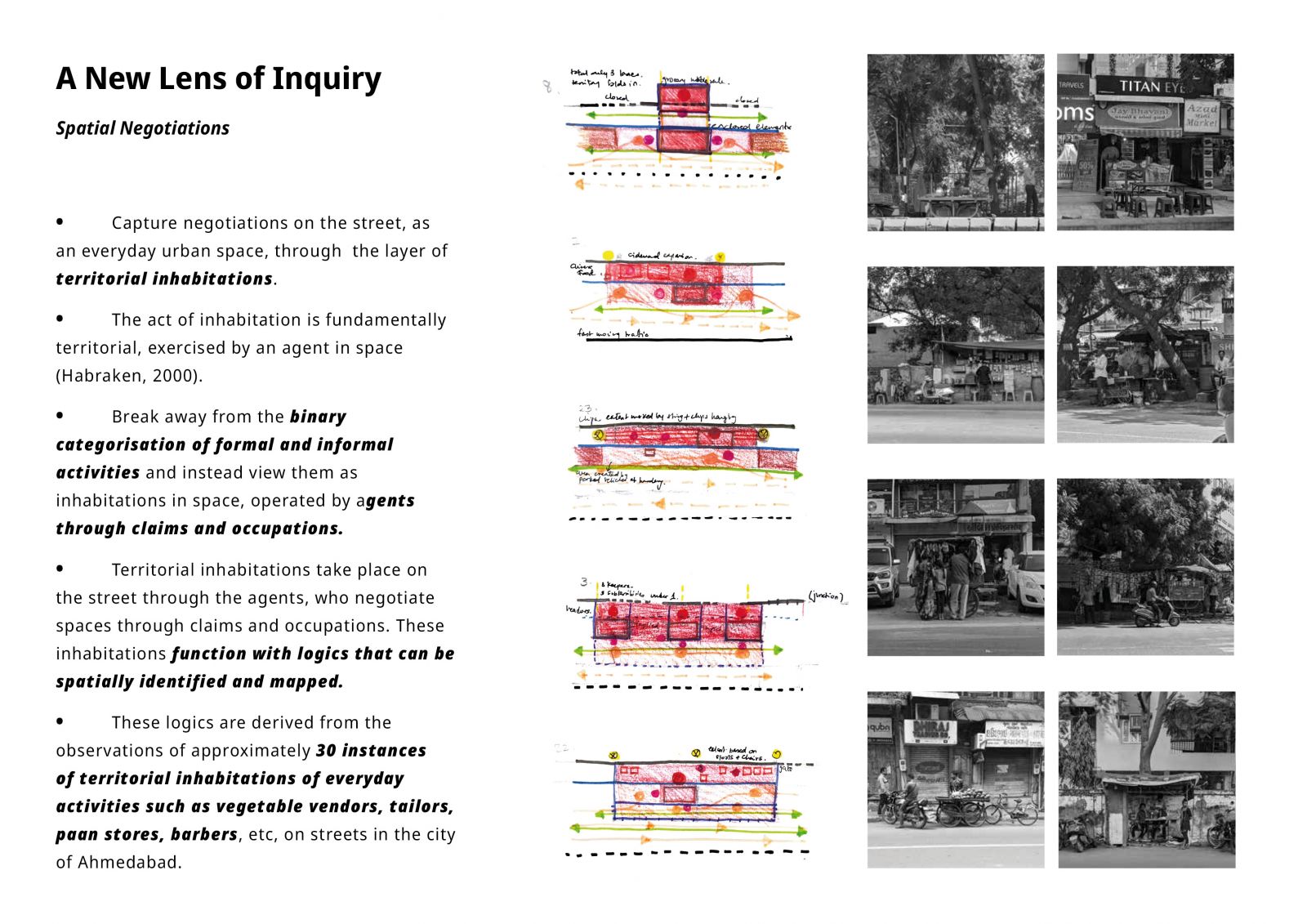
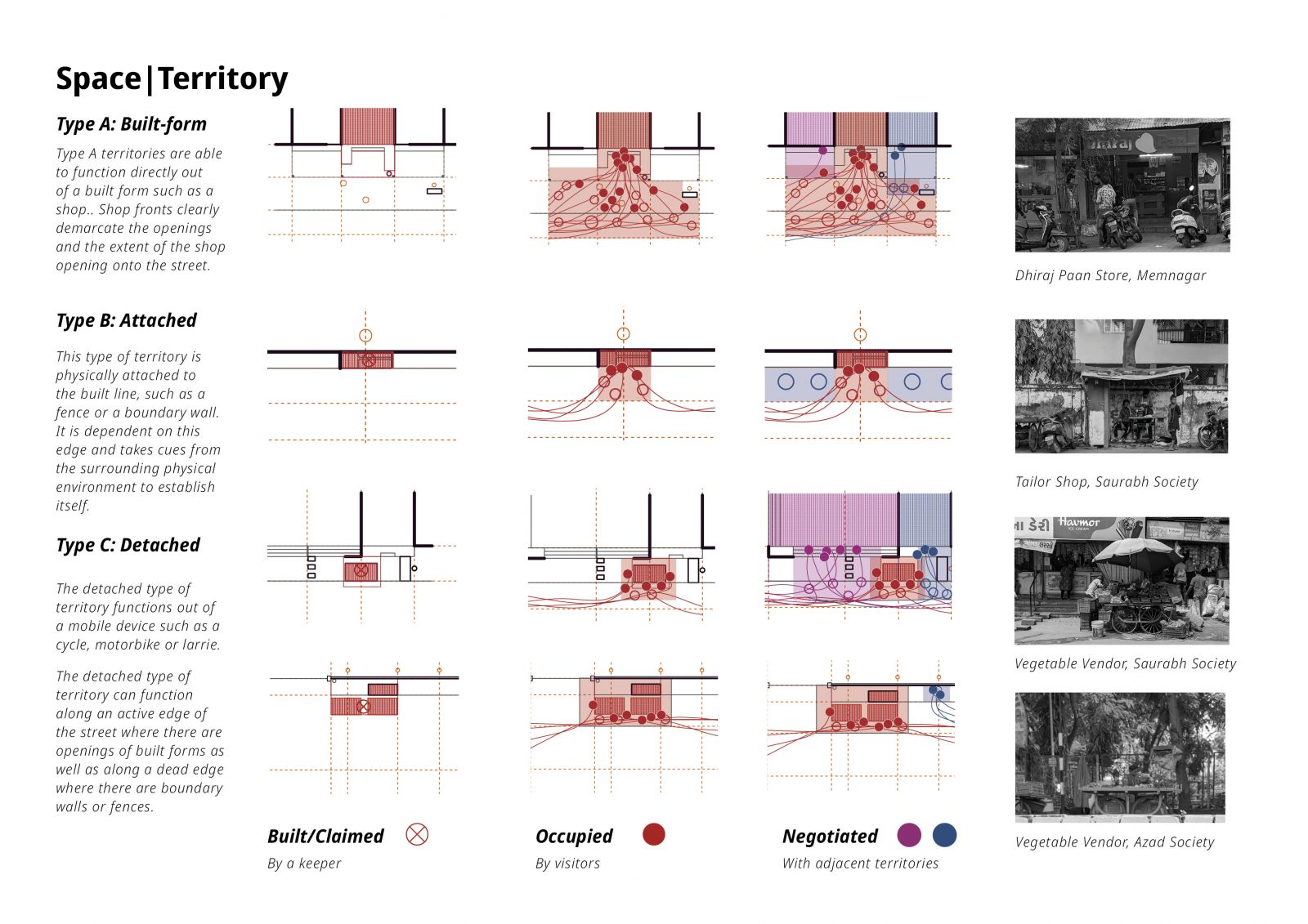
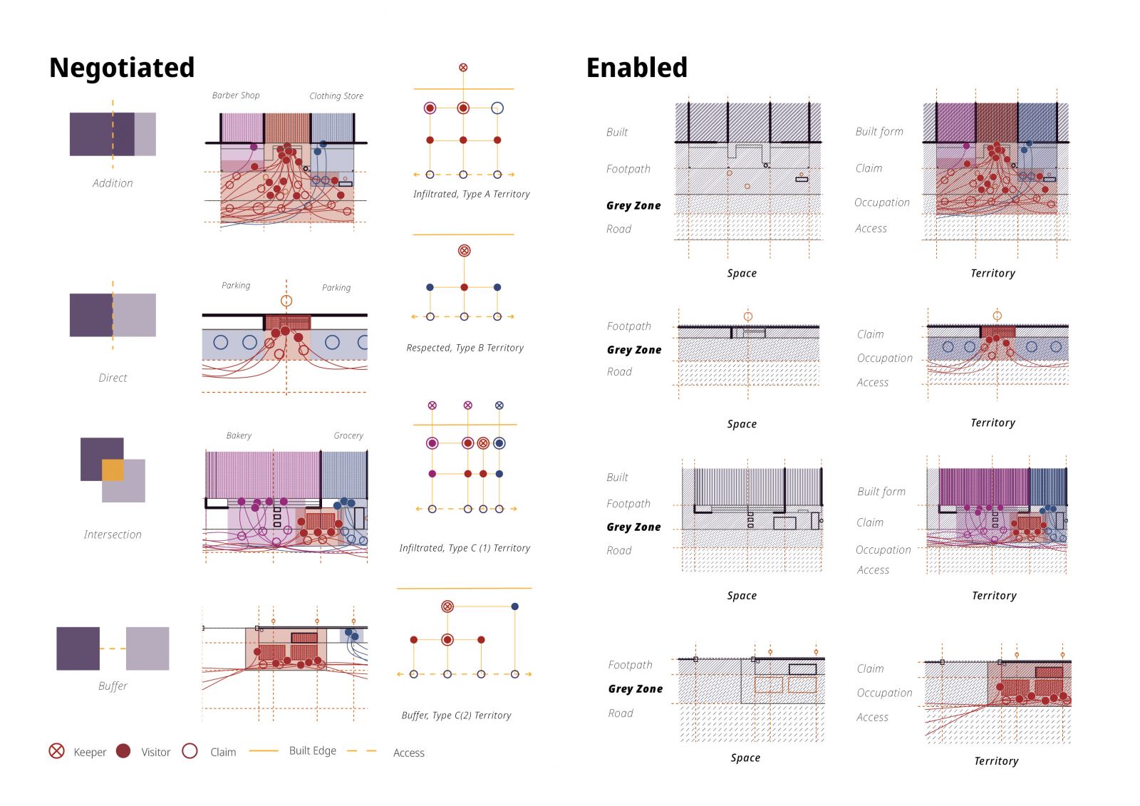
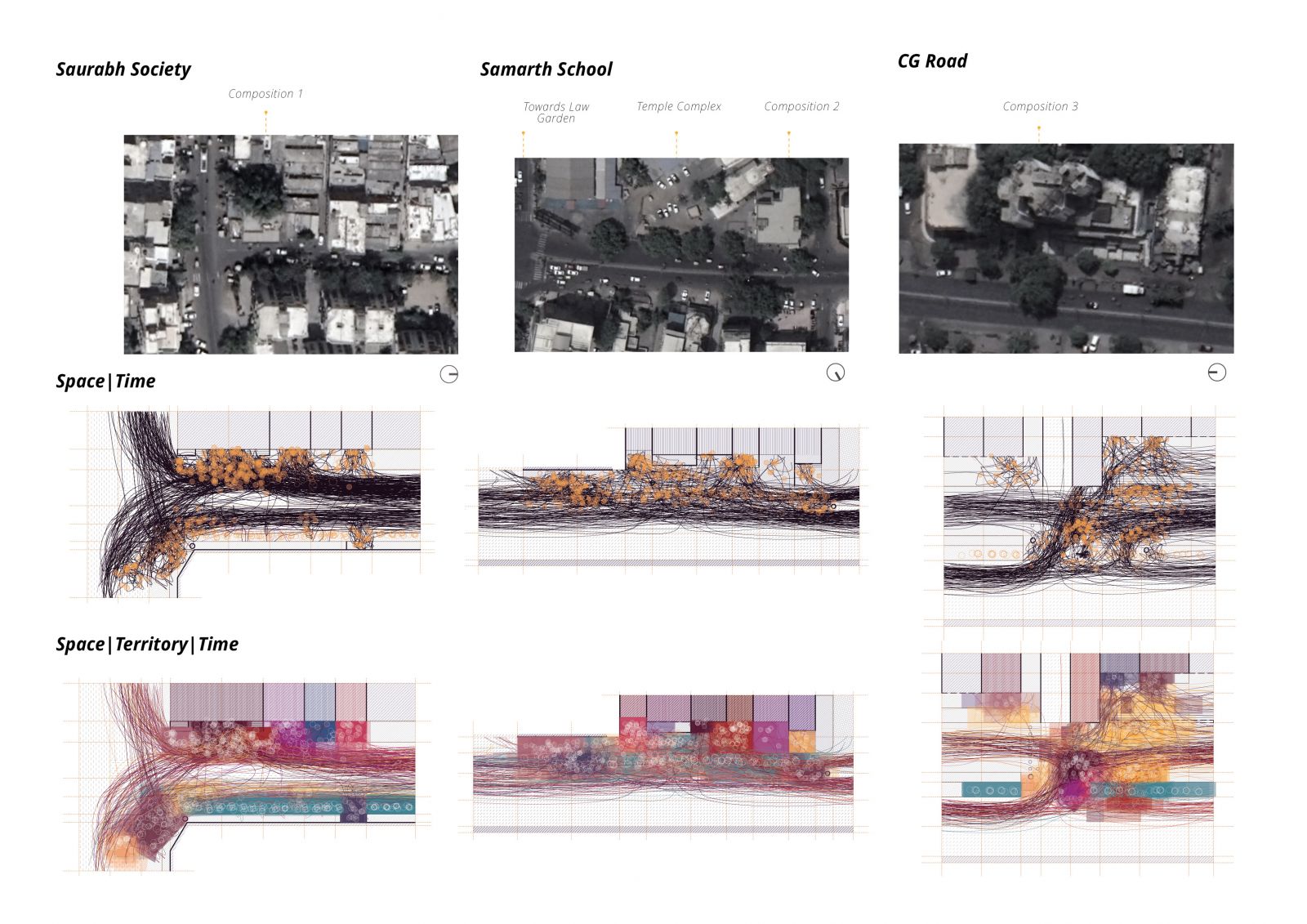
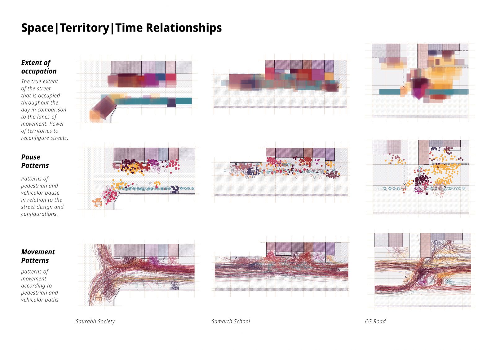
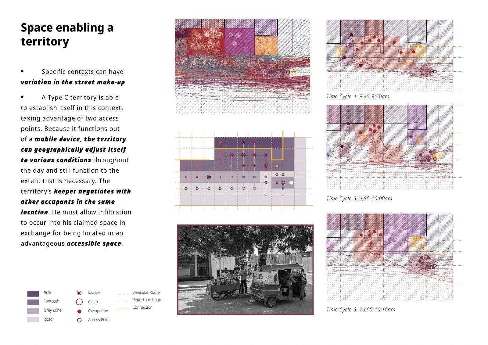
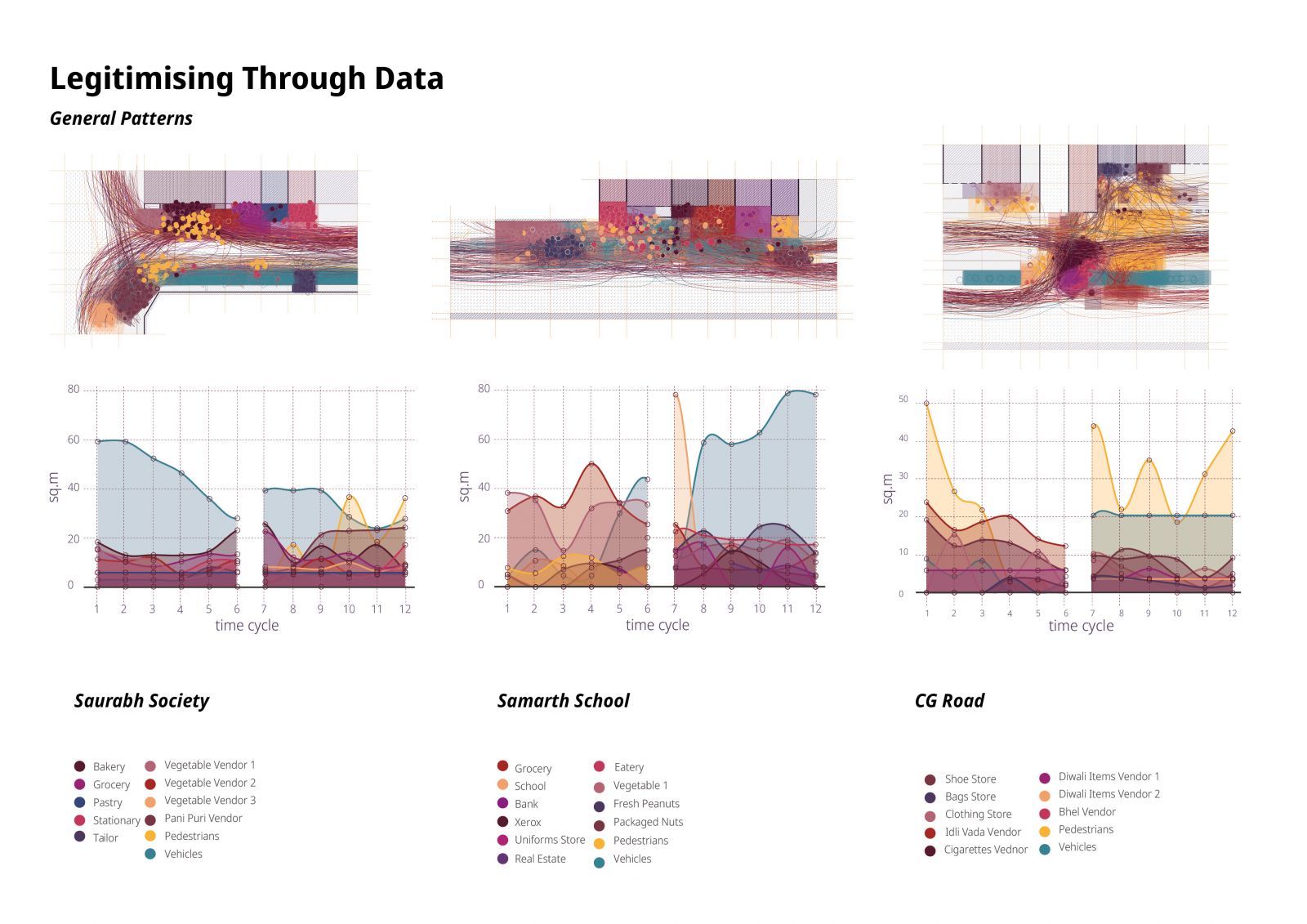
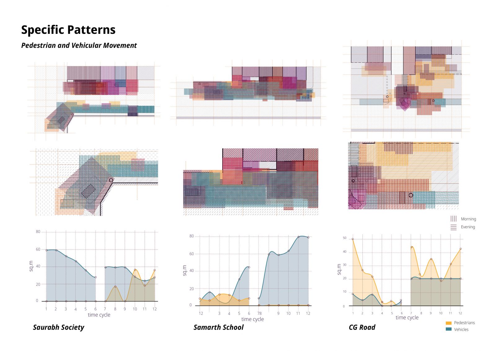
The study proposes a mapping method that is appropriate to the Indian context. There is a vital relationship between space and territory that is characterised by spatial negotiations. These negotiations cannot be dismissed in the representation of urban spaces because they have the power to reconfigure streets despite strict design interventions. Representations of the Indian context need to make the relationships between space, territory and time explicit to accurately represent everyday realities in general and specific patterns. Such visual vocabularies have the potential to inform urban design processes and as a result impact the experience of everyday life for the inhabitants of the city.
