- Student PATEL PRAJVAL BHADRESH
- Code PGE22247
- Faculty Technology
- Tutor/s Shaily Gandhi,Manushi Bhatt,Sweta Rajpurohit
- TA Kirtan Shah
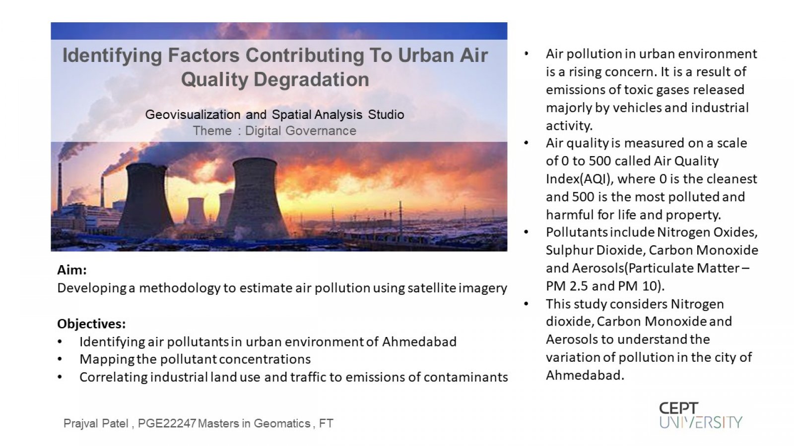
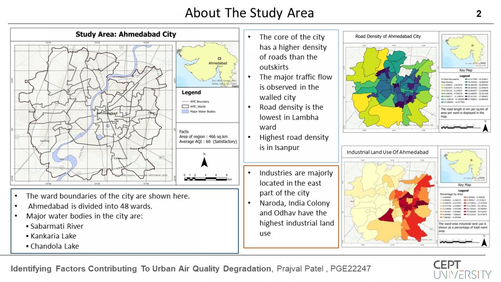
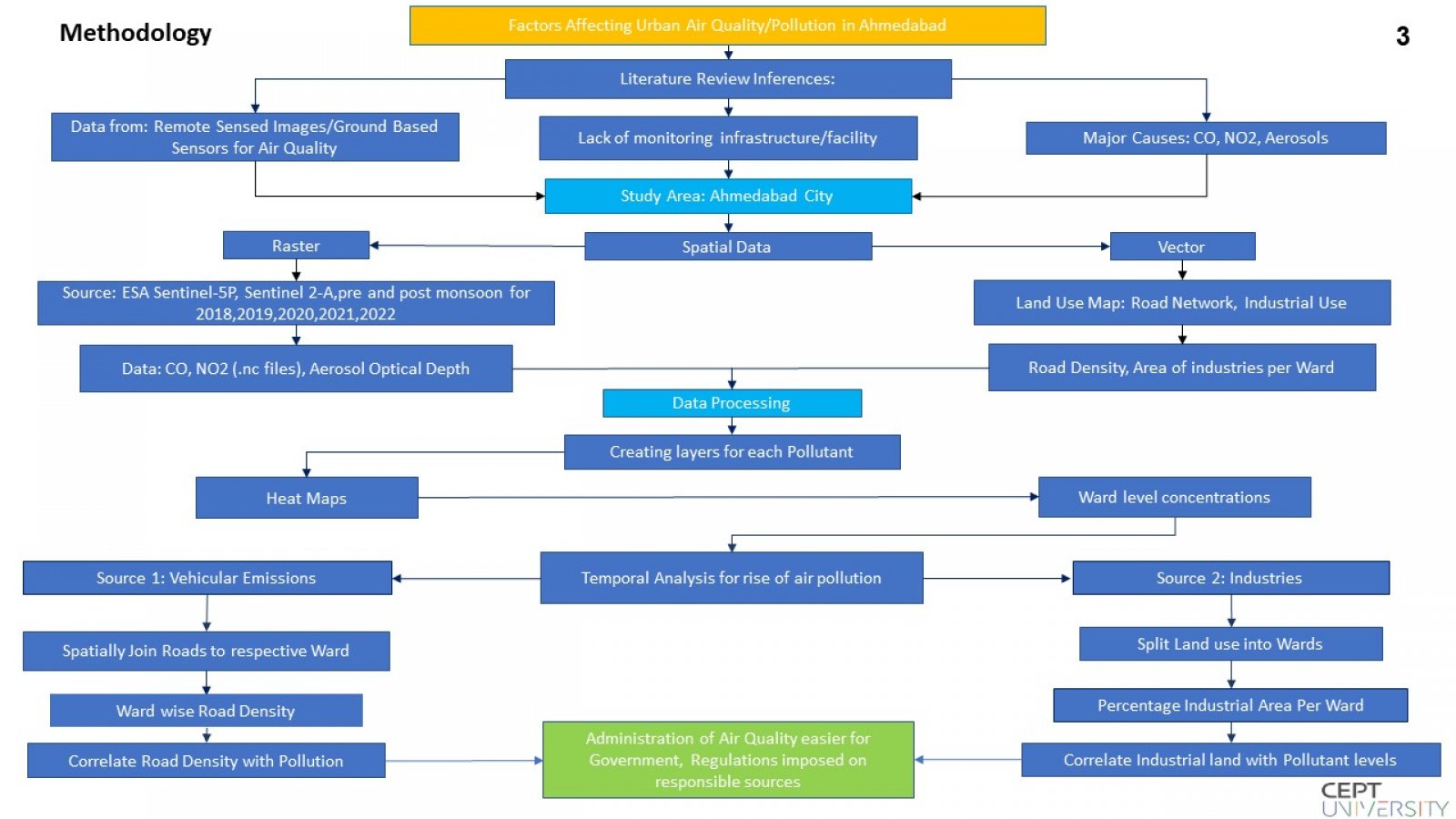
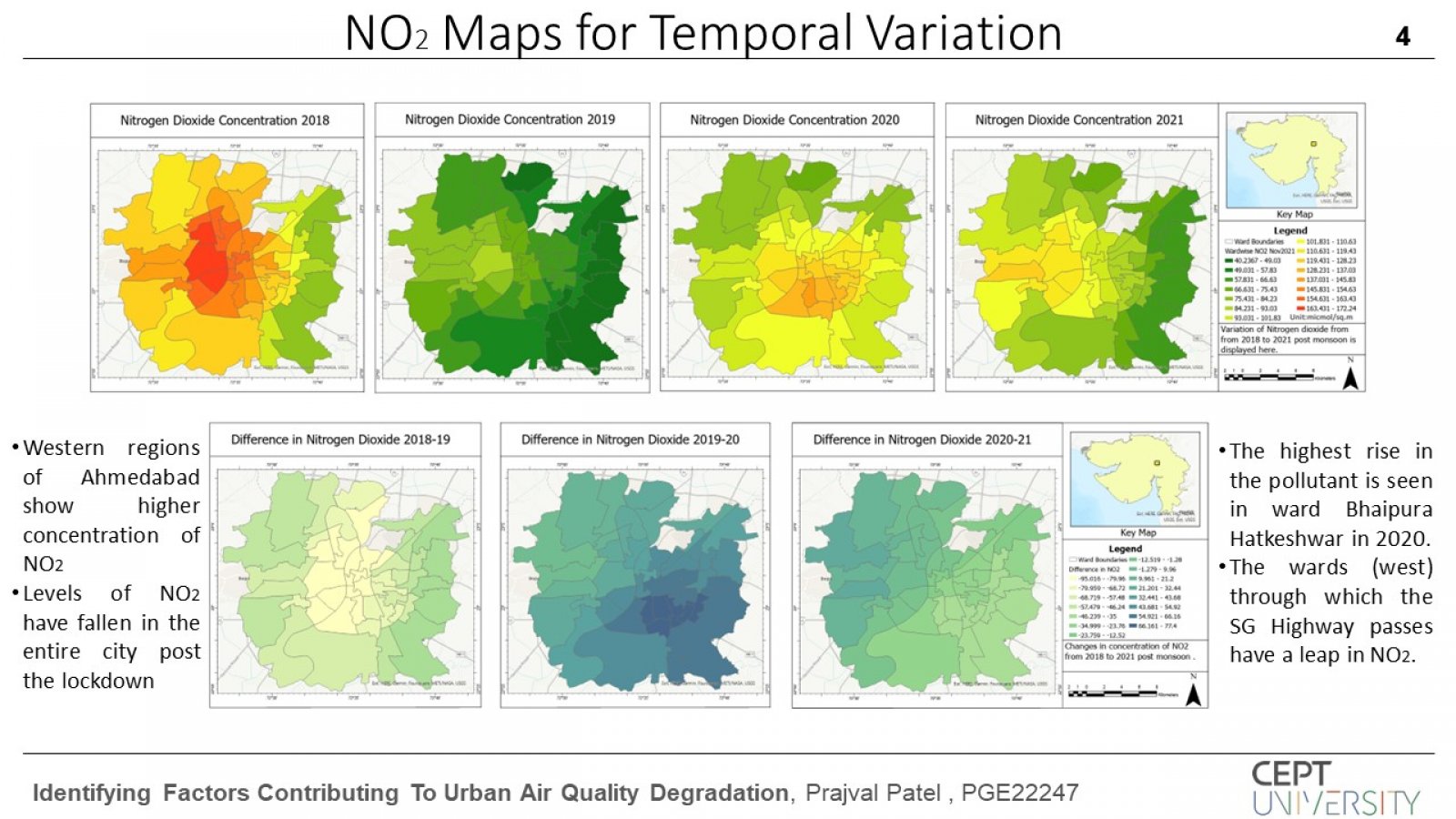
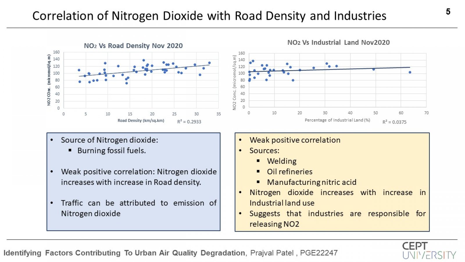
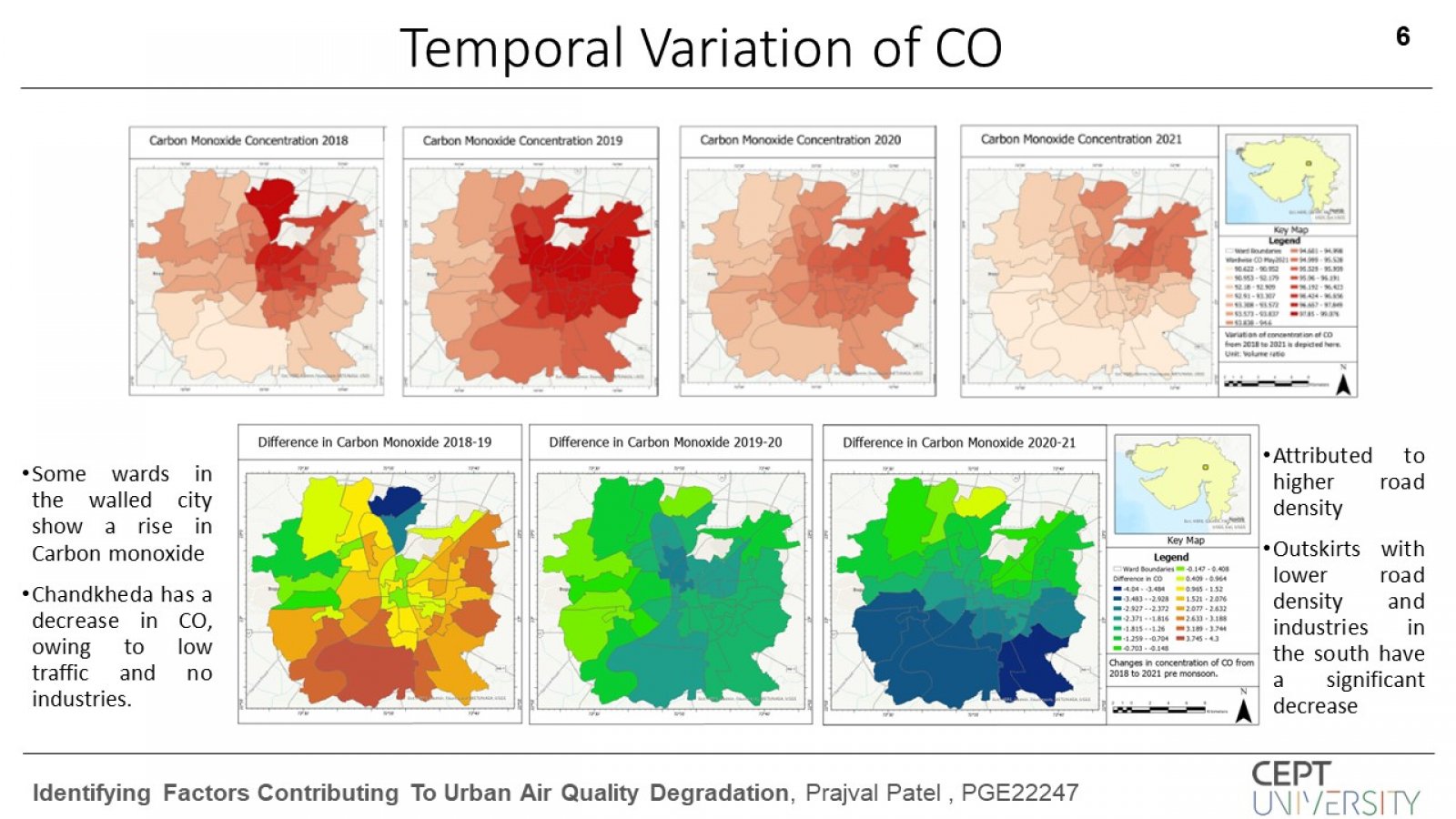
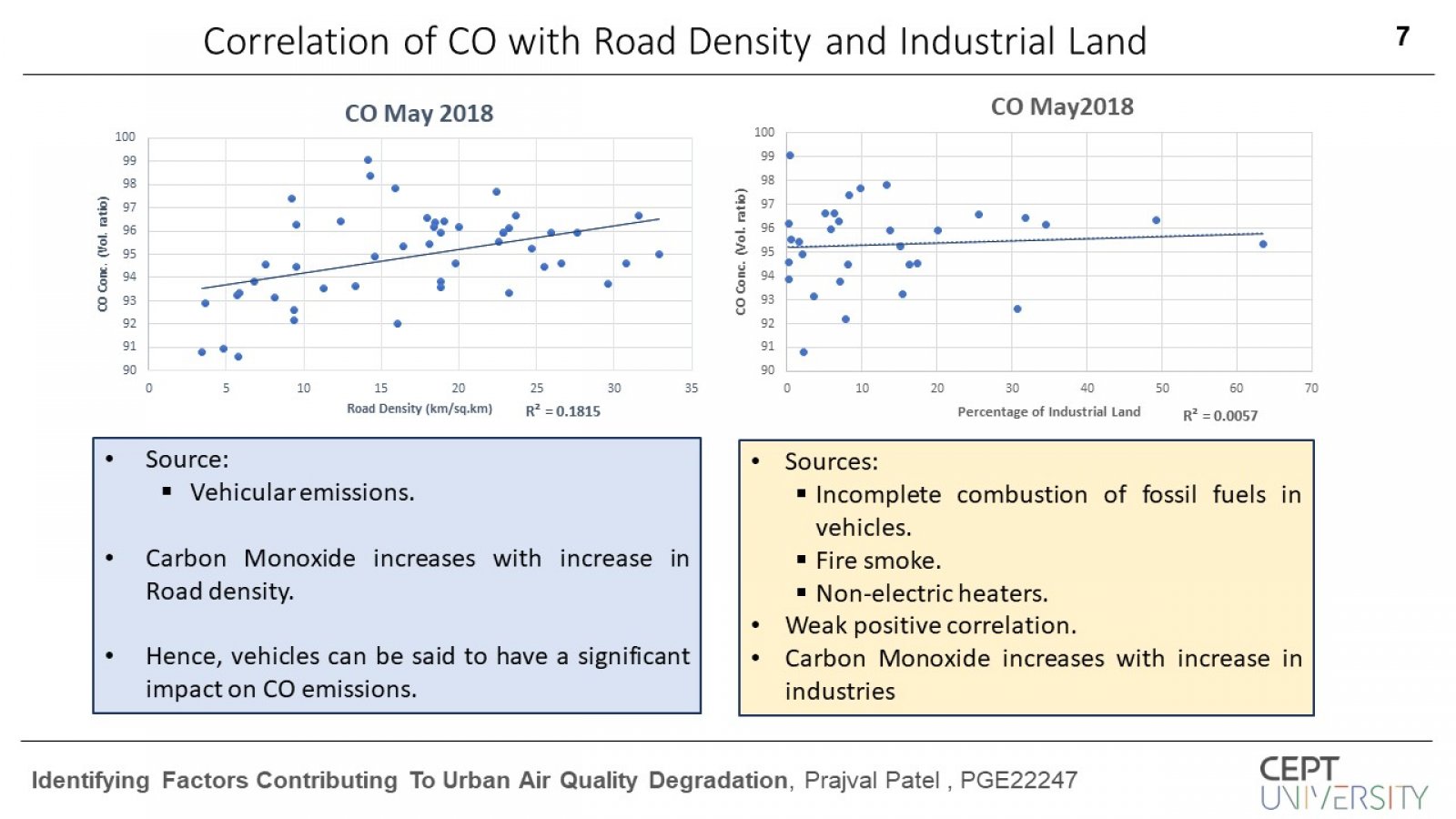
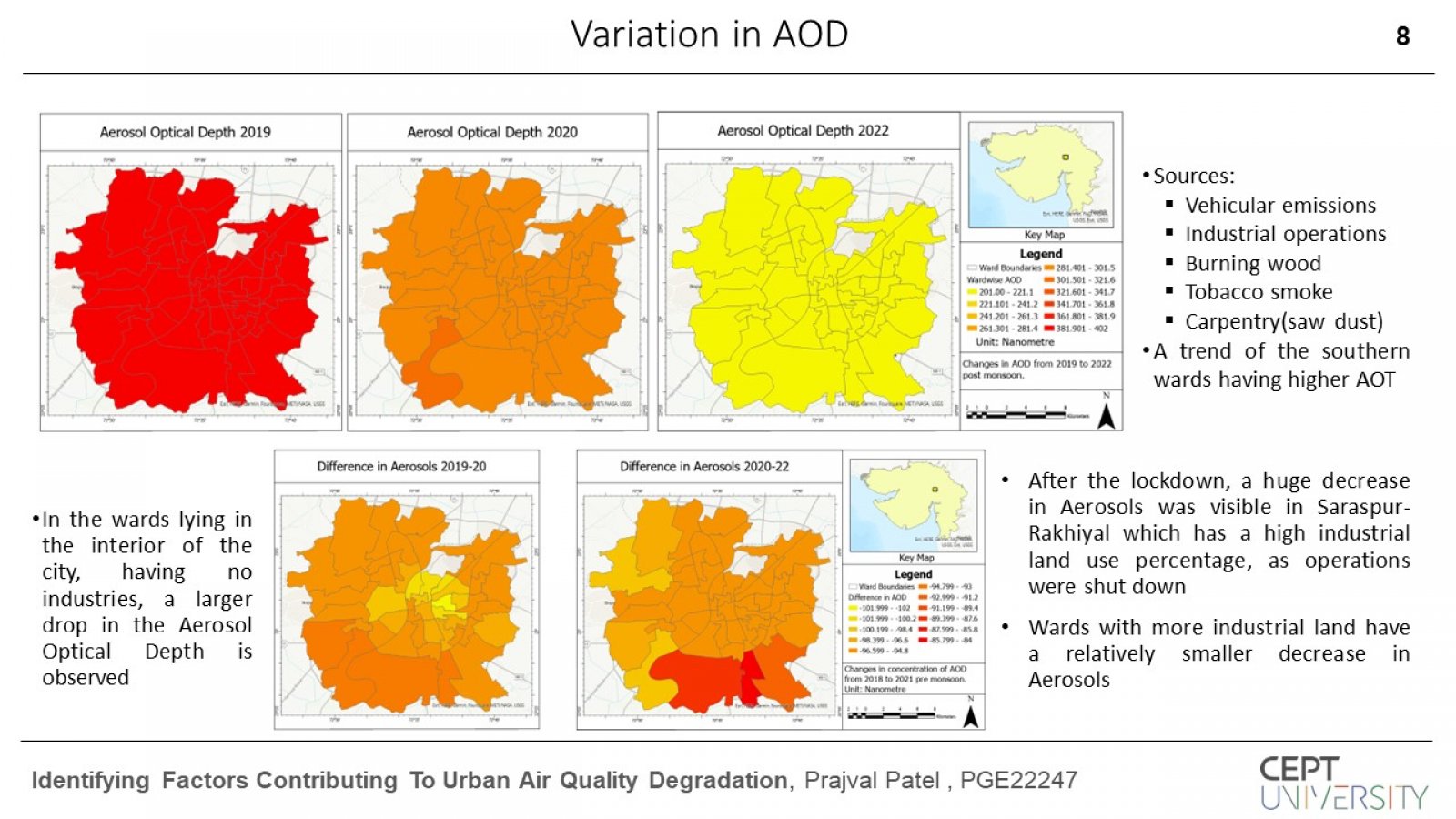
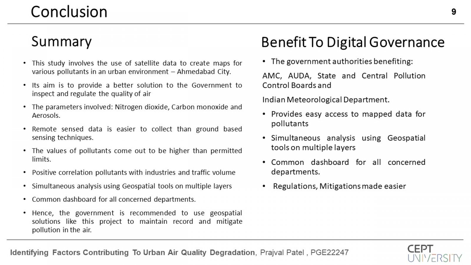
This study deals with the variation of major air pollutants and their variation in the city of Ahmedabad that affect the natural and cultural heritage and human health of the city. Identified pollutants are: Nitrogen dioxide, Carbon monoxide and Particulate matter (PM10, PM2.5), known as Aerosols. Data from remote sensing shall be used more extensively, as the range of coverage is greater, cost-effective and easier to collect. Air pollution has adverse effects on human health and the environment. The spatial (satellite) data in raster form was acquired from Copernicus Sentinel 2-A and 5-P, that provided concentration/amounts of pollutants. Vector data required was: Ward boundaries, Level 1-4 Roads and Land use map of Ahmedabad. Major sources responsible for pollutant emissions are vehicles and industries. To correlate pollution with the sources road densities and percentage of industrial land was calculated for each ward. The Road map was spatially joined with the Ward boundaries and the total length of roads in each ward was divided with the area of the ward, which gave the road density. The industrial land use area for each ward was divided by the total area of the ward, that resulted in the ward wise industrial use. Correlation between these urban parameters was carried out with the pollutant levels.
