- Student BHANPURAWALA QURESH MUDERBHAI
- Code PUT22265
- Faculty Planning
- Tutor/s Rutul Joshi,Umesh Shurpali,Anil kumar Roy,Ravi Sannabhadti,Nitika Bhakuni,Narendra Mangwani,Arjun Joshi,Tarun Patel,Rushil Palavajjhala ,Giby Abraham
- TA Sreedevi Kurur,Priyanka Baghel,Chinmay Gheware,Richa Bihari,Ratik Verma,Kirti chandra Devaguptapu,Rohini Chatterjee,Annesha Dasgupta,Arkadipta Banerjee,Garima Munjal
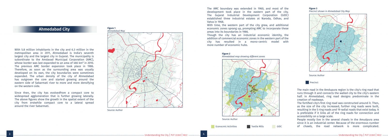
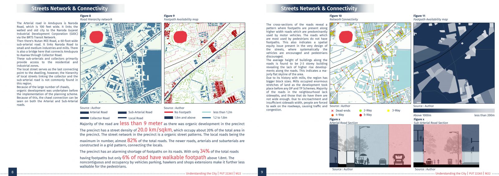
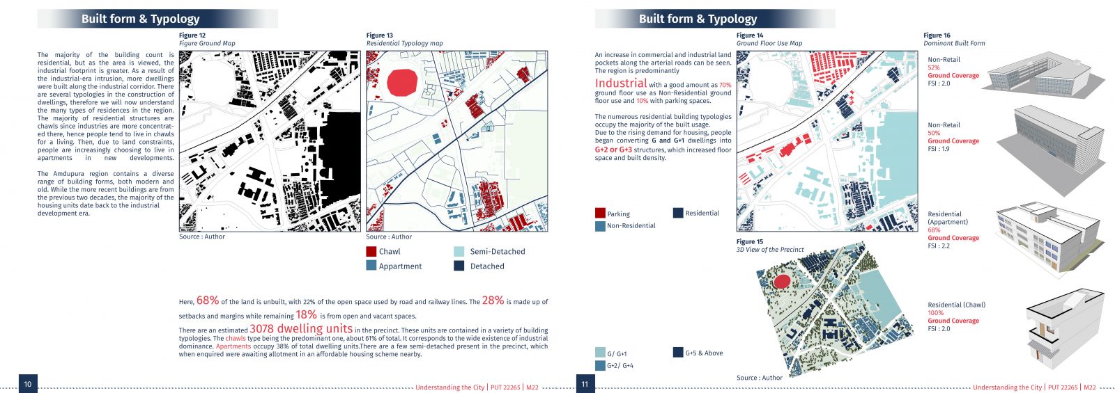
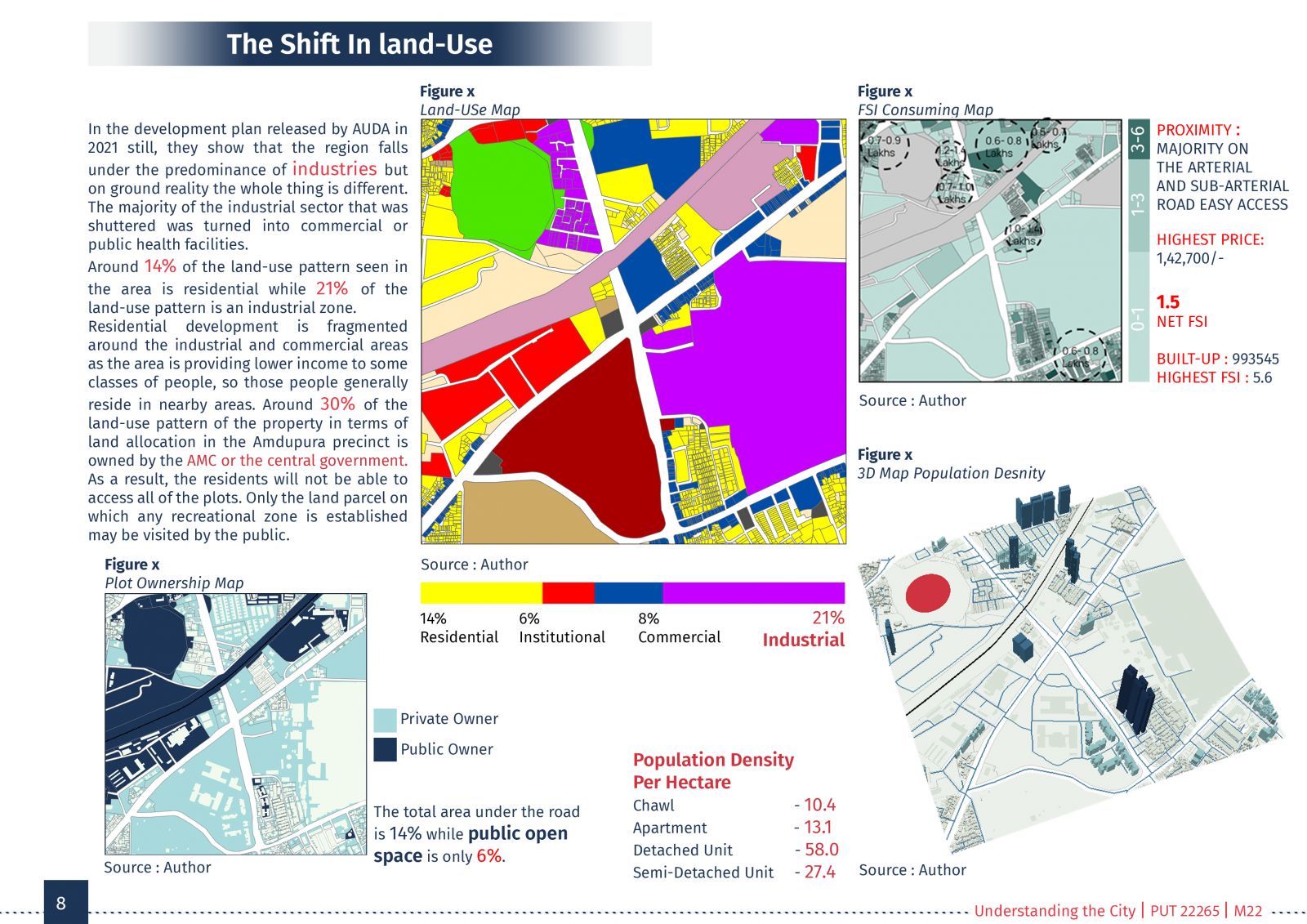
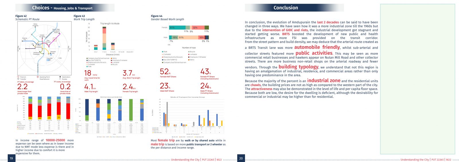
This report talks about the region of Amdupura of eastern Ahmedabad connecting the old fort-walled area and the industrial and textile area of eastern Ahmedabad through the Naroda BRTS Road. Amdupura was mainly recognized as an industrial zone till 2000 but then due to policy changes there was a transition in the land use to commercial land and with other urban development, the growth of these two areas was also seen during two decades. The main road in the Amdupura-Asarwa region is the city's ring road that runs through it and connects the walled city to the city's eastern half. In Ahmedabad, ring road designs predominate in the creation of roadways. The fortified city's first ring road was constructed around it. Then, as the size of the city increased, further ring roads were built, resulting in the 5 ring roads and 19 radial roads that exist today. The third chapter examines the transition of land uses in Amdupura as a result of numerous policies, as well as how the dynamics of the real estate market are influencing the desirability of Amdupura. It also comprehends how the planning norms and strategies regulated the landforms in Amdupura.