- Student PITLA SAMPATHKUMAR PRABHAKAR
- Code PUH22303
- Faculty Planning
- Tutor/s Rutul Joshi,Umesh Shurpali,Anil kumar Roy,Ravi Sannabhadti,Nitika Bhakuni,Narendra Mangwani,Arjun Joshi,Tarun Patel,Rushil Palavajjhala ,Giby Abraham
- TA Sreedevi Kurur,Priyanka Baghel,Chinmay Gheware,Richa Bihari,Ratik Verma,Kirti chandra Devaguptapu,Rohini Chatterjee,Annesha Dasgupta,Arkadipta Banerjee,Garima Munjal
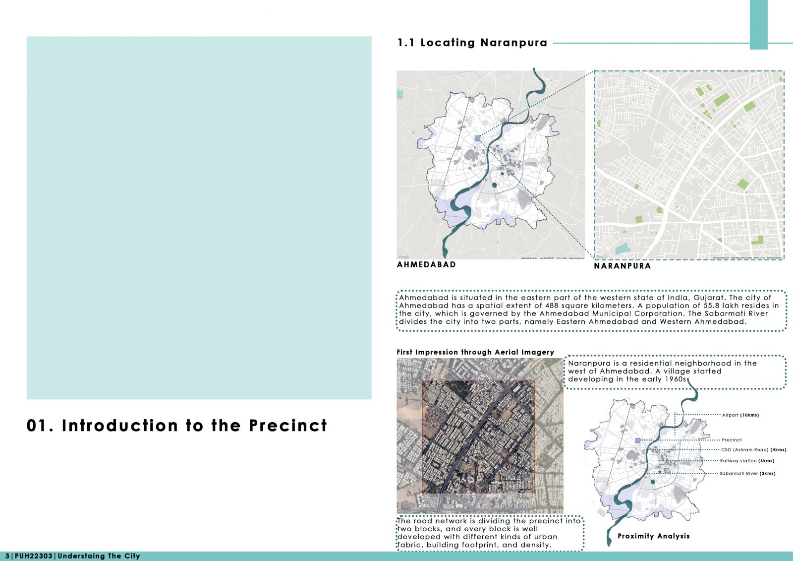
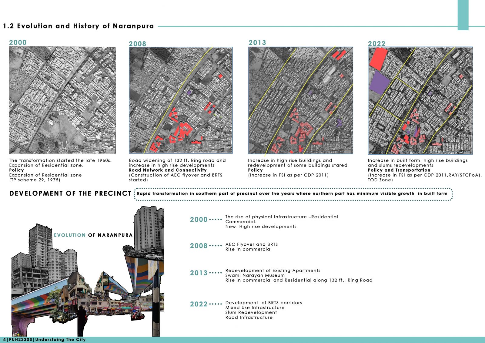
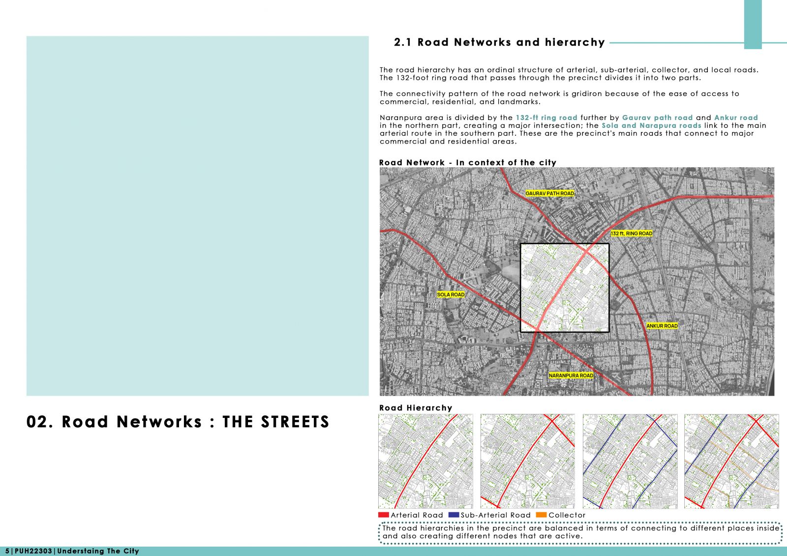
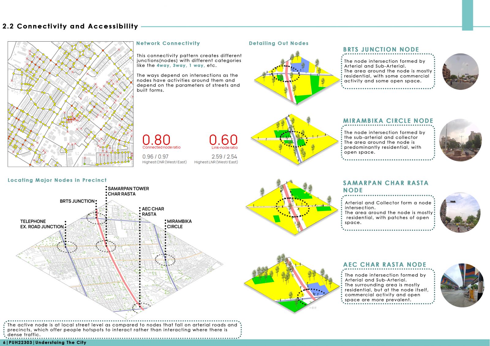
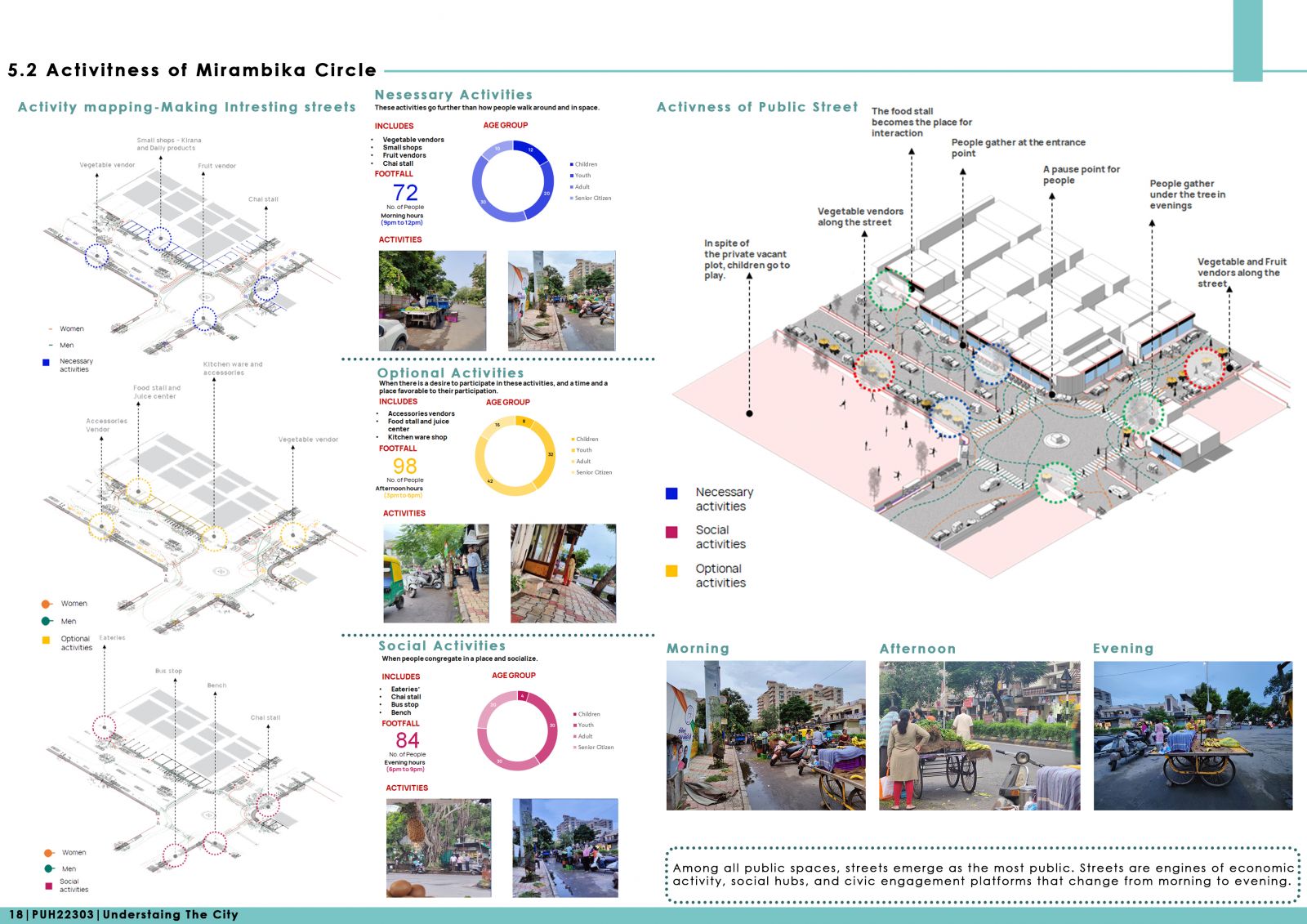
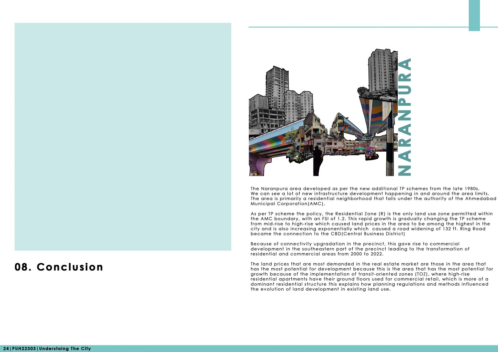
Naranpura is one of the oldest residential neighborhoods in the west of Ahmedabad. Initially, It was a village in the early 1960s. It was included in the city’s municipal limits expansion in 1958. This led to a slight migration of people from neighboring areas, resulting in the change from Naranpura village to Naranpura Colony after 1960. This report aims to aid the working group, comprising a sociologist, an economist, and three community representatives, by providing a thorough account of four aspects of Naranpura: preliminary observations; transformation; street network and built forms; and development of land. The portfolio comprises different layers, along with a conclusion. It talks about the transformation of Naranpura from which it builds a connection with the study area from 2000–2022. This is followed by examining the road hierarchy, which focuses on the layering of building forms, activities, and streets. The last discuss the equitable mix of land use and property prices and their correlation with building typology, which triggered the property prices of land parcels and buildings as compared to other precincts owing to locational advantage and superior connectivity. This study uses primary surveys of the area through GIS (Geographical Information System) mapping and physical documentation of the area. This forms the primary tool enabling the study.