- Student ANUP ANIL BUMB
- Code PUP22046
- Faculty Planning
- Tutor/s Rutul Joshi,Umesh Shurpali,Anil kumar Roy,Ravi Sannabhadti,Nitika Bhakuni,Narendra Mangwani,Arjun Joshi,Tarun Patel,Rushil Palavajjhala ,Giby Abraham
- TA Sreedevi Kurur,Priyanka Baghel,Chinmay Gheware,Richa Bihari,Ratik Verma,Kirti chandra Devaguptapu,Rohini Chatterjee,Annesha Dasgupta,Arkadipta Banerjee,Garima Munjal
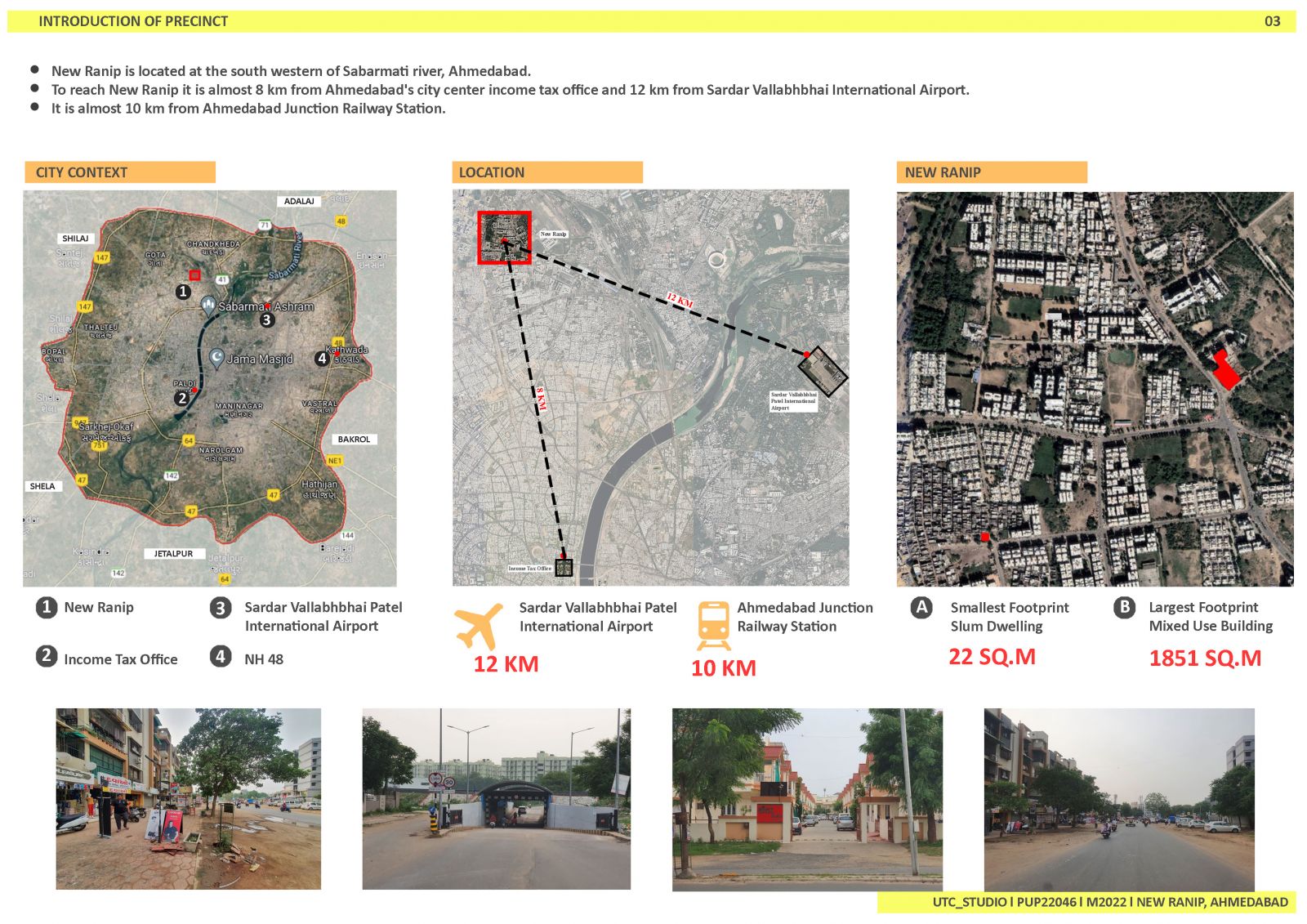
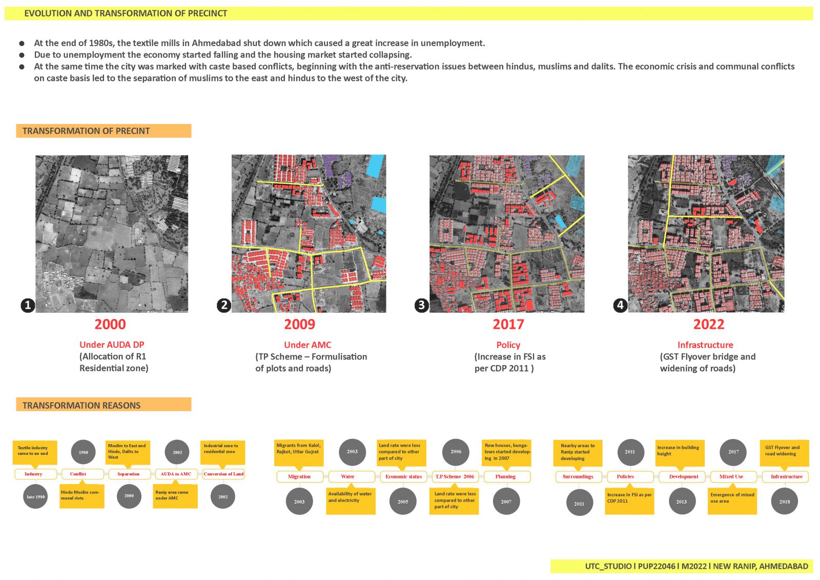
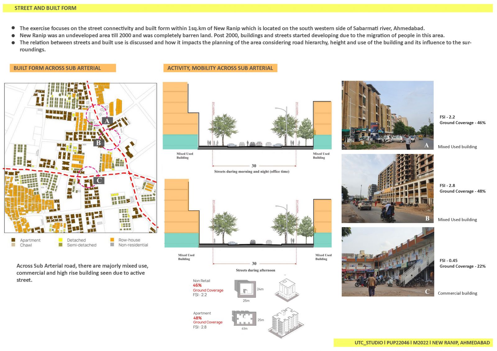
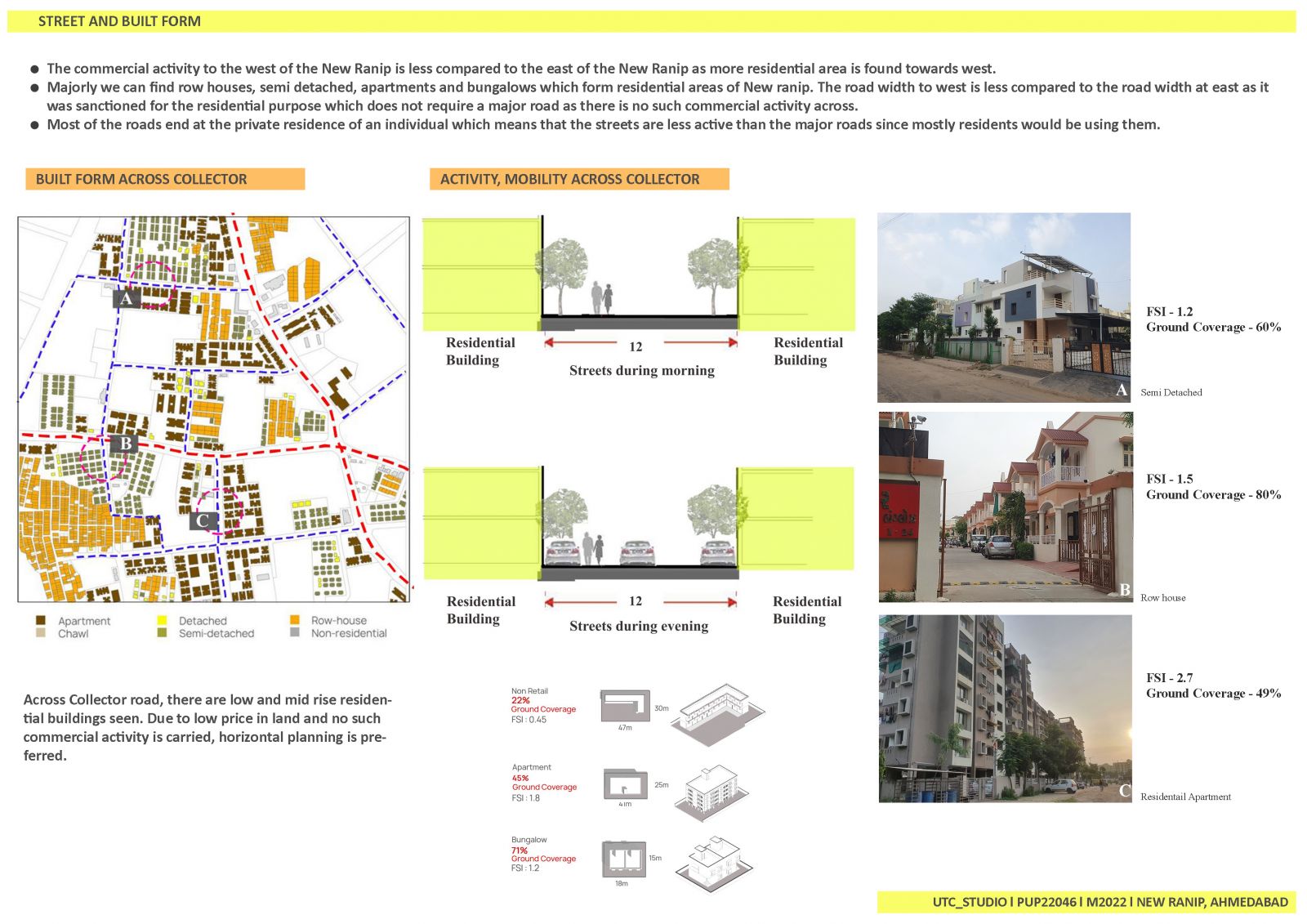
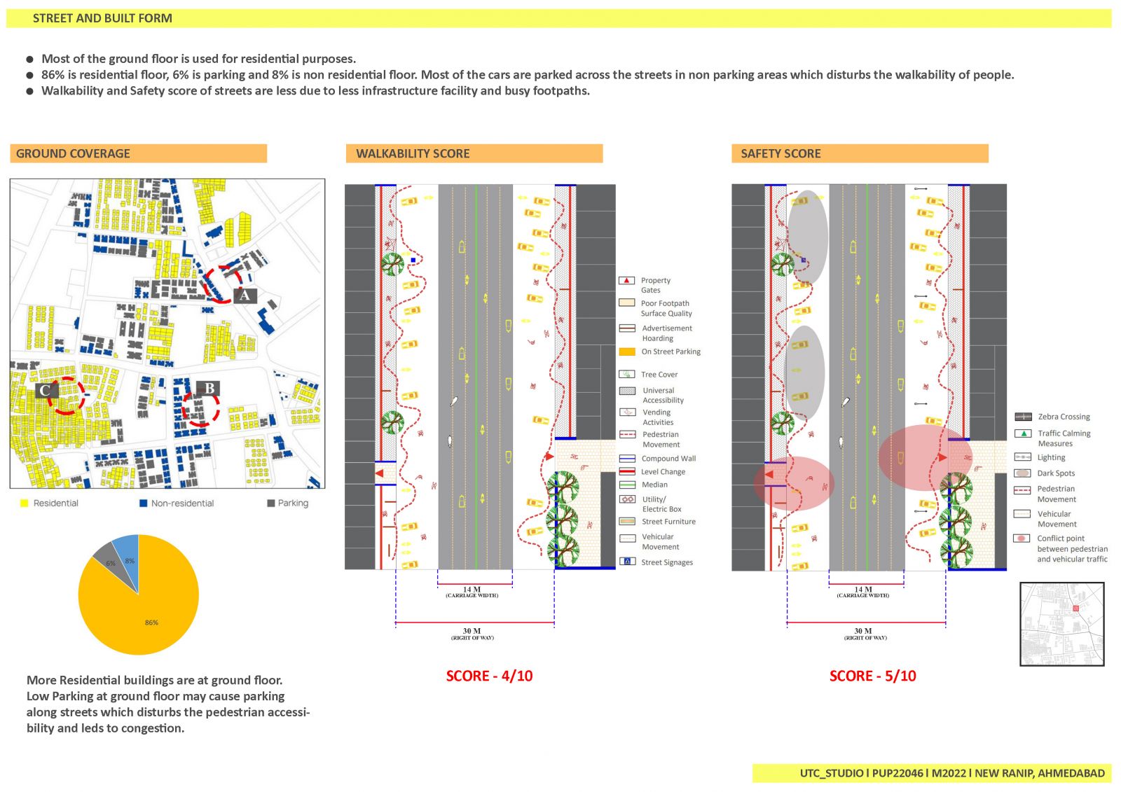
New Ranip is located at the south western of Sabarmati river, Ahmedabad. To reach New Ranip it is almost 8 km from Ahmedabad's city center income tax office and 12 km from Sardar Vallabhbhai International Airport. The area of New Ranip, in the west of Ahmedabad, till 2000 was used as industrial land. As industries shut down in 1990 and people migrated here for residing purposes the land use shifted from industrial to residential. Later the infrastructure of New Ranip started developing and mixed use buildings were introduced which led to the growth of New Ranip. This transformation has been discussed by showing the evolution of residential neighborhood between 2000 and 2022. It also discusses the relation between streets and built form and also the relation of streets with respect to buildings to identify the factors like road hierarchy, link node ratio, block perimeter, ground usage and built up to open space ratio and how all that affect people in the society. Also the factors affecting the land use, FSI and property prices are discussed.