- Student ANIRUDHA BISWAS
- Code PUT22438
- Faculty Planning
- Tutor/s Rutul Joshi,Umesh Shurpali,Anil kumar Roy,Ravi Sannabhadti,Nitika Bhakuni,Narendra Mangwani,Arjun Joshi,Tarun Patel,Rushil Palavajjhala ,Giby Abraham
- TA Sreedevi Kurur,Priyanka Baghel,Chinmay Gheware,Richa Bihari,Ratik Verma,Kirti chandra Devaguptapu,Rohini Chatterjee,Annesha Dasgupta,Arkadipta Banerjee,Garima Munjal
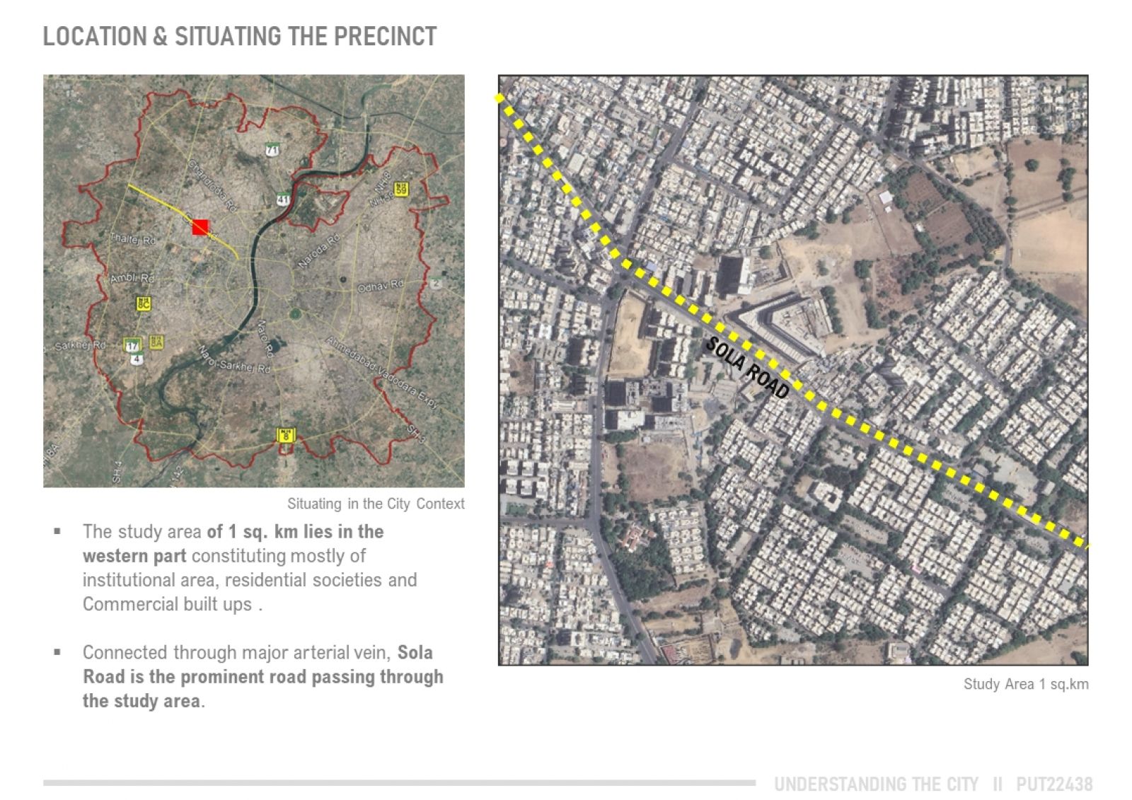
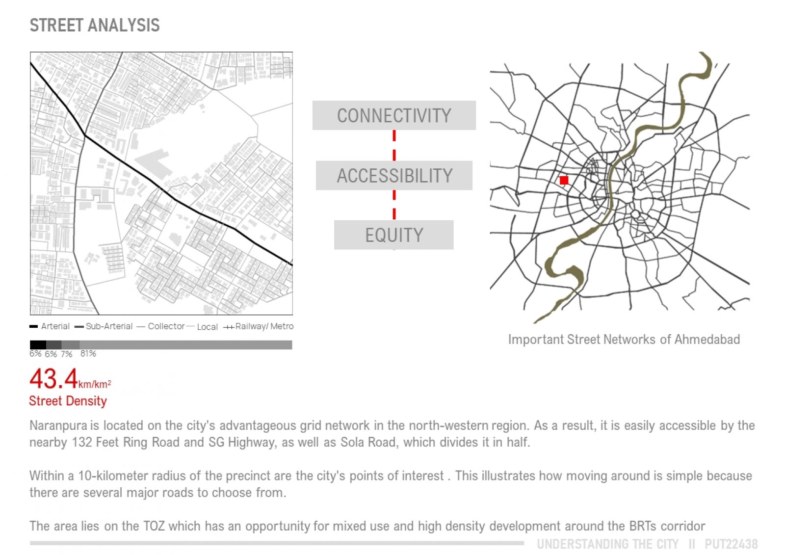
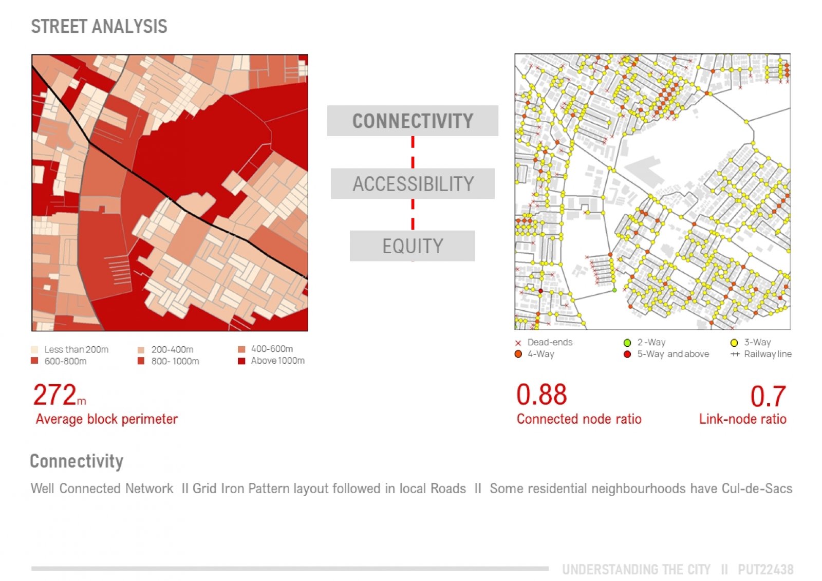
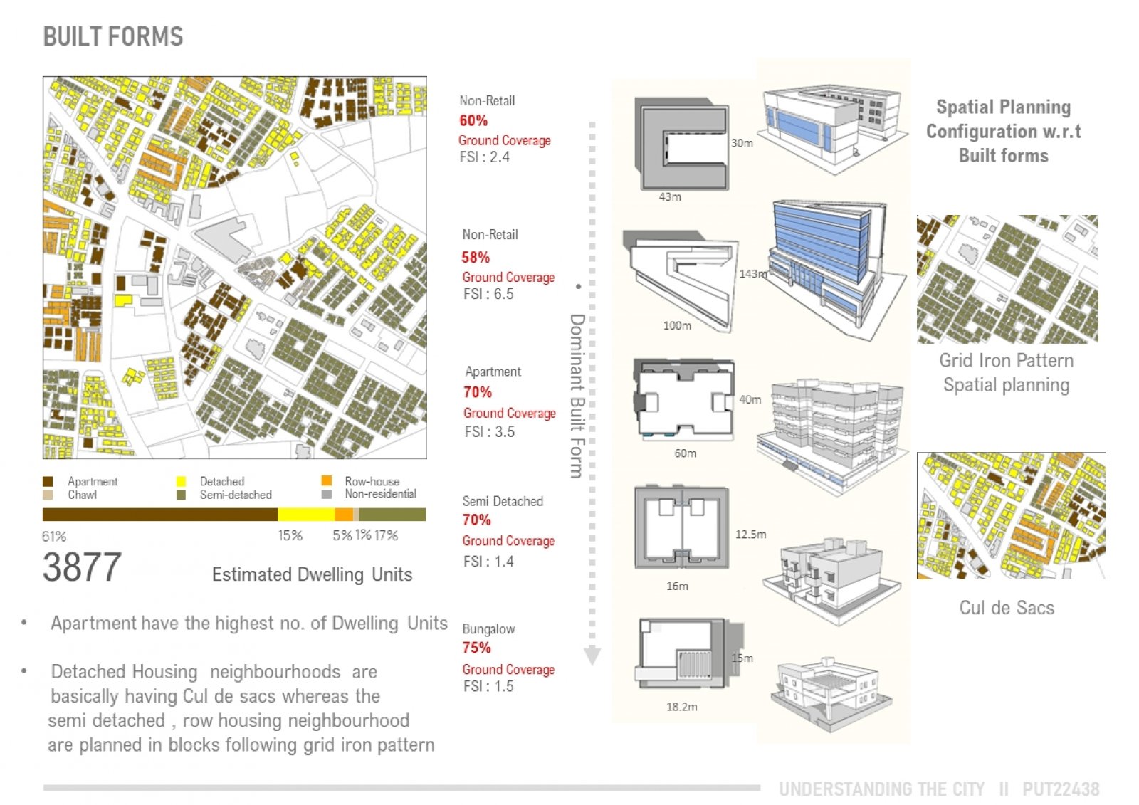
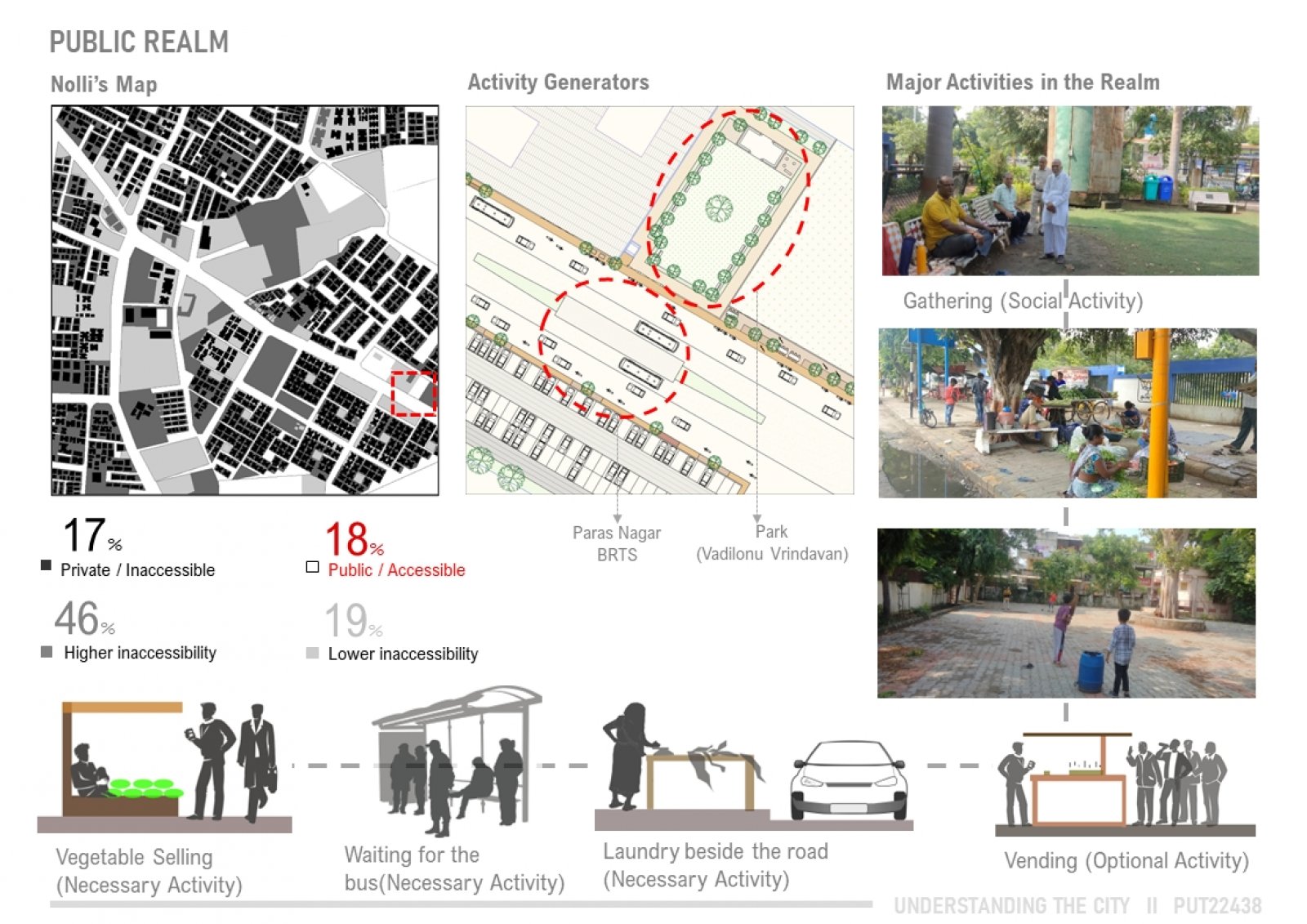
Naranpura is located in the North-western part of Ahmedabad and is well connected through the Sola Road which starts at AEC Char Rasta and is connected to Sattadhar Cross Road. With the coming up of BRTS in 2014 the area is well connected, and demand of this neighbourhood is rising.
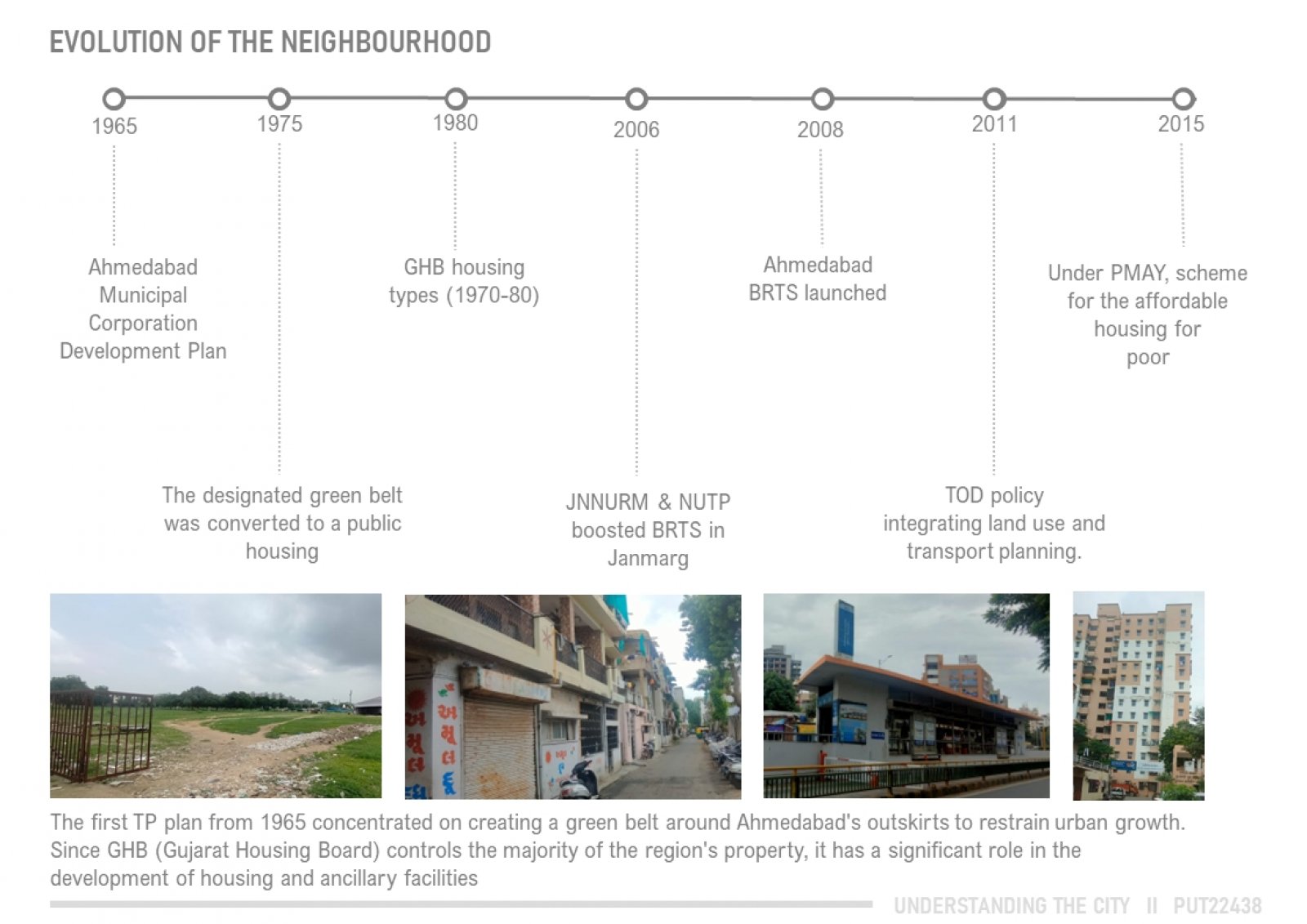
Naranpura is a part of Town Planning scheme 29. It falls under the green belt that was proposed in the development plan of 1965 as the city was expanding south and east. In 1980 Gujarat Housing board came up with a housing scheme and thus developed into a residential neighbourhood over the areas of Paras Nagar, Memnagar, Parul Nagar and Ghatlodiya. Rapid transformation along the Sola Road over the years with mixed use high rises and reduction of green belt.
References - Chaudhary A. (2020, February 20). Paras Nagar publicly developed residential
neighbourhood, Paras Nagar Publicly Developed Residential Neighbourhood | CEPT -Portfolio Alain Bertaud 2018 Cities As Labor Markets Order Without Design
Jacobs, J. (1961). The death and life of great American cities. Random House. Sinha K. (2021). Understanding the city. [Unpublished portfolio from Master of
Urban Planning]. CEPT University. AUDA Amdavad Municipal Corporation (ahmedabadcity.gov.in)