- Student PATEL AJAY PRADIPBHAI
- Code PGE23022
- Faculty Technology
- Tutor/s Manushi Bhatt
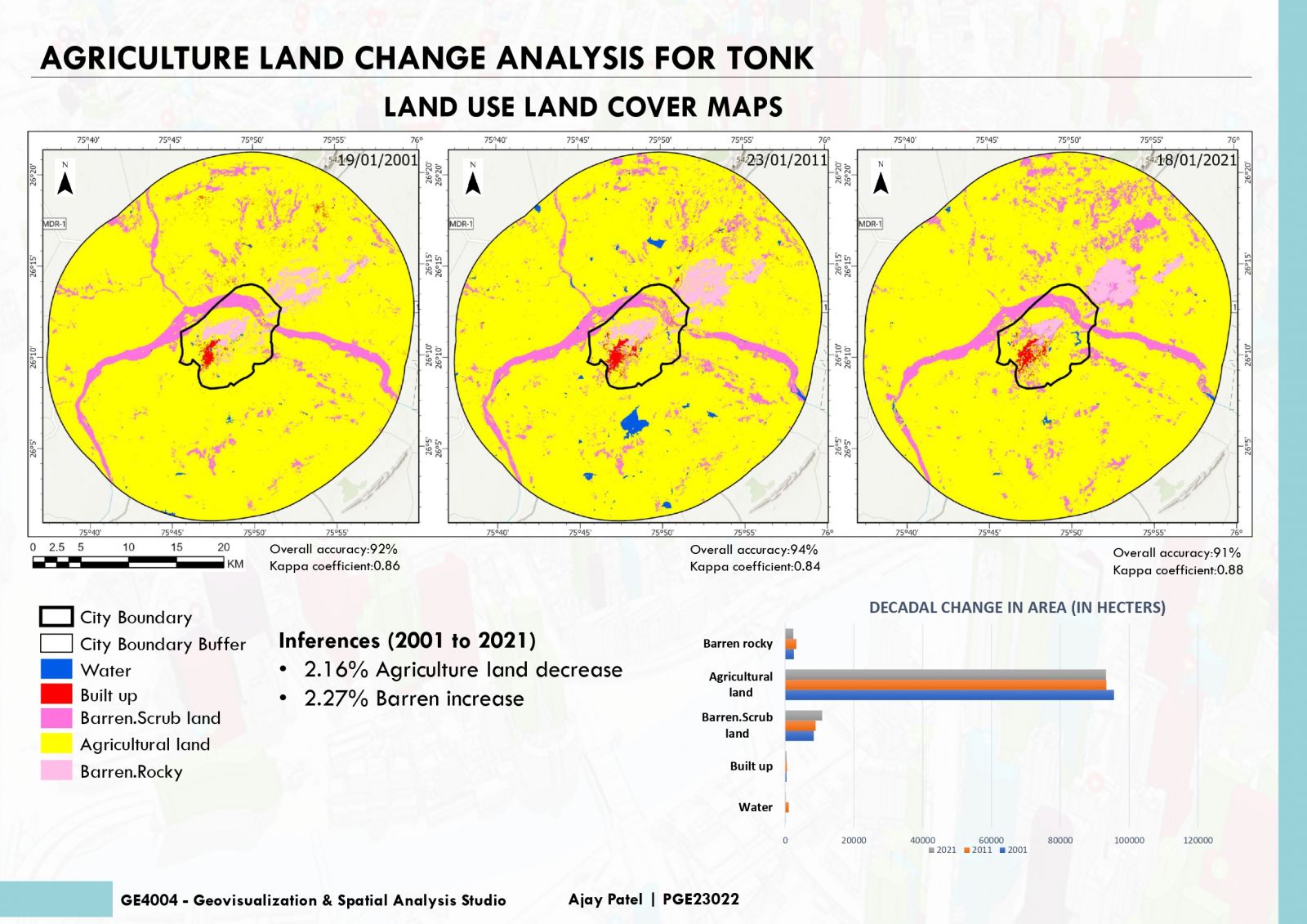
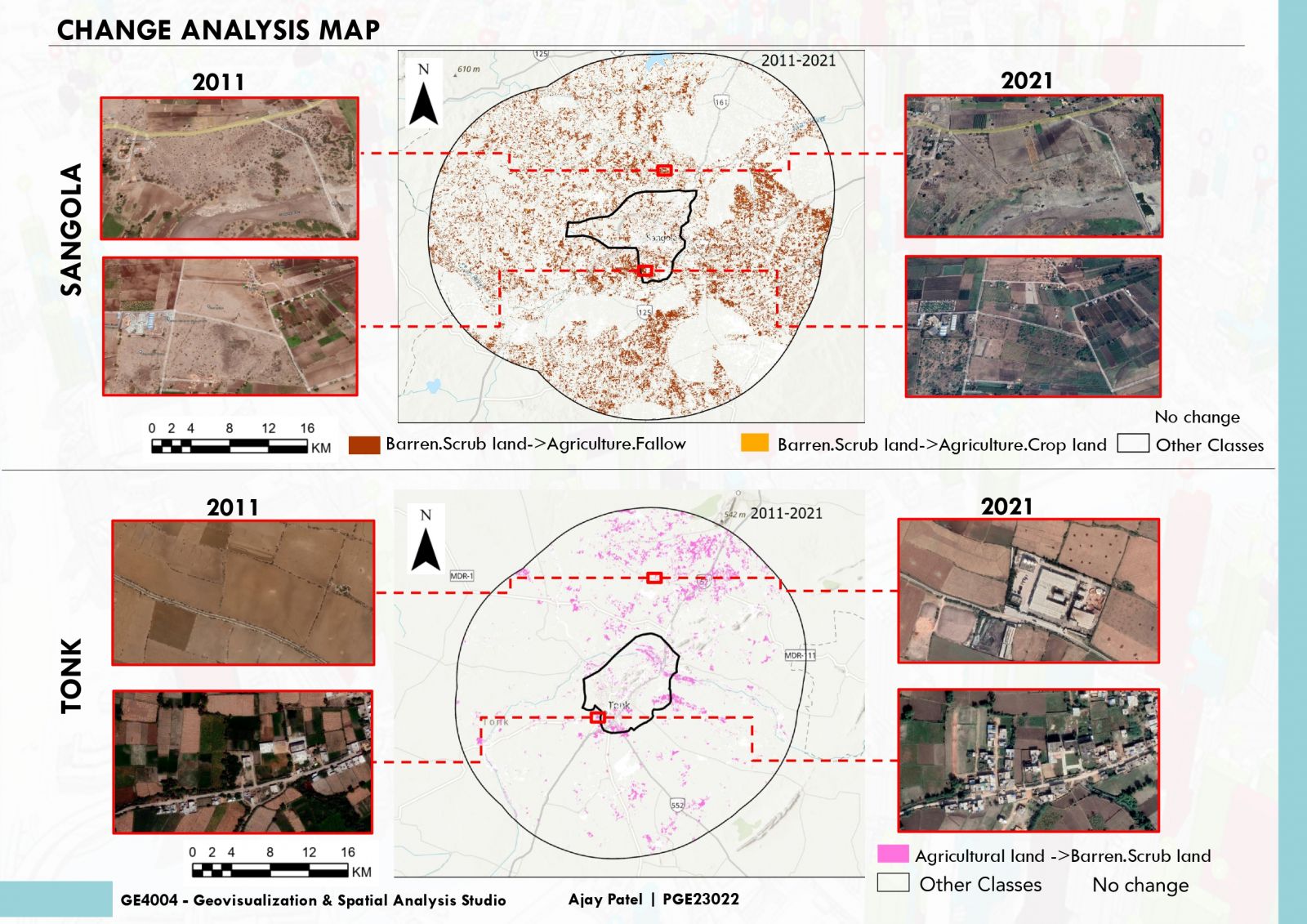
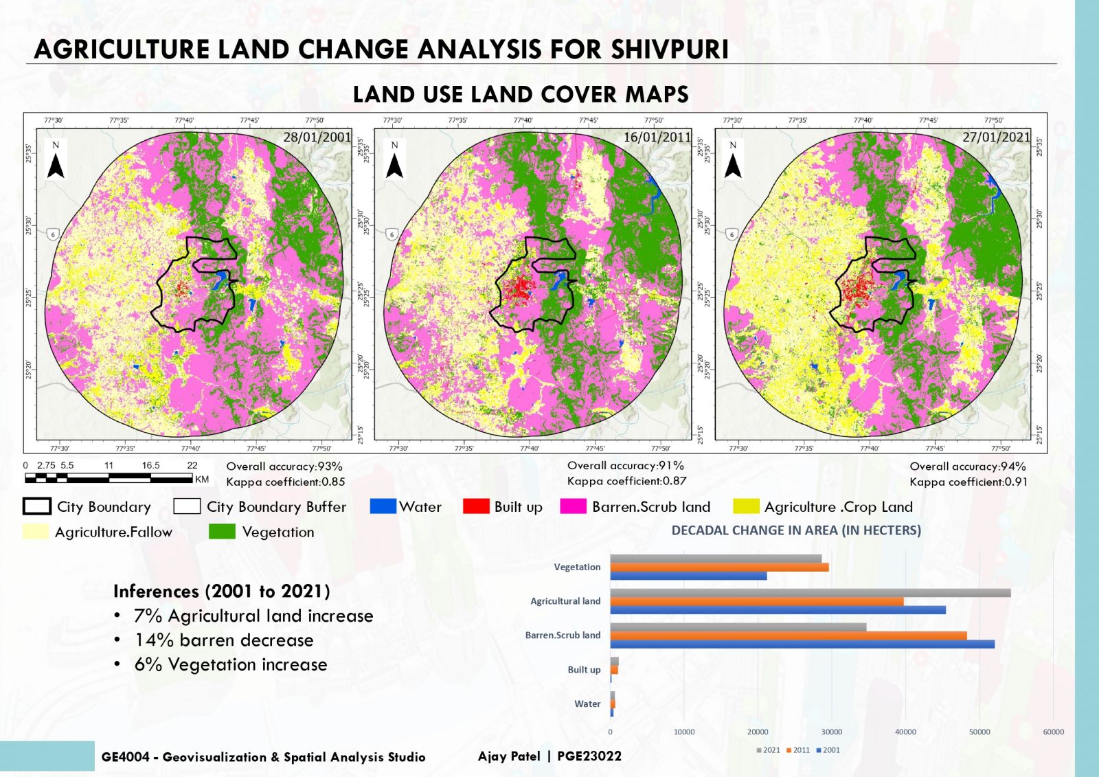
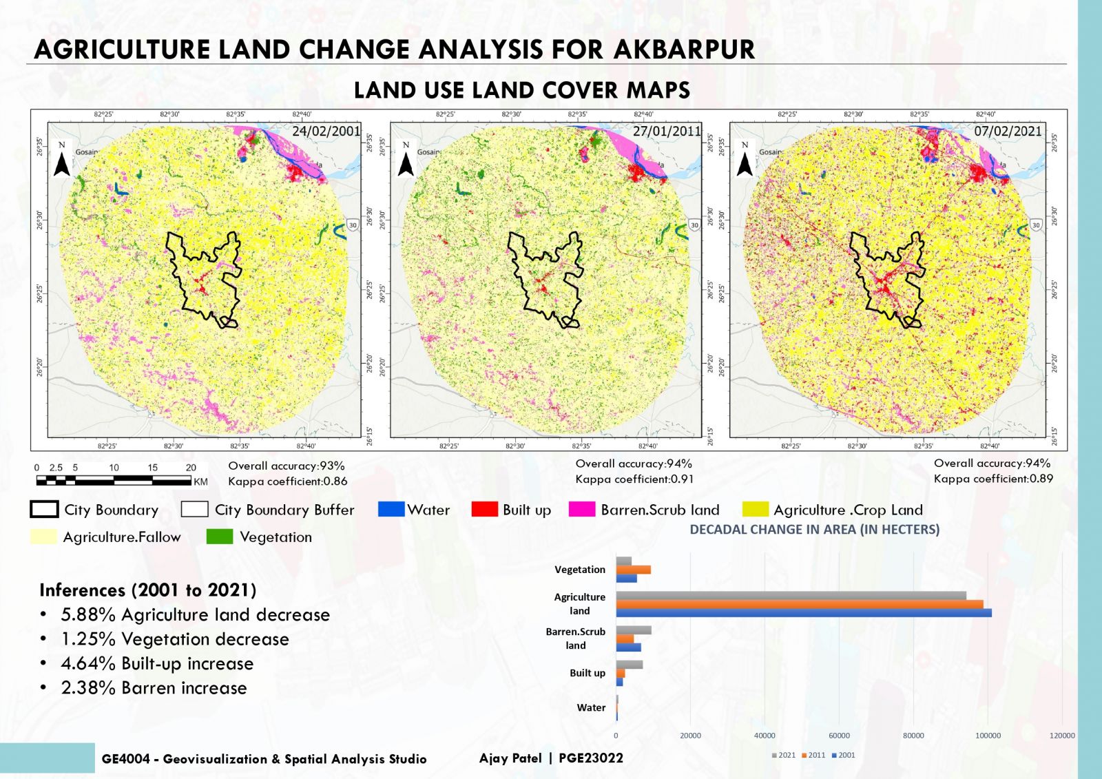
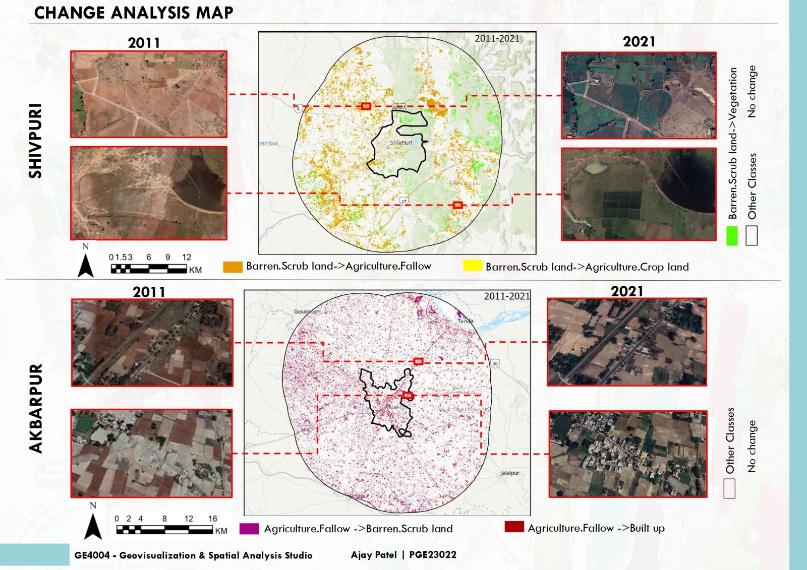
Agricultural land change analysis involves assessing shifts in land use over time. This process helps understand trends, identify factors influencing changes, and plan sustainable practices. Utilizing satellite imagery and geographic information systems (GIS), experts track alterations in land cover, such as transitions from agricultural to urban use or changes in crop patterns. By quantifying these modifications, policymakers and farmers can make informed decisions regarding resource allocation and conservation efforts. This analysis is crucial for promoting efficient land management, addressing environmental concerns, and ensuring food security in a rapidly evolving India.