- Student AYUSH ANIMESH JHA
- Code PGE23068
- Faculty Technology
- Tutor/s Manushi Bhatt
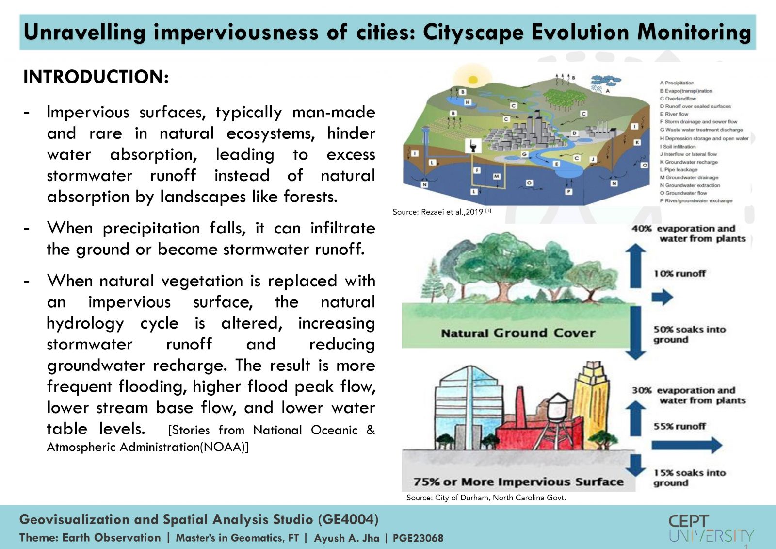
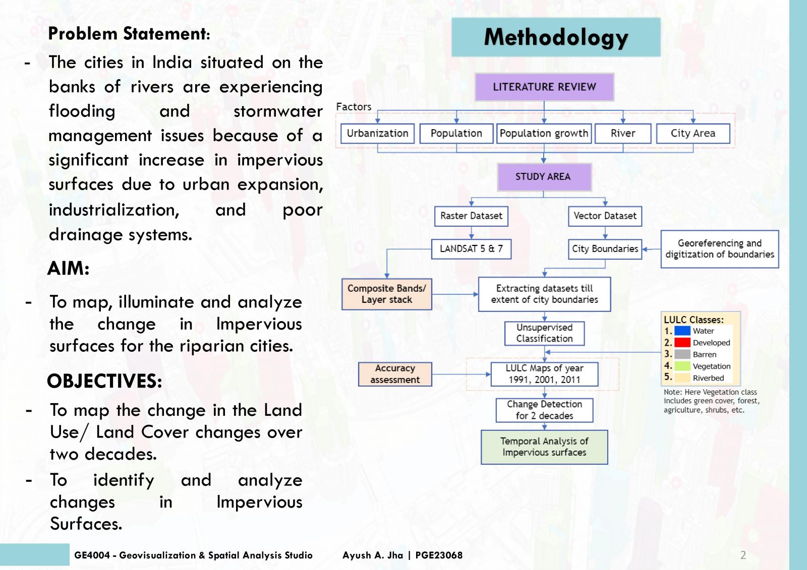
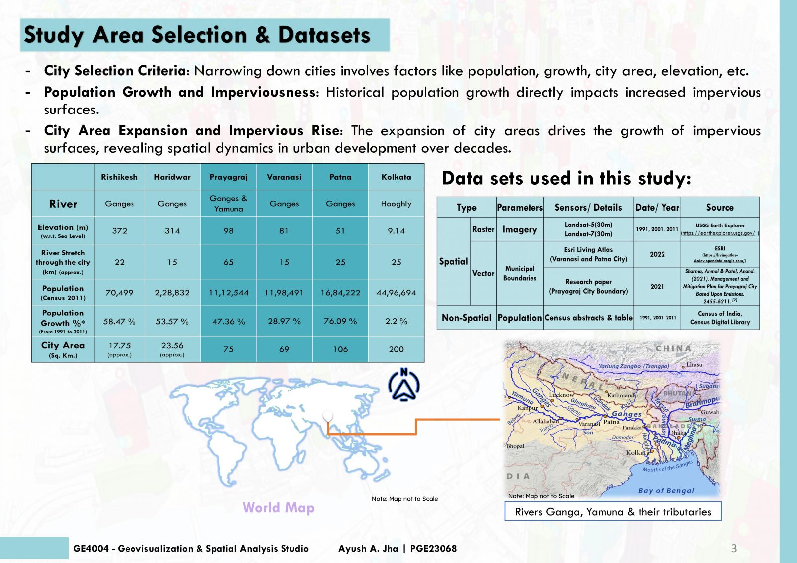
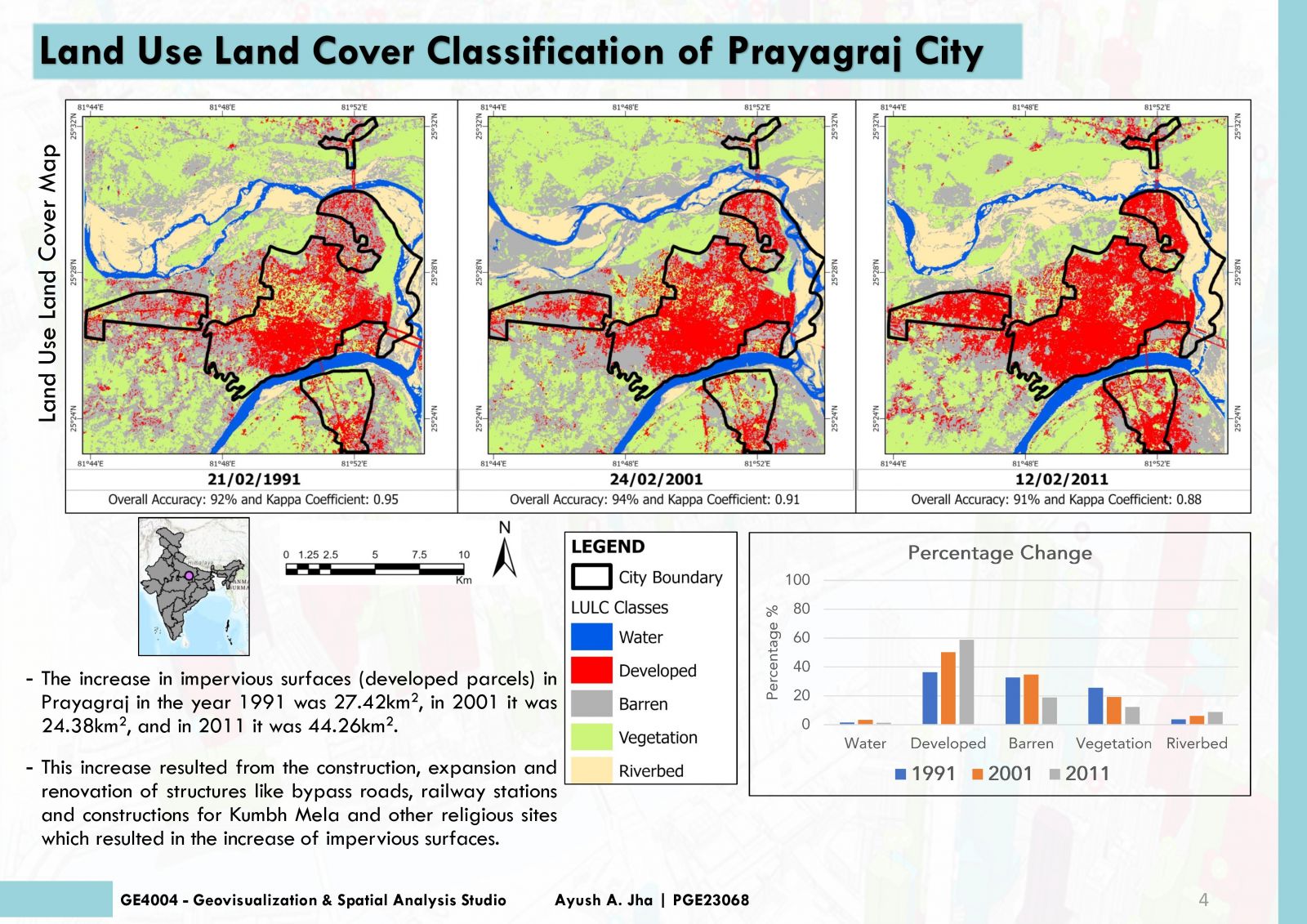
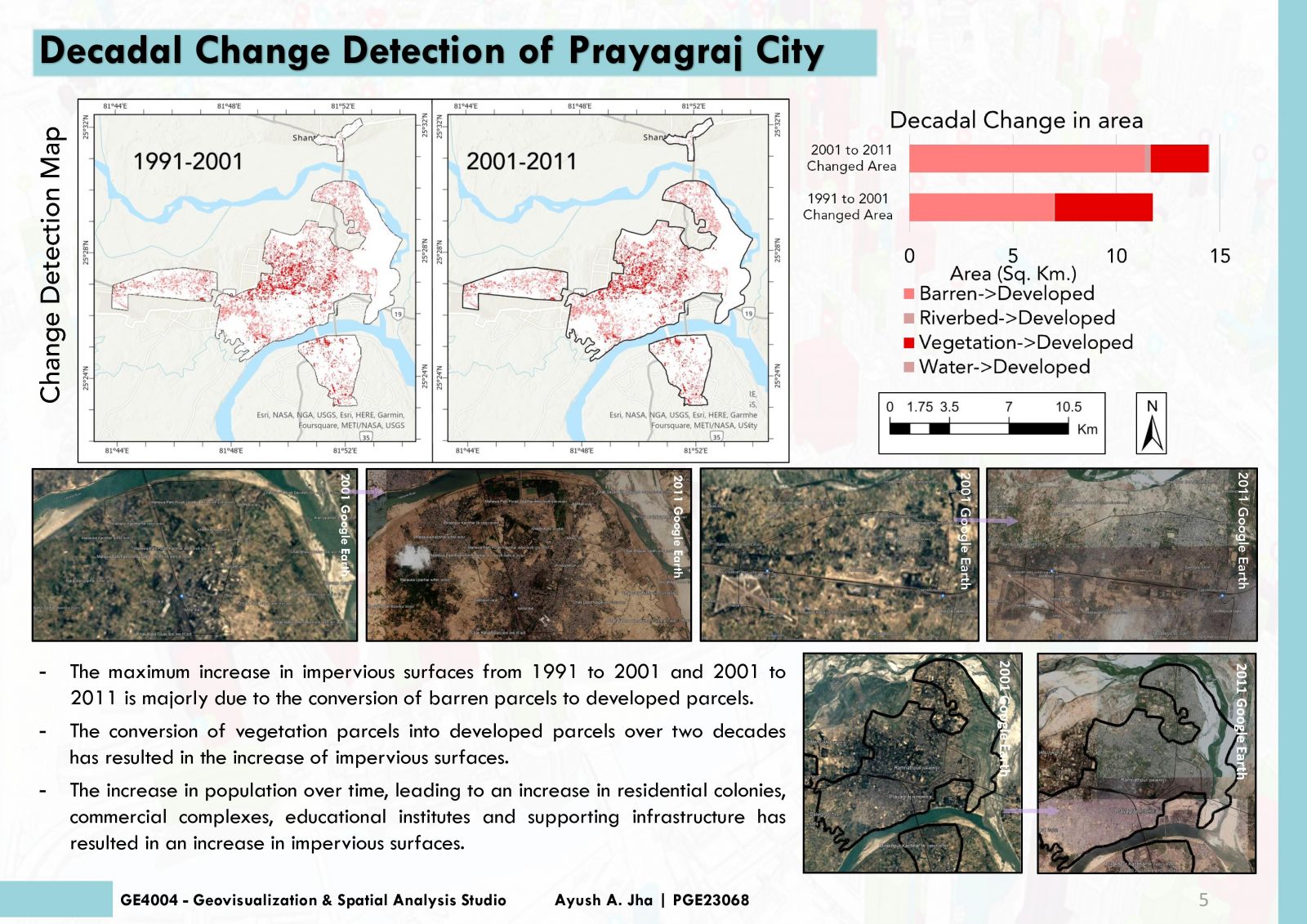
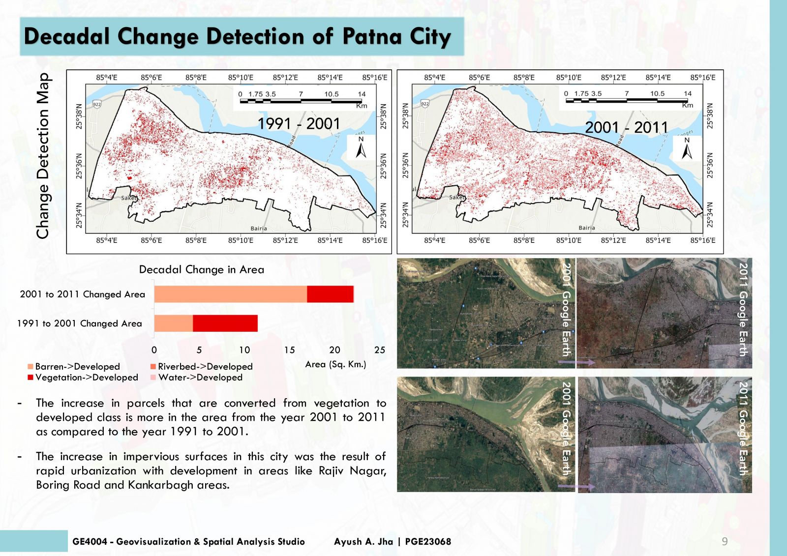
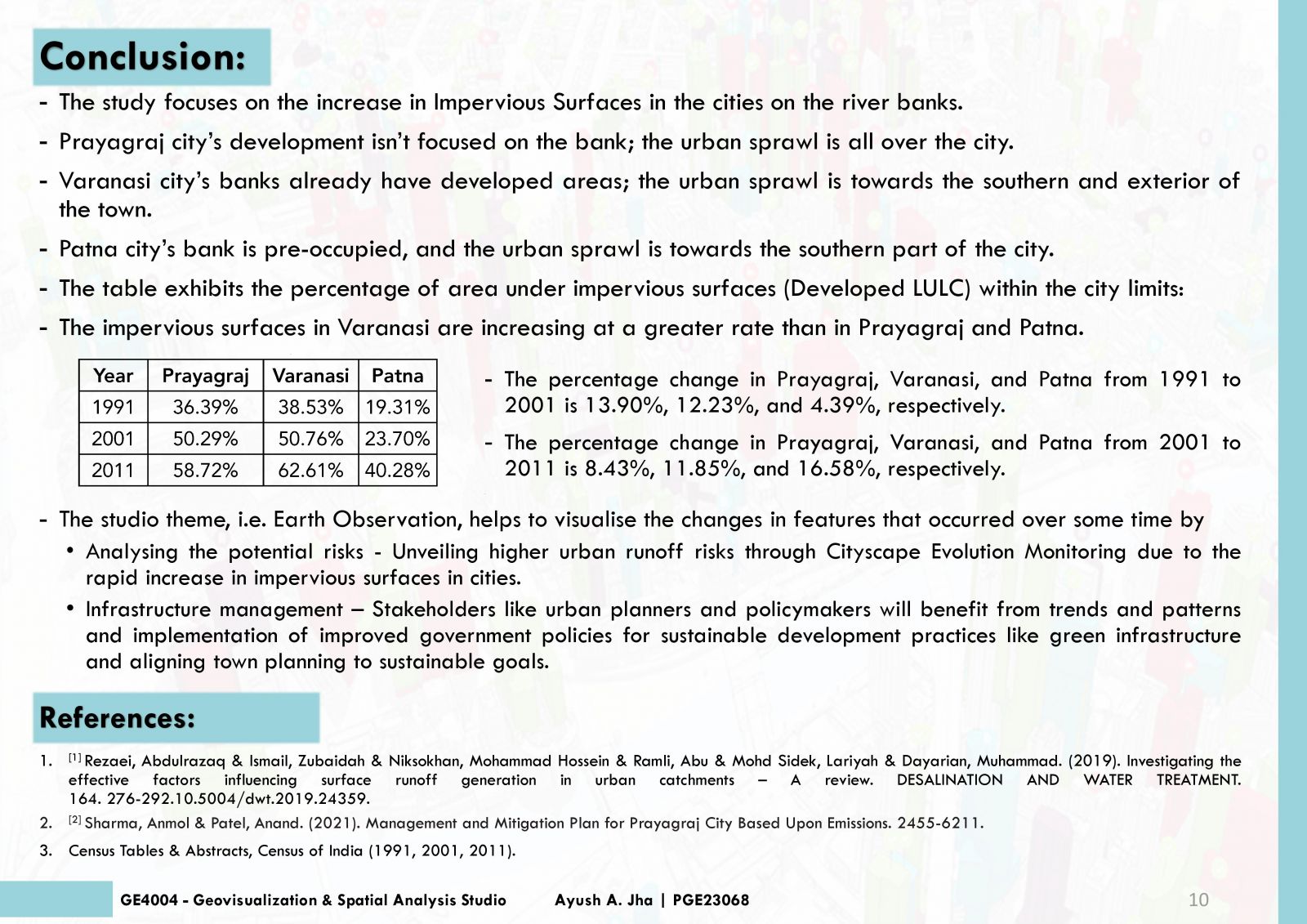
Addressing the escalating flooding and stormwater challenges in Indian riverside cities, this project aims to illuminate and analyze changes in impervious surfaces. With a focus on riparian cities, the objectives include mapping two decades of Land Use/Land Cover changes and identifying alterations in impervious surfaces. Using the unsupervised form of classification for the satellite images, land use/land cover maps were obtained, and furthermore, change detection was done. Developed parcels, assumed to be impervious surfaces, are mapped to unravel the intricate dynamics of urban expansion, industrialization, and drainage inefficiencies impacting these cities.