- Student NAHAR DRISHTI AMUL
- Code PUD23108
- Faculty Planning
- Tutor/s Rushil Palavajjhala ,Rutul Joshi,Nitika Bhakuni,Ravi Sannabhadti,Anil kumar Roy,Tarun Patel,Umesh Shurpali,Maulik Chauhan,Arjun Joshi,Jay Bhanushali,Tarunkumar Sharma
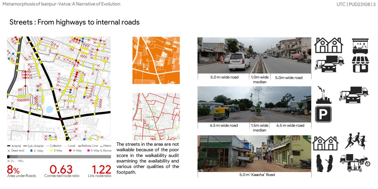
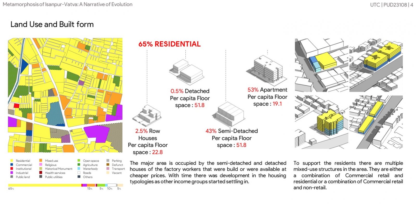
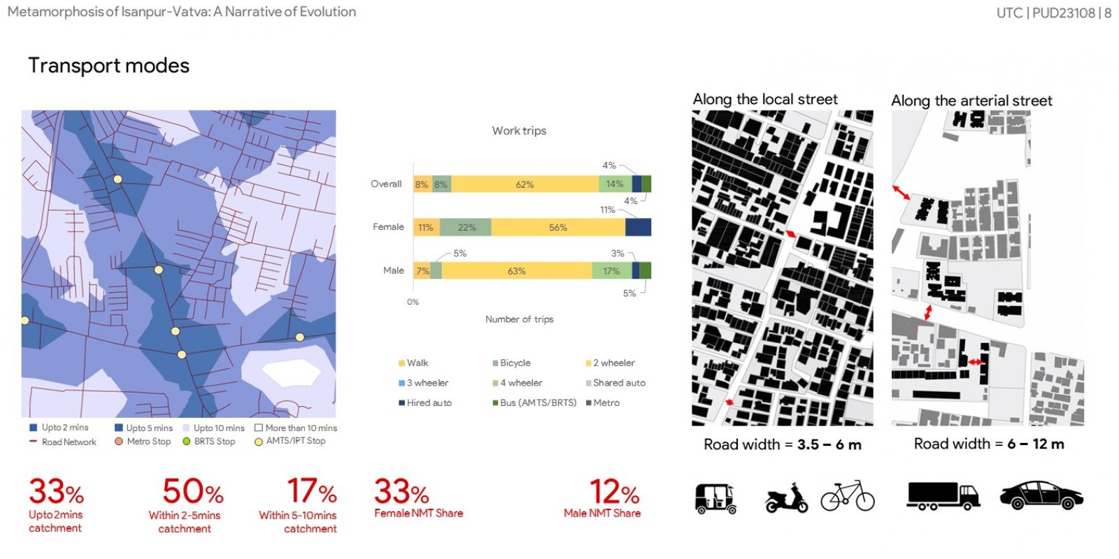
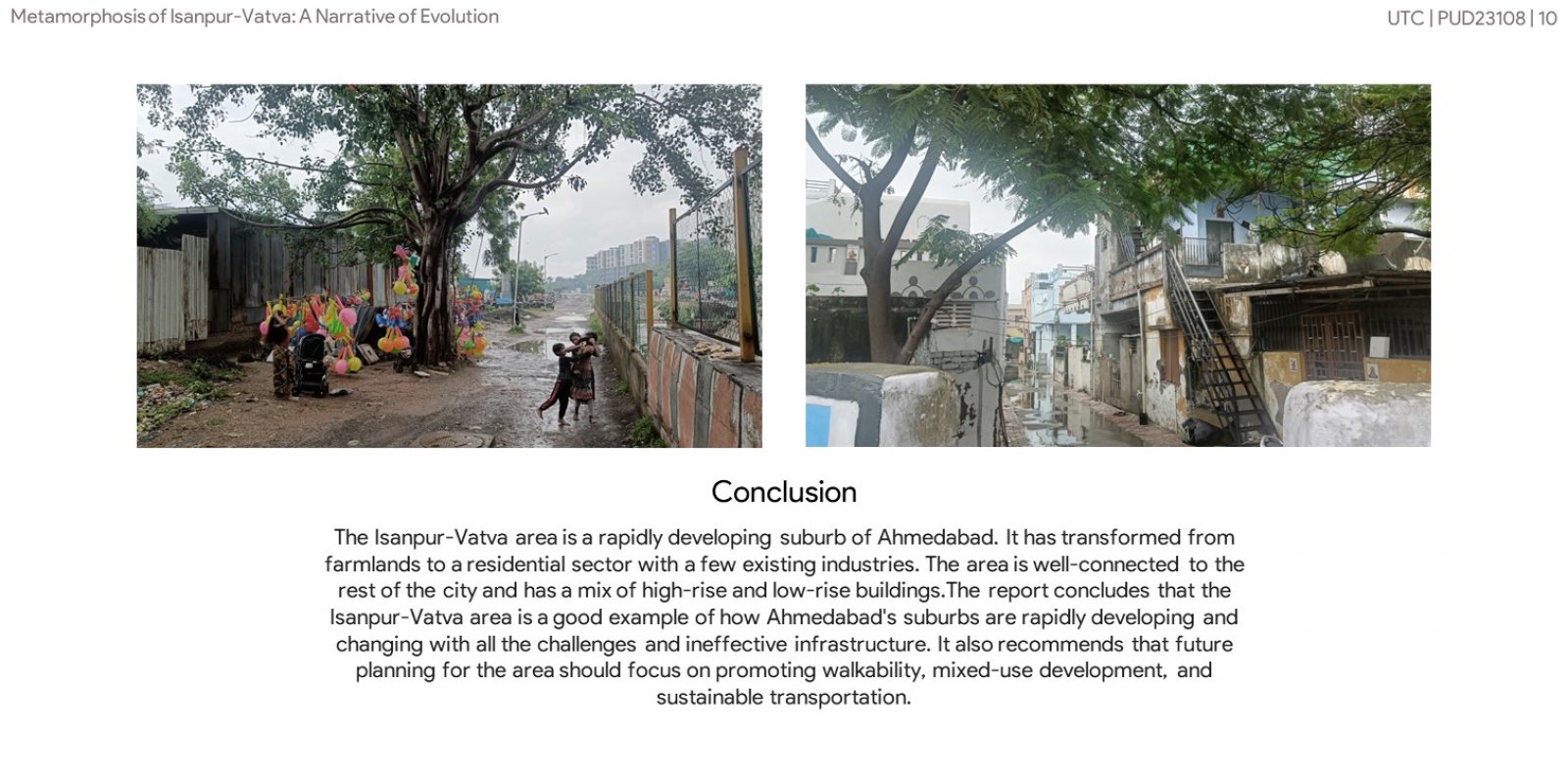
The Isanpur-Vatva area lies in the eastern suburbs of Ahmedabad, one of India's economic and Industrial hubs. The area is known for the industries developed after the GIDC formation and all the workers who settled in and around the area. The landmarks of the area being Bibi Talav and Alama masjid. Starting from understanding the spatial distribution and character of the area by the aerial images. Followed by history and evolution of the area which helped understanding how the area transformed from farmlands to residential sector with few existing industries. By studying and analyzing the street network and various terms like walkability, link node ratio and connected node ratio. This helped understand how the area is better connected to the rest of the city. Lastly it helped understanding what are the different types of land use, housing typologies and their built form.