- Student SHWETA PAL
- Code PFP23376
- Faculty Planning
- Tutor/s Nitika Bhakuni,Rutul Joshi,Ravi Sannabhadti,Anil kumar Roy,Maulik Chauhan,Arjun Joshi,Umesh Shurpali,Tarun Patel,Jay Bhanushali,Rushil Palavajjhala ,Tarunkumar Sharma
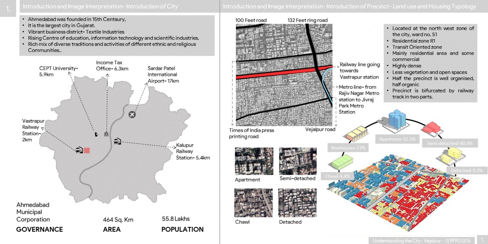
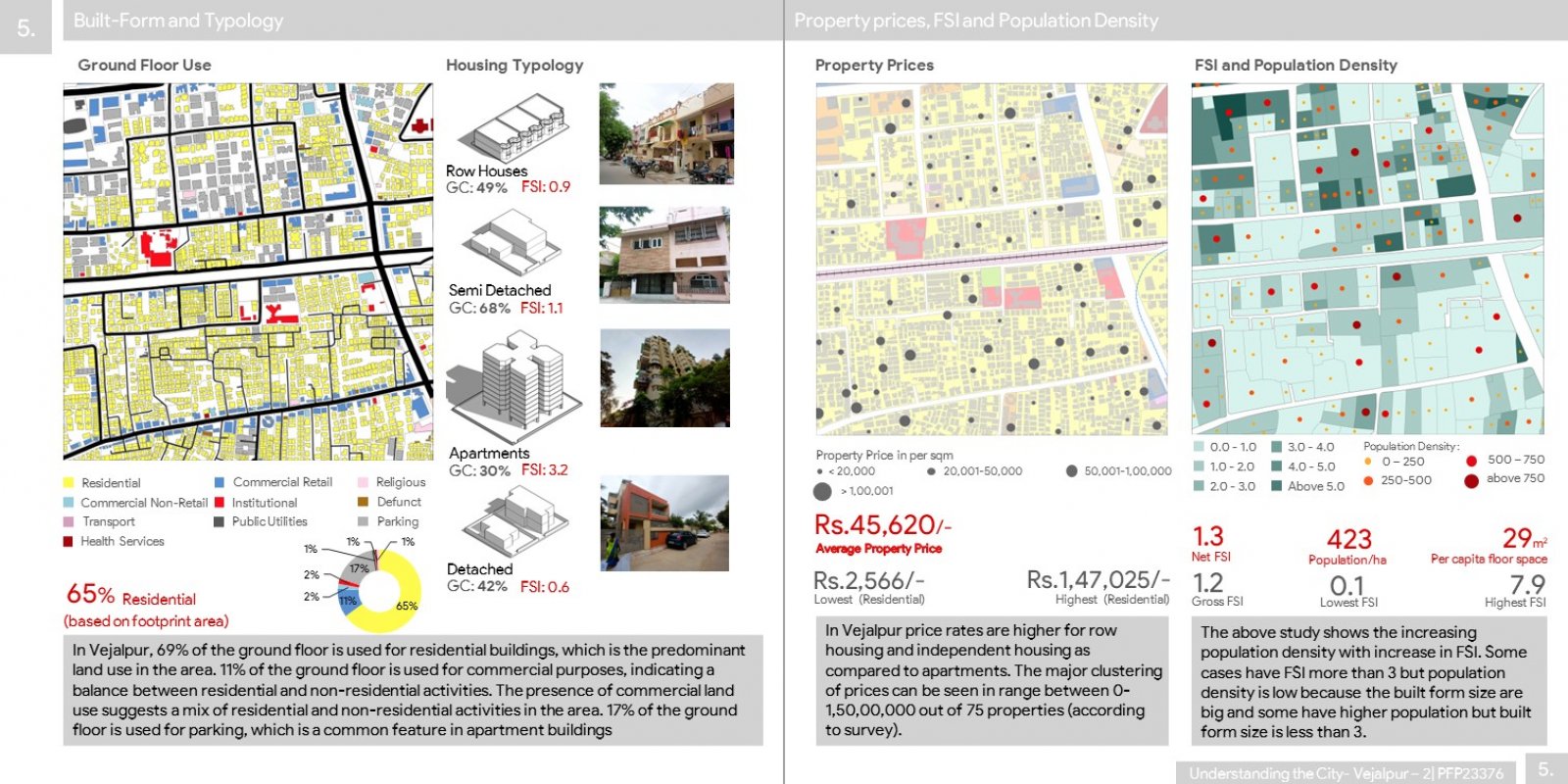
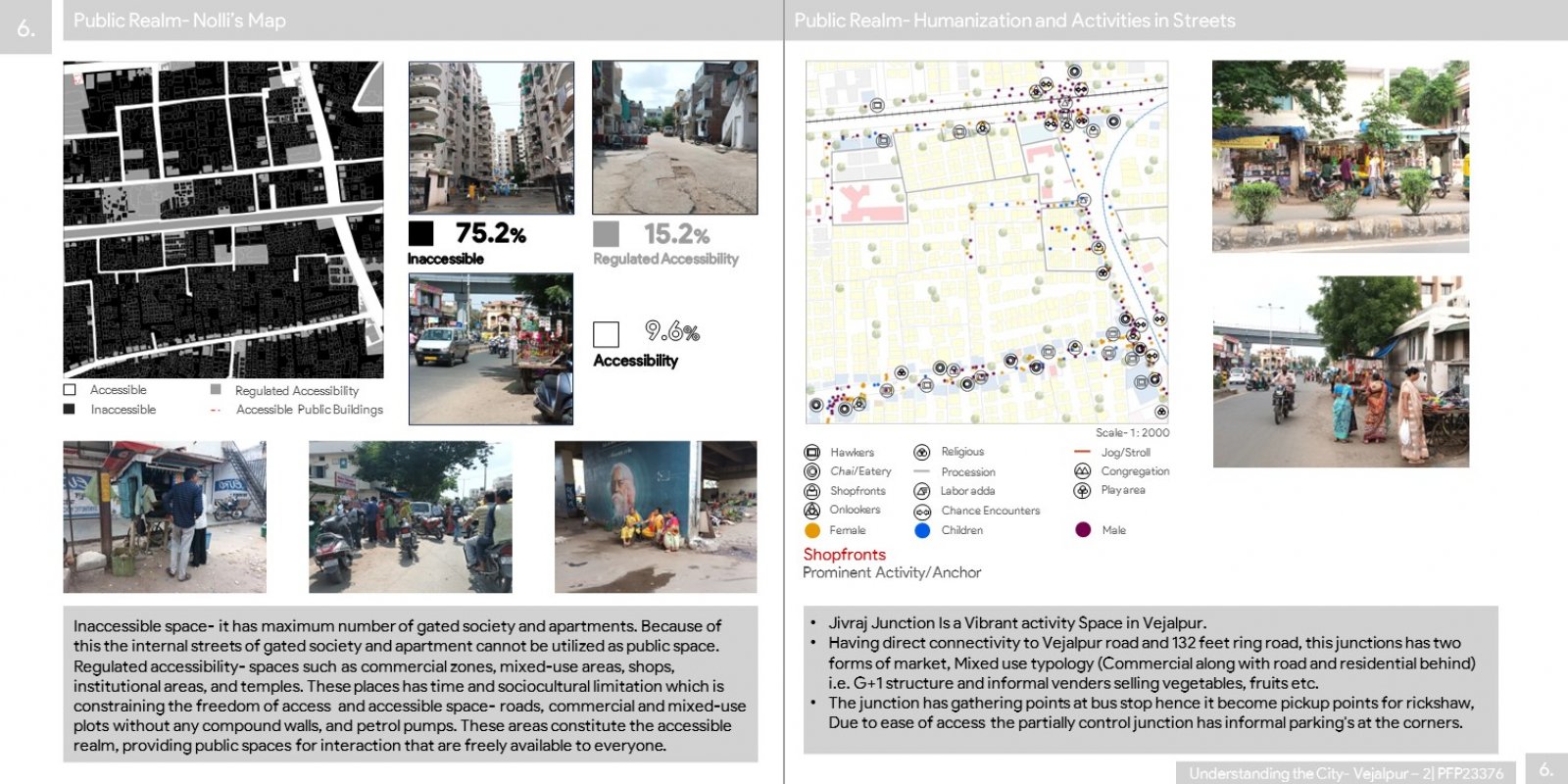
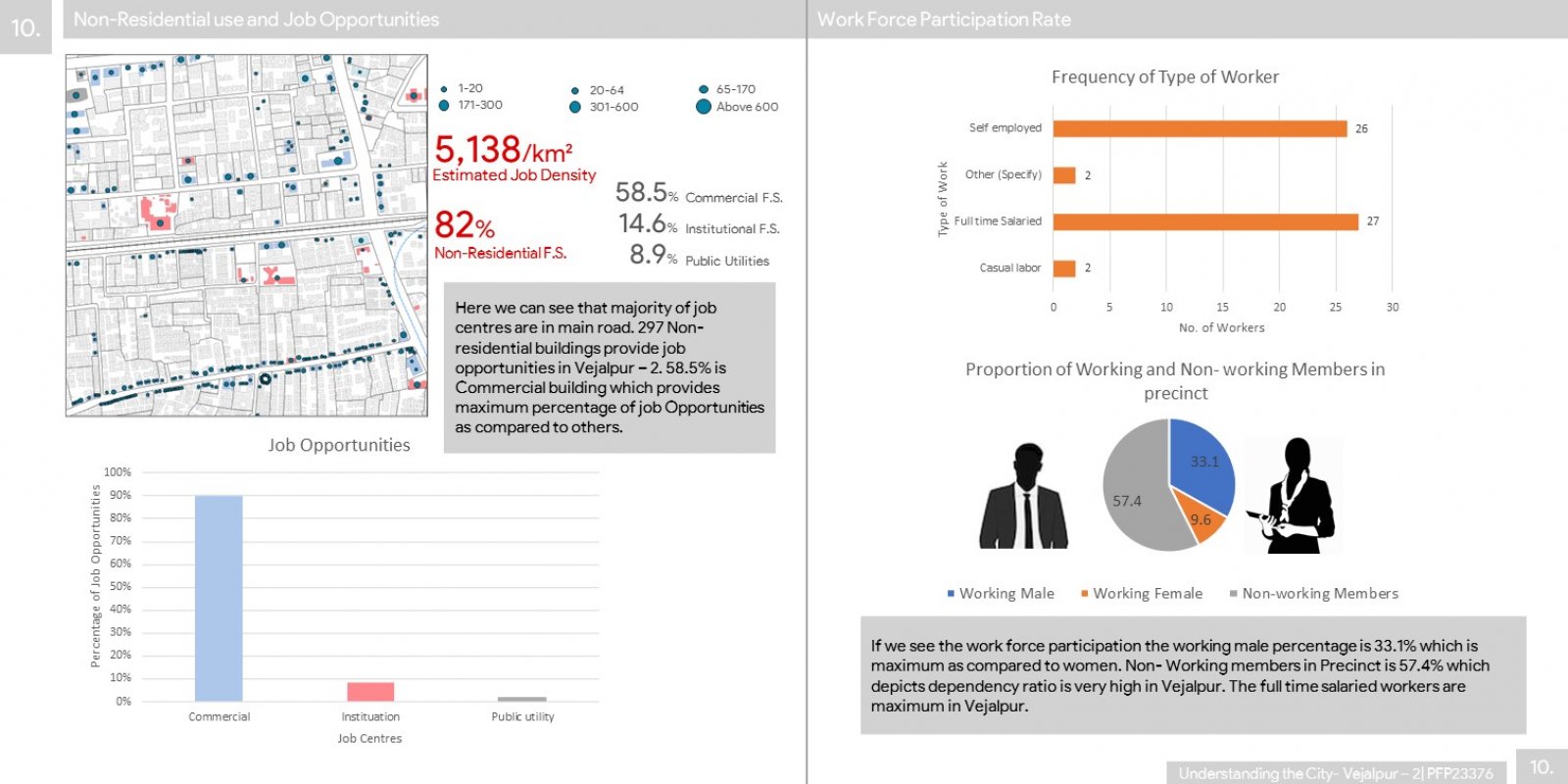
This portfolio focuses on one of the neighborhoods within Ahmedabad, which is Vejalpur - 2. This residential area has undergone many developments, evolving from farmland into a residential zone over the years. The portfolio centers its analysis on a 1 sq km portion of Vejalpur. The purpose of this portfolio is to provide comprehensive insights that we studied about Vejalpur - 2: initial observations, transformation, street network, and land use and built form. In the first chapter, we introduce Vejalpur - 2 through a detailed study. This involves conducting a physical survey and analyzing satellite imagery to present key information such as the area's location, historical context, and its evolution over the past two decades. Additionally, we talk about the perceptions of the local community regarding this precinct. The second chapter focuses on the street layout and connectivity within Vejalpur - 2. This section offers an analysis of the neighborhood's connectivity with the Ahmedabad city, highlighting key nodes, junctions, block parameters, and assessing walkability scores. The third chapter provides an in-depth study of the area's land characteristics and built form. It covers land use distribution, property ownership, presence of various mixed-use structures, ground floor use, population density, FSI (Floor Space Index), and property price within Vejalpur - 2. For the study, the primary tool used for this analysis was the Geographic Information System (GIS) mapping, combined with physical study of the area and in secondary level, the information is collected from academic journals, official documents and websites, newspaper sources, and personal interviews with residents of Vejalpur - 2.