- Student SAURAV ASHISH CHATTERJEE
- Code PUD23345
- Faculty Planning
- Tutor/s Anil kumar Roy,Rutul Joshi,Tarun Patel,Umesh Shurpali,Maulik Chauhan,Arjun Joshi,Rushil Palavajjhala ,Jay Bhanushali,Ravi Sannabhadti,Nitika Bhakuni,Tarunkumar Sharma
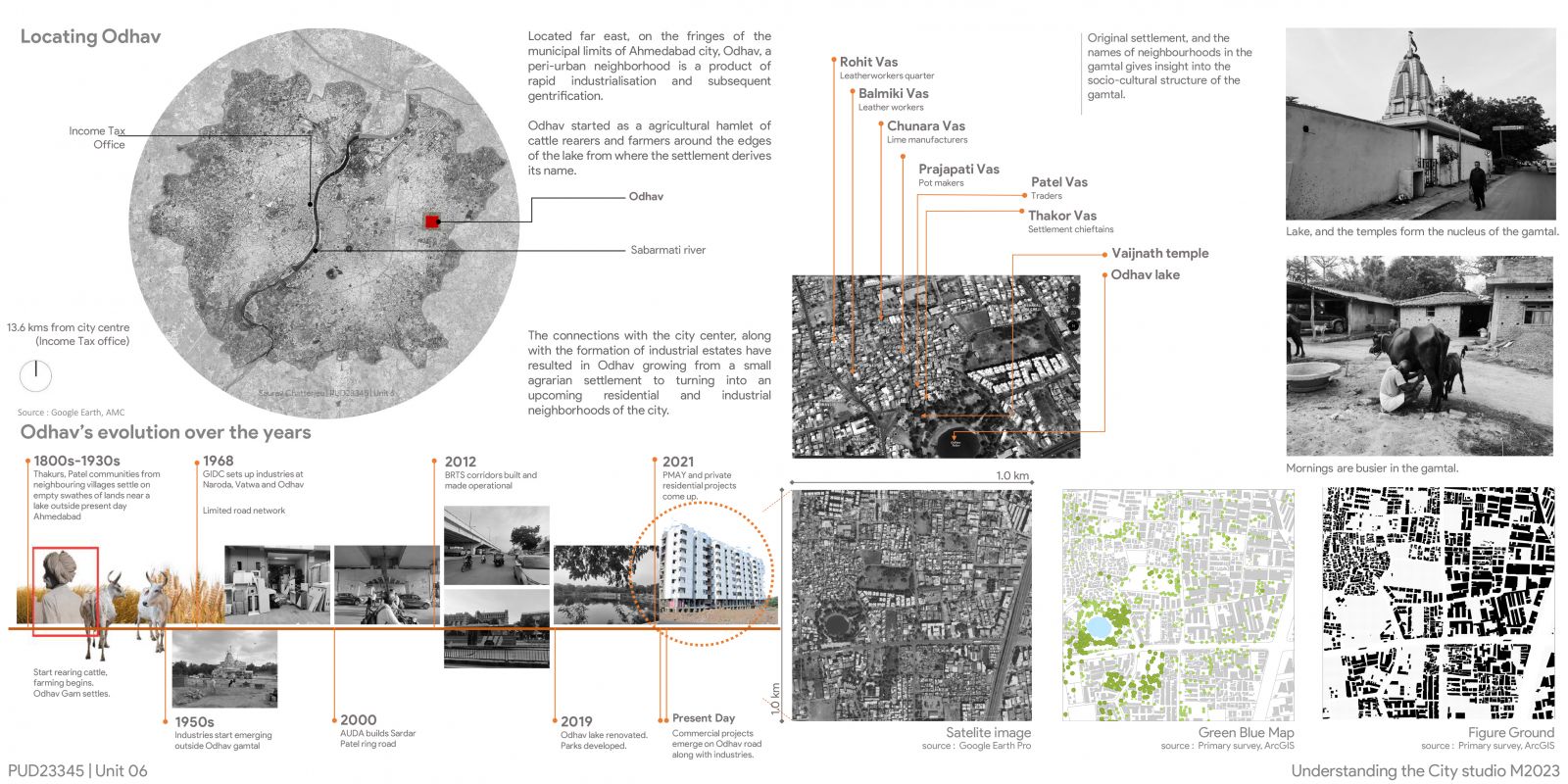
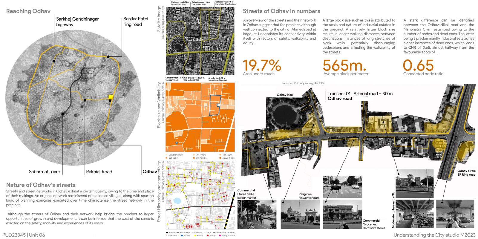
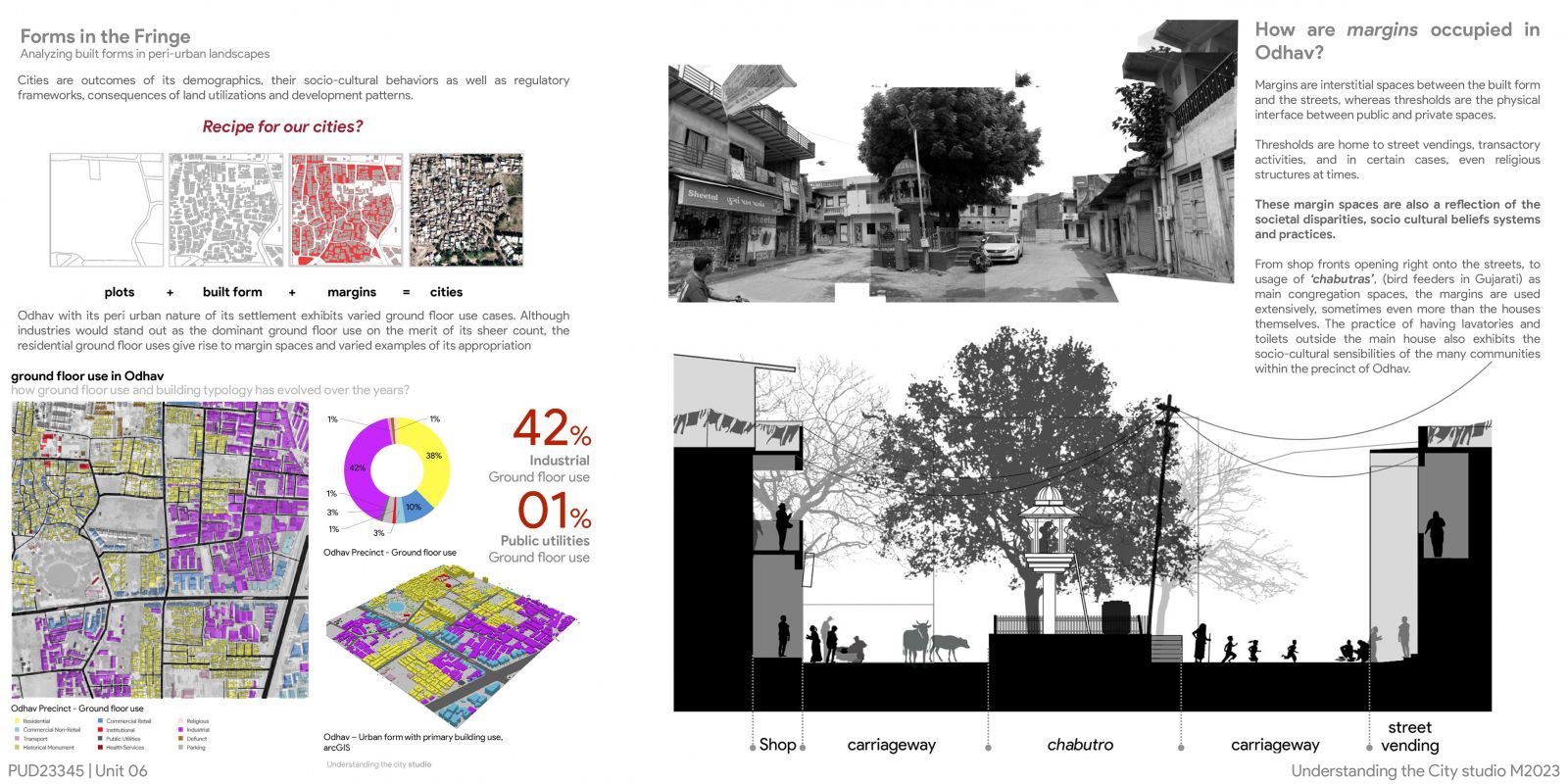
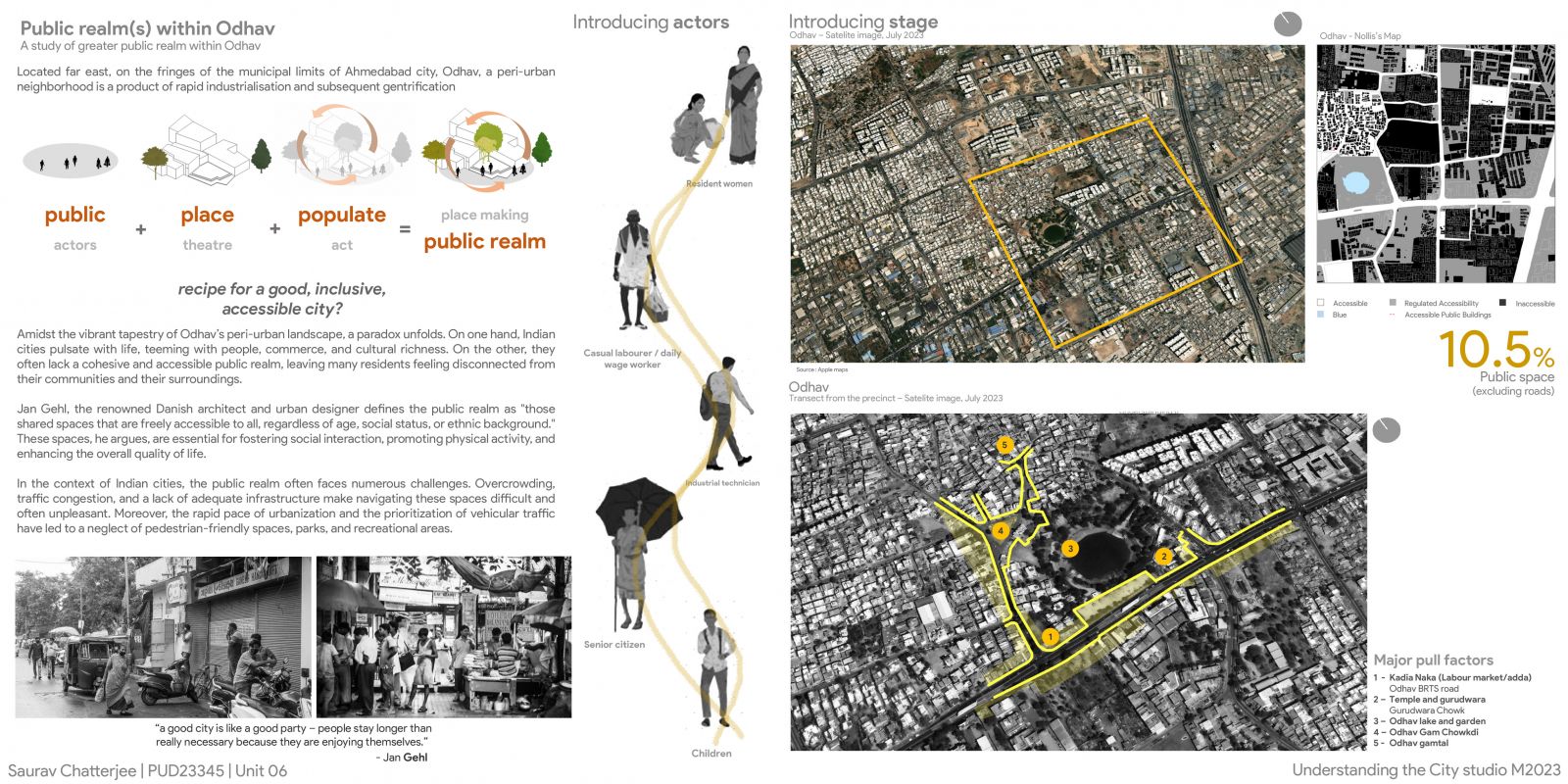
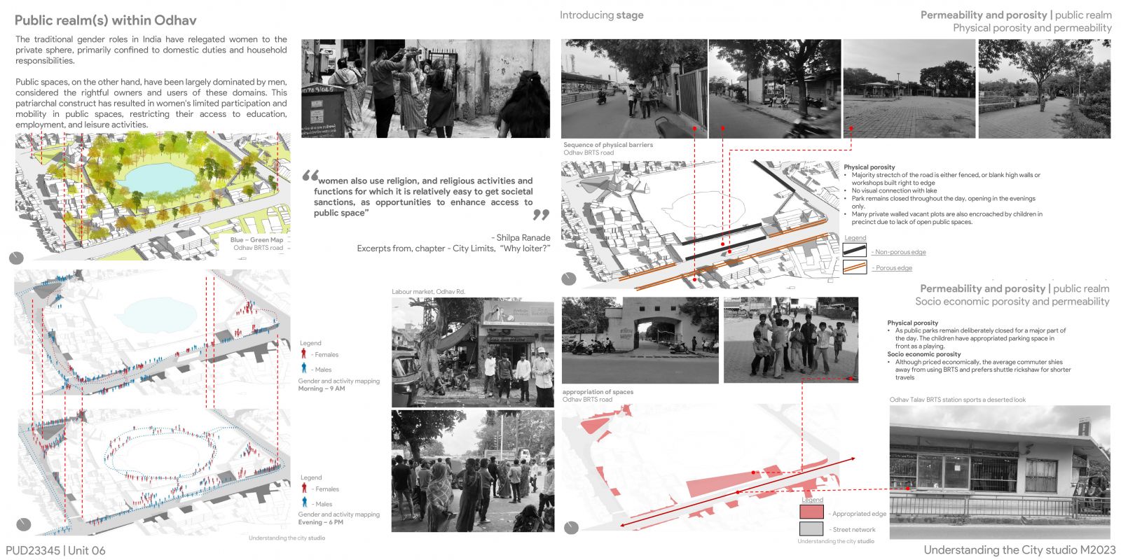
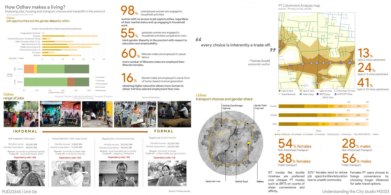
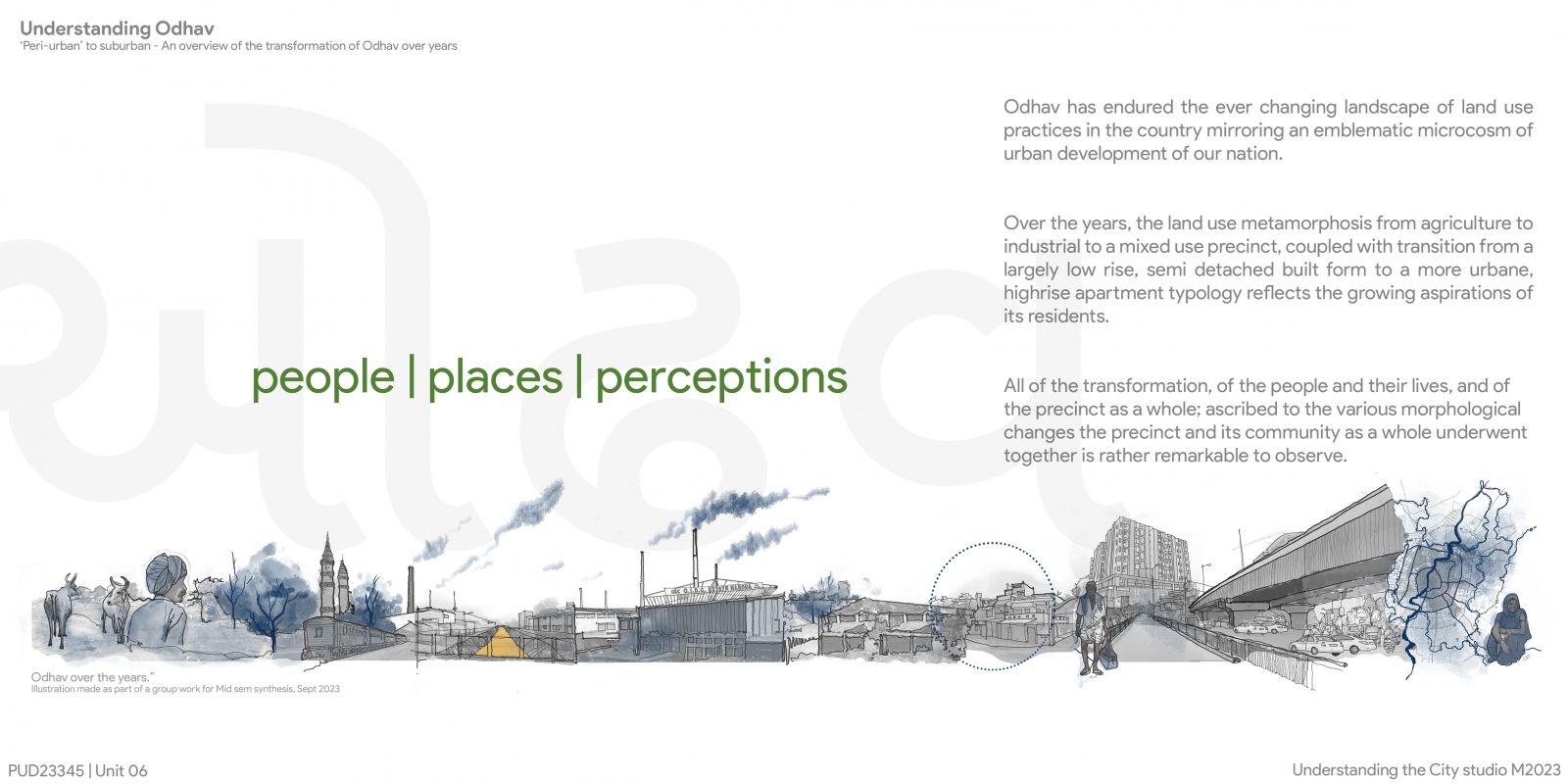
Located far east, on the fringes of the municipal limits of Ahmedabad city, Odhav, a peri-urban neighborhood is a product of rapid industrialization and subsequent gentrification. A series of development policies and changes in land use have resulted in Odhav’s predominantly industrial character with sporadic instances of residential and commercial enclaves. The study area (precinct of 1 sq. km) lies at the junction of the Sardar Patel ring road and the Odhav road, which separate the precinct into four distinct quarters, each with varied dominant land use and typology. The study aimed to analyze the precincts’ morphological transformation and its determinants over the years, the transition of the precinct from a largely rural settlement to a more urban, mixed use neighborhood. This is followed by a study of its road networks, its connectivity and walkability that led to its distinct spatial arrangement and its resultant effects on its inhabitants. The study also talks about the resultant urban form of the precinct and its built and unbuilt character. Along with on-site community engagement, the study employs software tools such as ArcGIS to examine the study area, its evolution and understand the socio-economic factors that have shaped this precinct’s unique landscape in order to delve deeper into the effects it has on its residents.