- Tutor/s Shaily Gandhi | Bindi Dave | Piyush Shah
- TA Ashishkumar Upadhyay
- Code GE4002
- Faculty Technology
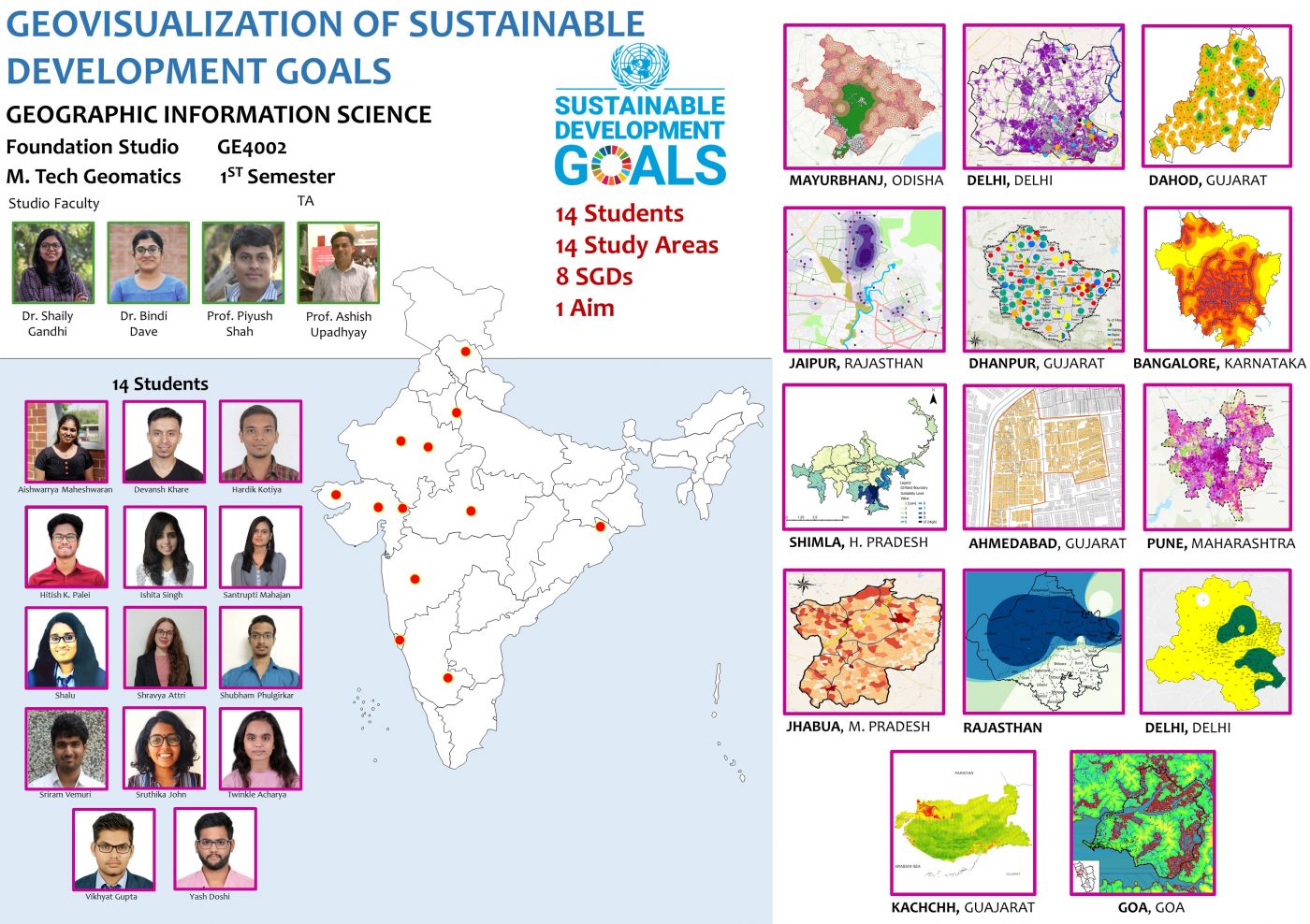
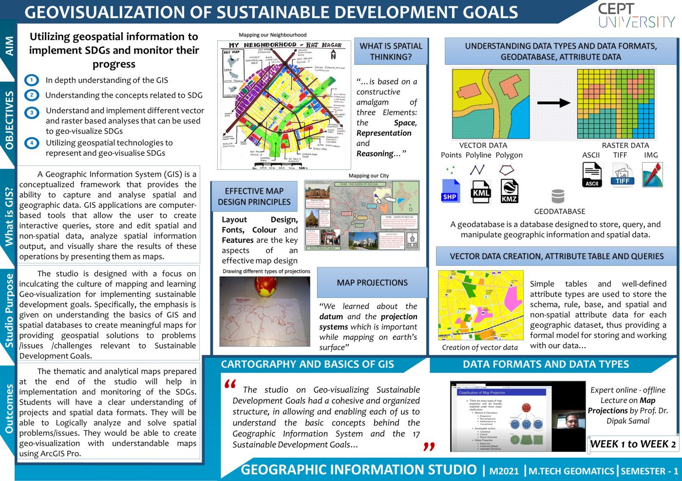
This studio is designed with a focus on inculcating the culture of mapping and learning geovisualization for implementing sustainable development goals. Specifically, the emphasis would be on understanding the basics of GIS and spatial databases to create meaningful maps for providing geospatial solutions to problems/issues/challenges relevant to SDGs. Geovisualization using vector and raster-based data models would be taught in depth. As a part of the studio, in order to facilitate the student’s ability to develop thematic geovisualization skills using GIS software a modular component on Introduction to GIS and cartography shall be covered. Also, several thematic areas related to the SDGs will be covered. As a part of the studio, several interactions with experts and planners will be carried out to understand the SDG Goals and solve them using geospatial technology. Towards the end, the students would be able to solve or propose probable solutions that would represent SGDs Goals on maps. The studio learning aims to build skills among the students: skill to collect and compile the information, skill to visual representation of the information, through mapping and analysis as well as innovative thinking on the real-time case study.


